Browse / United States / Colorado / Morrison
Morrison
Coloradotown

Morrison
Total population
412
Median home value
$875,000
Bachelor's+
Median income
$122,083
Demographic figures from US Census Bureau · ACS 5-year estimates. Overview below cites Wikipedia and may reference a different year.
City facts
Facts from Wikidata (CC0).
Overview
Morrison is a home rule municipality in Jefferson County, Colorado, United States. The population was 396 at the 2020 census.
Read more on WikipediaHistory & geography
History
This small foothills settlement is named after George Morrison (April 16, 1822 – June 11, 1895), a builder and businessman who left a mark not only on the town that now bears his name, but on the history of the area. A stonemason who immigrated from Canada to the Mt. Vernon area in 1859, he helped found the town of Mt. Vernon and built the Mt. Vernon House, seat of the territorial government under Robert Steele, and an important stop for travelers on the Mt. Vernon Toll Road from Denver to the goldfields of the Rocky Mountains. He became a U.S. citizen on May 22, 1862. George Morrison later moved south to Bear Creek, where he founded the Morrison Stone, Lime, and Town Co., and in 1874 platted the town that became known as Morrison, or briefly as Mt. Morrison. With Gov. John Evans, he was instrumental in bringing the Denver, South Park and Pacific Railroad to Morrison in 1874. As a quarryman, Morrison developed the building stone and other industrial stone (lime, gypsum) of the Morrison/Mt. Vernon area, bringing fame to the region for its high-quality dimension stone. Two of the three stone buildings he built in Morrison, as well as the Mt. Vernon House further north, are still standing; all three surviving buildings are recognized historic sites (National Register of Historic Places, 1976). Before its demolition in 1982, the original Evergreen Hotel, built by George Morrison in 1874, served as the first home of Sacred Heart College (now Regis University), and later as the Mt. Morrison Casino, where John Brisben Walker entertained many of the dignitaries he brought to the foothills as part of his promotional enterprises. The Morrison Schoolhouse he built served the town's educational needs from its construction in 1875 until 1955, and stands today as a private…
Geography
According to the United States Census Bureau, the town has a total area of , all of it land. Morrison is approximately southwest of Denver and is located on State Highway 470 and Morrison Road. The Morrison postal ZIP code (80465) extends west up Turkey Creek Canyon and south of the town. It thus applies to an area covering approximately 5,000 addresses. Because the Morrison Post Office serves this large area beyond the town boundaries proper, many events and people connected with "Morrison" are actually in unincorporated portions of Jefferson County.
Excerpted from the corresponding Wikipedia article (CC BY-SA).
Demographics & economy
Race & ethnicity
Source: US Census Bureau — American Community Survey, 5-year estimates.
Geography
Coordinates & boundaries from the US Census TIGER/Line shapefiles.
Climate
Current forecast
Forecast for Morrison, CO from NOAA NWS API.
Air quality
Industrial & pollution facilities
Natural hazard risk
Health (adults)
Age-adjusted prevalence estimates from CDC PLACES (latest release).
Walkability
Amenities nearby
Wildlife & biodiversity
Most-observed species
- House FinchHaemorhous mexicanus (P.L.Statius Müller, 1776) · Aves81,538
- Black-capped ChickadeePoecile atricapillus (Linnaeus, 1766) · Aves74,146
- Northern FlickerColaptes auratus (Linnaeus, 1758) · Aves72,317
- MallardAnas platyrhynchos Linnaeus, 1758 · Aves61,178
- American RobinTurdus migratorius Linnaeus, 1766 · Aves61,091
- American CrowCorvus brachyrhynchos C.L.Brehm, 1822 · Aves56,450
- Black-billed MagpiePica hudsonia (Sabine, 1823) · Aves56,130
- Canada Goose (canadensis Group)Branta canadensis (Linnaeus, 1758) · Aves53,565
Citizen-science & research observations from the Global Biodiversity Information Facility (GBIF).
Schools
Earthquake history
Most recent
- M 3 — 2025-10-1711 km NNE of Black Forest, Colorado
- M 2.7 — 2025-06-137 km SE of Erie, Colorado
- M 2.5 — 2020-10-242 km ESE of Georgetown, Colorado
- M 2.9 — 2008-02-2629 km WNW of Westcreek, Colorado
Events from the USGS Earthquake Catalog (global) (FDSN Event Web Service).
Photos
Sights & places nearby
Notable people from here
Nearby places in Colorado
Geography & sun
Elevation, sunrise/sunset and daylight from Open-Meteo. Solar climatology from NASA POWER.
Nearby airports
Public attention
Pageview totals from the Wikimedia Pageviews API.
Books about Morrison
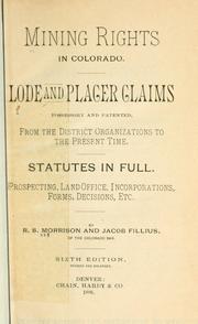

Search results from Open Library.
Recent natural events nearby
- Wildfire 310, Garfield, ColoradoWildfires · 2026-08-06 · 149 mi
- Wildfire Moonshine, Albany, WyomingWildfires · 2026-09-07 · 160 mi
- Wildfire Swiss Roll, Archuleta, ColoradoWildfires · 2026-08-20 · 177 mi
- Wildfire Post, Las Animas, ColoradoWildfires · 2026-08-11 · 182 mi
- Wildfire Rio Blanco, Archuleta, ColoradoWildfires · 2026-07-28 · 198 mi
- Wildfire Sheep Pen, Las Animas, ColoradoWildfires · 2026-08-12 · 205 mi
- Wildfire Cold Springs, Converse, WyomingWildfires · 2026-08-10 · 214 mi
- Wildfire LAUGHLIN, Colfax, New MexicoWildfires · 2026-08-25 · 219 mi
Wildfires, storms and other events from NASA EONET (last 12 months, within 250 mi).
Ground air-quality sensors
Recently spotted species
Nearest stream gauge
Events
Gallery
Sources
- • Wikipedia
- • US Census Bureau (ACS 5-year estimates)
- • NOAA National Weather Service
- • Wikidata
- • USGS Earthquake Catalog (global feed)
- • GBIF (Global Biodiversity Information Facility)
- • CDC PLACES
- • Open-Meteo / sunrise-sunset.org
- • Wikipedia Pageviews API
- • Open Library
- • NASA EONET