Browse / United States / Colorado / Vail
Vail
Coloradotown

Vail
Total population
4,613
Median home value
$1,400,700
Bachelor's+
Median income
$98,893
Founded
1966
Demographic figures from US Census Bureau · ACS 5-year estimates. Overview below cites Wikipedia and may reference a different year.
City facts
Sister cities
Facts from Wikidata (CC0).
Overview
Vail is a home rule municipality in Eagle County, Colorado, United States. The population of the town was 4,835 in 2020. Home to Vail Ski Resort, the largest ski mountain in Colorado, the town is known for its hotels, dining, and for the numerous events the city hosts annually, such as the Vail Film Festival, Vail Resorts Snow Days, and Bravo! Vail.
Read more on WikipediaHistory & geography
History
Vail was incorporated in 1966, four years after the opening of Vail Ski Resort. The ski area was founded by Pete Seibert and local rancher Earl Eaton in 1962, at the base of Vail Pass. The pass was named after Charles Vail, the highway engineer who routed U.S. Highway 6 through the Eagle Valley in 1940, which eventually became Interstate 70. Seibert, a New England native, served in the U.S. Army's 10th Mountain Division during World War II, which trained at Camp Hale, 14 miles south of Vail between Red Cliff and Leadville. He was wounded in Italy at the Battle of Riva Ridge but went on to become a professional skier after he recovered. Within the first year, the village had a ski shop operated by Dick Hauserman and Joe Langmaid, a ski boutique operated by Blanche Hauserman and Bunny Langmaid, a hotel and restaurant operated by Pepi Gramshammer, and the mountain had a manager. By 1969, Vail was the most popular ski resort in the state. In 1988 Vail opened China Bowl, making Vail the third largest ski area in North America. In 2023, the village paid $17 million to Vail Resorts to prevent Vail Resorts from building housing for 165 workers. This was preceded by a lengthy conflict where the village sought to block the construction of housing.
Geography
Vail's average elevation is above sea level. The town has a total area of , with no lakes (there is, however, at least one pond). Gore Creek flows from east to west through the center of town. The town is surrounded by the White River National Forest and the Vail Ski Resort is leased from the United States Forest Service. Mount of the Holy Cross is visible from Vail Mountain. Vail Mountain rises from to , giving a vertical rise of . It has a skiable area, 33 ski lifts, 193 marked skiing trails on three faces: the front side, the back bowls, and Blue Sky Basin. The seven back bowls are Sun Down Bowl, Sun Up Bowl, Teacup Bowl, China Bowl, Siberia Bowl, Inner Mongolia Bowl, and Outer Mongolia Bowl. Blue Sky Basin includes Pete's Bowl and Earl's Bowl—to commemorate Pete Seibert and Earl Eaton. The mountain resort also includes 17 miles of recreation paths, botanical gardens, and an outdoor amphitheater. Vail has warm summers and cold winters because of its elevation. Depending on the classification used, it is either an alpine or subarctic climate transitional with humid continental due to the mild daytime temperatures in September bringing the daily mean to around . Minimum temperatures mostly remain below the freezing point from late September to late May. The town receives an average of of snowfall per season, with even more in the surrounding mountains. Roads may close occasionally during heavy snowfall. Summer temperatures can reach the 80s, but are more often in the mid to high 70s. Combined with mountain breezes, this makes summers refreshing and cool. For being a borderline subarctic climate, daytime temperatures are very mild, indicating high diurnal temperature variation due to the altitude.
Excerpted from the corresponding Wikipedia article (CC BY-SA).
Demographics & economy
Race & ethnicity
Source: US Census Bureau — American Community Survey, 5-year estimates.
Geography
Coordinates & boundaries from the US Census TIGER/Line shapefiles.
Climate
Current forecast
Forecast for Vail, CO from NOAA NWS API.
Air quality
Industrial & pollution facilities
Natural hazard risk
Health (adults)
Age-adjusted prevalence estimates from CDC PLACES (latest release).
Walkability
Amenities nearby
Wildlife & biodiversity
Schools
Largest nearby schools
- Homestake Peak SchoolElementary · AVON · 500 students · 11.4:1 ratio
- Avon Elementary SchoolElementary · AVON · 296 students · 11.4:1 ratio
- Vail Ski and Snowboard Academy (VSSA)High · MINTURN · 259 students · 15.2:1 ratio
- Red Sandstone Elementary SchoolElementary · VAIL · 258 students · 13.6:1 ratio
Public K–12 schools within ~10 mi from Urban Institute Education Data Portal (NCES Common Core of Data, 2022).
Earthquake history
Photos
Sights & places nearby
Notable people from here


People born within ~10 km, from Wikidata (CC0). Click any name for their Wikipedia article.
Nearby places in Colorado
Geography & sun
Elevation, sunrise/sunset and daylight from Open-Meteo. Solar climatology from NASA POWER.
Nearby airports
Public attention
Pageview totals from the Wikimedia Pageviews API.
Books about Vail


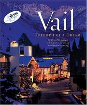

Search results from Open Library.
Recent natural events nearby
Ground air-quality sensors
Recently spotted species
Nearest stream gauge
Events
Gallery
Sources
- • Wikipedia
- • US Census Bureau (ACS 5-year estimates)
- • NOAA National Weather Service
- • Wikidata
- • NCES via Urban Institute Education Data Portal
- • CDC PLACES
- • Open-Meteo / sunrise-sunset.org
- • Wikipedia Pageviews API
- • Open Library