Browse / United States / Connecticut / Colchester
Colchester
ConnecticutCDP

Colchester
Total population
4,692
Median home value
$294,600
Bachelor's+
Median income
$86,760
Founded
1698
Demographic figures from US Census Bureau · ACS 5-year estimates. Overview below cites Wikipedia and may reference a different year.
City facts
Facts from Wikidata (CC0).
Overview
Colchester is a town in New London County, Connecticut, United States. The town is part of the Southeastern Connecticut Planning Region. The population was 15,555 at the 2020 census. In 2010 Colchester became the first town in Connecticut, and the 36th in the country, to be certified with the National Wildlife Federation as a Community Wildlife Habitat.
Read more on WikipediaHistory & geography
History
On March 31, 1661, the original settlement of Colchester was founded by Jeremy Adams on a 340-acre area of land, then known as "Jeremiah's Farme." The land was given to Jeremy by Uncas, Sachem of the Mohegan tribe. When Connecticut's first counties were created in 1666, Colchester stayed under Adams' ownership and was not incorporated into any new county, possibly because of its proximity to both Hartford and New London County. It would not formally join a county until 1698. At this time, Colchester was mainly a farming community. In 2009, Colchester adopted a right-to-farm ordinance, recognizing the "significant role" that agriculture played in Colchester's "heritage and future." On October 13, 1698, Michael Taintor II, Samuel Northam and Nathaniel Foote III applied to officially settle Colchester. Jeremiah's Farme was selected as the main point of reference for the town, with its north boundary as the Twenty Mile River. The southern side is bordered by Lyme, and the west boundary meets the east bounds of Middletown and Haddam. The east and northeast boundary runs to the bounds of Lebanon and Norwich. During the initial settlement, the area was also referred to as the Plantation of the Twenty-mile River. On May 11, 1699, the town's principal founders asked the general court of Hartford for assistance, alleging that several persons had hindered the advancement of the settlement by claiming ownership of "considerable tracts of land" within the grant. Nathaniel Foote and his family were some of the first to settle here and finished building their house in 1702. The house began construction in 1699 by Nathaniel Foote III and was then finished by his son Nathaniel Foote IV. The first schoolmaster began operations in 1705, and a schoolhouse was finished in 1711. The…
Geography
According to the United States Census Bureau, the town has a total area of , of which is land and , or 1.49%, is water. Among the many waterways are the Salmon River, Jeremy River, and Dickinson Creek, which is spanned by the Lyman Viaduct. It is approximately halfway between Hartford (25 miles away) and New London (28 miles away). *Colchester center *Golden Hill Paugussett Reservation *North Westchester *Westchester This climatic region is typified by large seasonal temperature differences, with warm to hot (and often humid) summers and cold (sometimes severely cold) winters. According to the Köppen Climate Classification system, Colchester has a humid continental climate, abbreviated "Dfb" on climate maps.
Excerpted from the corresponding Wikipedia article (CC BY-SA).
Demographics & economy
Race & ethnicity
Source: US Census Bureau — American Community Survey, 5-year estimates.
Geography
Coordinates & boundaries from the US Census TIGER/Line shapefiles.
Climate
Current forecast
Forecast for Colchester, CT from NOAA NWS API.
Air quality
Industrial & pollution facilities
Natural hazard risk
Health (adults)
Age-adjusted prevalence estimates from CDC PLACES (latest release).
Walkability
Amenities nearby
Wildlife & biodiversity
Schools
Largest nearby schools
- Bacon AcademyHigh · Colchester · 672 students · 11:1 ratio
- Colchester Elementary SchoolElementary · Colchester · 630 students · 13.7:1 ratio
- William J. Johnston Middle SchoolMiddle · Colchester · 477 students · 11.1:1 ratio
- Jack Jackter Intermediate SchoolElementary · Colchester · 444 students · 11.1:1 ratio
- Salem Elementary SchoolElementary · Salem · 397 students · 11.3:1 ratio
- Lebanon Elementary SchoolElementary · Lebanon · 366 students · 12.2:1 ratio
- Lyman Memorial High SchoolHigh · Lebanon · 322 students · 8.3:1 ratio
- Lebanon Middle SchoolMiddle · Lebanon · 264 students · 9.1:1 ratio
Public K–12 schools within ~10 mi from Urban Institute Education Data Portal (NCES Common Core of Data, 2022).
Earthquake history
Photos
Sights & places nearby
Notable people from here


People born within ~10 km, from Wikidata (CC0). Click any name for their Wikipedia article.
Nearby places in Connecticut
- East Hampton7.9 mi away
- Terramuggus8.2 mi away
- Lake Pocotopaug8.9 mi away
- South Windham10.7 mi away
- Willimantic11.5 mi away
- South Coventry12.5 mi away
- Higganum13.1 mi away
- Chester Center13.7 mi away
- Coventry Lake13.9 mi away · pop. 2,647
- Oxoboxo River14.1 mi away
- Deep River Center14.8 mi away · pop. 2,407
- Portland14.8 mi away · pop. 5,944
Geography & sun
Elevation, sunrise/sunset and daylight from Open-Meteo. Solar climatology from NASA POWER.
Nearby airports
Public attention
Pageview totals from the Wikimedia Pageviews API.
Books about Colchester
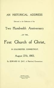
Search results from Open Library.
Recent natural events nearby
Ground air-quality sensors
Recently spotted species
Nearest stream gauge
Events
Gallery
Sources
- • Wikipedia
- • US Census Bureau (ACS 5-year estimates)
- • NOAA National Weather Service
- • Wikidata
- • NCES via Urban Institute Education Data Portal
- • CDC PLACES
- • Open-Meteo / sunrise-sunset.org
- • Wikipedia Pageviews API
- • Open Library