Browse / United States / Connecticut / Middletown
Middletown
Connecticutcity
Total population
47,958
Median home value
$295,300
Bachelor's+
Median income
$79,438
Founded
1651
Demographic figures from US Census Bureau · ACS 5-year estimates. Overview below cites Wikipedia and may reference a different year.
City facts
Facts from Wikidata (CC0).
Overview
Middletown is a city in Middlesex County, Connecticut, United States, located along the Connecticut River, in the central part of the state, 16 miles (25.8 km) south of Hartford. Middletown is the largest city in the Lower Connecticut River Valley Planning Region. In 1650, it was incorporated by English settlers as a town under its original Native American name, Mattabeseck, after the local Wangunk village of the same name. They were among many tribes along the Atlantic coast who spoke Algonquian languages. The colonists renamed the settlement in 1653.
Read more on WikipediaHistory & geography
History
The land on the western bank of the Connecticut River where Middletown now lies was home to a village of the Wangunk, a tribe of Algonquian-speaking Native Americans. The village was named Mattabesset (also spelled Mattabesett, Mattabesec, Mattabeseck, and Mattabesek); the area they inhabited—now Middletown and the surrounding area—was named after it. When the primarily English European settlers arrived in the region the Mattabesset were a part of the Wangunk, a large tribe in the Connecticut Valley, at the time under a sachem named Sowheag. Plans for the colonial settlement were drawn up by the General Court in 1646; the first migrants came from nearby Connecticut colonies in 1650. On September 11, 1651, the General Court of Connecticut established the town of "Mattabesett". A couple of years later in November 1653, the settlement was renamed as Middletown. This name was chosen because the site was approximately halfway between Windsor and Saybrook on the Great River. Life was not easy for these early colonial Puritans; clearing the land and building houses, and tending farms in the rocky soil of New England was a labor-intensive ordeal. They had a strict society; offenses legally punishable by death in the Connecticut colonies included "witchcraft, blasphemy, cursing or smiting of parents, and incorrigible stubbornness of children." During the 18th century, Middletown became the largest and most prosperous settlement in Connecticut. By the time of the American Revolution, Middletown was a thriving port, where one-third of its residents were involved in merchant and maritime activities. Some settlers held enslaved Africans as workers in the early economy of Middletown; they worked as domestic servants, laborers, and in shipping. African slaves were imported by the…
Geography
Middletown sits on the west bank of the Connecticut River, in the south-central portion of the state. Running alongside the river, Route 9 bisects the city. According to the United States Census Bureau, the city has a total area of 42.3 square miles (109.6 km), of which 40.9 square miles (105.9 km) is land and 1.4 square miles (3.7 km) is water. The total area is 3.36% water. Middletown shares borders with the neighboring towns of Cromwell, Portland, East Hampton, Haddam, Durham, Middlefield, Berlin, and Meriden. Of all the neighboring towns, Portland and East Hampton are the only ones that do not have any land boundaries, as they are located on the eastern side of the Connecticut River. The west side of Middletown is flanked by the Metacomet Ridge—a mountainous trap rock ridgeline that stretches from Long Island Sound to nearly the Vermont border. Notable mountains of the Metacomet Ridge in Middletown include Higby Mountain and the north side of Lamentation Mountain. The Mattabesett Trail traverses the ridge. The Nature Conservancy manages the summit and ledges of Higby Mountain. Major bodies of water include the Connecticut River along the towns eastern boundary, the Mattabesset River along its northern boundary, Crystal Lake in the southern end of town, and Pameacha Pond along South Main Street. The Mount Higby and Adder reservoirs also fall along its western boundary with Middlefield. * Highland – The westernmost neighborhood of Middletown. It is the only section of the city that Interstate 91 passes through within its total distance through Middletown. * Westfield – Formerly a village, now a mostly residential neighborhood located in the northwestern corner of the city, lying just south of the border with Cromwell. * Miramichi –…
Excerpted from the corresponding Wikipedia article (CC BY-SA).
Demographics & economy
Race & ethnicity
Source: US Census Bureau — American Community Survey, 5-year estimates.
Geography
Coordinates & boundaries from the US Census TIGER/Line shapefiles.
Climate
Current forecast
Forecast for Middletown, CT from NOAA NWS API.
Air quality
Industrial & pollution facilities
Natural hazard risk
Health (adults)
Age-adjusted prevalence estimates from CDC PLACES (latest release).
Walkability
Amenities nearby
Wildlife & biodiversity
Schools
Largest nearby schools
- Middletown High SchoolHigh · Middletown · 1,214 students · 11.3:1 ratio
- Beman Middle SchoolMiddle · Middletown · 968 students · 10.9:1 ratio
- Haddam-Killingworth High SchoolHigh · Higganum · 546 students · 10.7:1 ratio
- Memorial SchoolElementary · East Hampton · 544 students · 14.3:1 ratio
- Cromwell High SchoolHigh · Cromwell · 536 students · 11.4:1 ratio
- Vinal Technical High SchoolHigh · Middletown · 529 students · 10.6:1 ratio
- East Hampton High SchoolHigh · East Hampton · 514 students · 12.5:1 ratio
- Cromwell Middle SchoolMiddle · Cromwell · 483 students · 11.5:1 ratio
Public K–12 schools within ~10 mi from Urban Institute Education Data Portal (NCES Common Core of Data, 2022).
Earthquake history
Photos
Sights & places nearby
Notable people from here


People born within ~10 km, from Wikidata (CC0). Click any name for their Wikipedia article.
Nearby places in Connecticut
- Portland2.8 mi away · pop. 5,944
- East Hampton9.1 mi away · pop. 3,347
- Terramuggus11.2 mi away
- Cheshire Village12.8 mi away
- Quinnipiac University15.1 mi away · pop. 4,311
- North Haven15.5 mi away · pop. 24,336
- Deep River Center16.2 mi away · pop. 2,407
- Terryville20.2 mi away · pop. 5,461
- Naugatuck20.9 mi away
- Weatogue22.5 mi away · pop. 2,672
- Oakville22.6 mi away · pop. 9,276
- Coventry Lake23.1 mi away · pop. 2,647
Geography & sun
Elevation, sunrise/sunset and daylight from Open-Meteo. Solar climatology from NASA POWER.
Nearby airports
Public attention
Pageview totals from the Wikimedia Pageviews API.
Books about Middletown
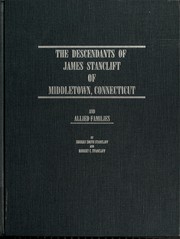

Search results from Open Library.
Recent natural events nearby
Ground air-quality sensors
Recently spotted species
Nearest stream gauge
Events
Gallery
Sources
- • Wikipedia
- • US Census Bureau (ACS 5-year estimates)
- • NOAA National Weather Service
- • Wikidata
- • NCES via Urban Institute Education Data Portal
- • CDC PLACES
- • Open-Meteo / sunrise-sunset.org
- • Wikipedia Pageviews API
- • Open Library