Browse / United States / Connecticut / Torrington
Torrington
Connecticutcity

Torrington
Total population
35,547
Median home value
$215,500
Bachelor's+
Median income
$70,856
Founded
1740
Demographic figures from US Census Bureau · ACS 5-year estimates. Overview below cites Wikipedia and may reference a different year.
City facts
Facts from Wikidata (CC0).
Overview
Torrington is the most populated municipality and largest city in Litchfield County, Connecticut, and the Northwest Hills Planning Region. It is also the core city of Greater Torrington, one of the largest micropolitan areas in the United States. The city population was 35,515 according to the 2020 census. The city is located roughly 23 miles (37 km) west of Hartford, 34 miles (55 km) southwest of Springfield, Massachusetts, 67 miles (108 km) southeast of Albany, New York, 84 miles (135 km) northeast of New York City, and 127 miles (204 km) west of Boston, Massachusetts.
Read more on WikipediaHistory & geography
History
Torrington was first settled in 1735 by Ebenezer Lyman, Jr., of Durham, Connecticut. The downtown section of Torrington was known as Wolcottville, after the Wolcott family of Connecticut, which produced several governors between 1813 and 1881. Its early settlers resided on the hills west of the Naugatuck River where the first school, church, store, and tavern were constructed. Later, the eastern hill known as Torringford was settled, as it provided the best farmland. Torrington was given permission to organize a government and incorporate as a town in October 1740. The town is named after Torrington in Devon, England. The fast moving waters of the Naugatuck River were used to power early nineteenth-century industries. Industrial growth skyrocketed when Frederick Wolcott constructed a woolen mill in 1813. The mill attracted a large workforce and created demands for goods, services, and housing. Israel Coe and Erastus Hodges began the construction of two brass mills on the Naugatuck River in 1834. This event sparked the beginning of the brass industry in Torrington, which later would spread throughout the entire Naugatuck Valley. In 1849, the Naugatuck Valley railroad was completed, connecting Torrington with other population centers, ending its isolation, and stimulating further industrial growth. Soon, Torrington was producing a variety of metal products, including needles, brass, hardware, bicycles, and tacks. Torrington's growing industrial plants attracted English, Irish, and German immigrants throughout the nineteenth and early twentieth centuries. Between 1880 and 1920, Torrington's population soared from 3,000 to 22,000 as immigration from southern and eastern Europe increased; most immigrants during this period were Poles, Czechs, Slovaks, and Italians.…
Geography
According to the United States Census Bureau, the city has a total area of 40.4 square miles (104.6 km). Approximately 39.8 square miles (103.1 km) of this area is land and 1.5 km (0.6 sq mi or 1.41%) is water. The eastern and western sides of the city, at its borders, are at the tops of peaks, while the downtown and central sections of the city are in the Naugatuck River Valley. This provides some interesting views from the higher locations, with the city lights as a backdrop below. Due to the lack of suitable highways and bypass routes in an east–west direction, crossing the city requires driving down into the valley and back up the other side. *Burrville *Drakeville *Newfield *Torringford (part of which has been named the Torringford Street Historic District) *Downtown Torrington *West Torrington *Wrightville This climatic region is typified by large seasonal temperature differences, with warm to hot (and often humid) summers and cold (sometimes severely cold) winters. According to the Köppen Climate Classification system, Torrington has a humid continental climate, abbreviated "Dfb" on climate maps. The climate data is taken from a weather station in Bakerville, CT 5 miles east of Torrington.
Excerpted from the corresponding Wikipedia article (CC BY-SA).
Demographics & economy
Race & ethnicity
Source: US Census Bureau — American Community Survey, 5-year estimates.
Geography
Coordinates & boundaries from the US Census TIGER/Line shapefiles.
Climate
Current forecast
Forecast for Torrington, CT from NOAA NWS API.
Air quality
Industrial & pollution facilities
Natural hazard risk
Health (adults)
Age-adjusted prevalence estimates from CDC PLACES (latest release).
Walkability
Amenities nearby
Wildlife & biodiversity
Schools
Largest nearby schools
- Torrington High SchoolHigh · Torrington · 1,010 students · 11.6:1 ratio
- Torrington Middle SchoolMiddle · Torrington · 975 students · 11.9:1 ratio
- Har-Bur Middle SchoolMiddle · Burlington · 653 students · 10.4:1 ratio
- Lewis S. Mills High SchoolHigh · Burlington · 648 students · 11.2:1 ratio
- Oliver Wolcott Technical High SchoolHigh · Torrington · 618 students · 12.1:1 ratio
- Torringford SchoolElementary · Torrington · 612 students · 13.6:1 ratio
- Northwestern Regional High SchoolHigh · Winsted · 564 students · 9.6:1 ratio
- Vogel-Wetmore SchoolElementary · Torrington · 532 students · 11.1:1 ratio
Public K–12 schools within ~10 mi from Urban Institute Education Data Portal (NCES Common Core of Data, 2022).
Earthquake history
Photos
Sights & places nearby
Notable people from here


People born within ~10 km, from Wikidata (CC0). Click any name for their Wikipedia article.
Geography & sun
Elevation, sunrise/sunset and daylight from Open-Meteo. Solar climatology from NASA POWER.
Nearby airports
Public attention
Pageview totals from the Wikimedia Pageviews API.
Books about Torrington
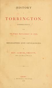


Search results from Open Library.
Recent natural events nearby
Ground air-quality sensors
Recently spotted species


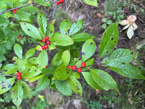


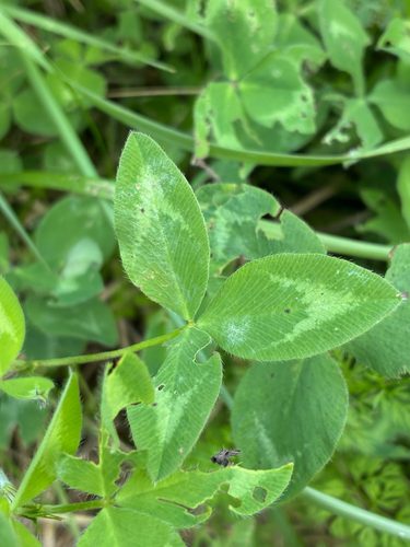


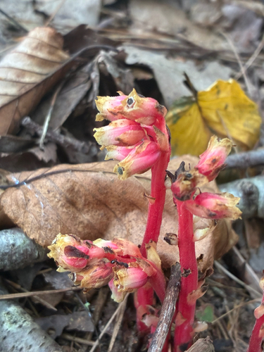
Research-grade observations from iNaturalist (within ~15 mi).
Nearest stream gauge
Events
Gallery
Sources
- • Wikipedia
- • US Census Bureau (ACS 5-year estimates)
- • NOAA National Weather Service
- • Wikidata
- • NCES via Urban Institute Education Data Portal
- • iNaturalist
- • CDC PLACES
- • Open-Meteo / sunrise-sunset.org
- • Wikipedia Pageviews API
- • Open Library