Browse / Cuba / Cuba / Chambas
Chambas
Cubatown
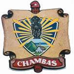
Chambas
Total population
10,808
Demographic figures from ONEI Cuba. Overview below cites Wikipedia and may reference a different year.
City facts
Facts from Wikidata (CC0).
Overview
Chambas is a municipality and town in the Ciego de Ávila Province of Cuba. It emerged in 1976 with the new political-administrative division, occupies an area of 770.08 km², including 12 km² of adjacent cays, which ranks it second in the province in terms of surface area. It has a population of 39,085 inhabitants, with a density of 54.5 inhabitants per square kilometer, lower than the provincial average. However, it is one of the municipalities with the highest population density in the province, surpassed only by the municipalities of Ciego de Ávila, Morón, and Florencia.
Read more on WikipediaHistory & geography
History
According to some preserved historical data, upon the arrival of the Spanish conquistadors to the territory of the current municipality of Chambas, they encountered several groups of indigenous people. Currently, several areas showing signs of having been inhabited by indigenous people are being studied, examples of these places are: * Nauyú aboriginal settlement, near the town of "El Calvario". * Santa Clarita aboriginal settlement, next to the springs of the Aguas Azules tourist center. * Mabuya aboriginal settlement, located next to the bridge of the stream that runs east of the town. * Buchillones aboriginal settlement between Punta Alegre and the Máximo Gómez sugar mill. Currently, a recovery and conservation of pieces found in the aforementioned sites are being carried out in the municipality as evidence of the indigenous populations that existed in the Chambas area, which can be seen in the municipal museum.
Geography
It is located in the northern part of the province, bordering the municipalities of Morón and Florencia, as well as the province of Sancti Spíritus. To the north it borders the Bay of Buena Vista and the Laguna de Leche. It comprises the villages of El Asiento, El Calvario, Falla, Kilo 9, Las Palmas, Los Perros, Mabuya, Piedra, Punta Alegre, Punta San Juan (Maxímo Gómez Sugar Mill) and Ranchuelo.
Excerpted from the corresponding Wikipedia article (CC BY-SA).
Geography
Coordinates & boundaries from the US Census TIGER/Line shapefiles.
Climate
Air quality
Walkability
Amenities nearby
Wildlife & biodiversity
Earthquake history
Photos
Sights & places nearby
Notable people from here
Geography & sun
Elevation, sunrise/sunset and daylight from Open-Meteo. Solar climatology from NASA POWER.
Nearby airports
Public attention
Pageview totals from the Wikimedia Pageviews API.
Books about Chambas
Search results from Open Library.
Recent natural events nearby
Ground air-quality sensors
Recently spotted species
Events
Gallery
Sources
- • Wikipedia
- • Wikidata
- • Open-Meteo / sunrise-sunset.org
- • Wikipedia Pageviews API
- • Open Library