Browse / Czechia / Moravian-Silesian / Frýdlant nad Ostravicí
Frýdlant nad Ostravicí
Moravian-Silesiantown

Frýdlant nad Ostravicí
Total population
8,781
Demographic figures from Czech Statistical Office. Overview below cites Wikipedia and may reference a different year.
City facts
Sister cities
Facts from Wikidata (CC0).
Overview
Frýdlant nad Ostravicí is a town in Frýdek-Místek District in the Moravian-Silesian Region of the Czech Republic. It has about 9,800 inhabitants. The town is located on the Ostravice River, on the border between the Moravian-Silesian Foothills and Moravian-Silesian Beskids.
Read more on WikipediaHistory & geography
History
The first written mention of Frýdlant is from 1395. The town was founded in the second half of the 14th century during German Ostsiedlung. It was established as a market town that was supposed to be the local centre of trade and handicrafts. In 1402, Frýdlant was sold by the Lords of Kravaře to Duke Przemyslaus I Noszak and joined to Duchy of Teschen. Frýdlant found itself on the periphery, lost its position and became a mere village. The economy was also hit by the Hussite Wars. In the 16th century, Frýdlant was sold to the Olomouc bishopric and became part of the Hukvaldy estate. It was the impetus for the re-development of crafts. In 1625, the village received various privileges from the bishop Franz von Dietrichstein. During the Thirty Years' War, Frýdlant suffered from frequent army crossings. Between 1646 and 1648, the first hammer mills were built and Frýdland gradually became a centre of ironworks. The village later known as Nová Ves was founded near the hammer mills in 1647. In 1675, blast furnaces were built. Thanks to the development of the ironworks and the prosperous paper mill, the village was promoted by Maria Theresa to the market town again in 1775. The railway was built in 1871. Large fires in 1886 and 1890 damaged the market town severely. In 1948, Frýdland was promoted to a town.
Geography
Frýdlant nad Ostravicí is located about south of Frýdek-Místek and south of Ostrava. It lies mostly in the Moravian-Silesian Foothills, only the southern part of the municipal territory extends into the Moravian-Silesian Beskids. The highest point is at above sea level. The town lies on the Ostravice River, at its confluence with the Čeladenka Stream. The left bank of the Ostravice with the town proper lies in the historical land of Moravia, while the right bank with the villages of Lubno and Nová Ves lies in Czech Silesia.
Excerpted from the corresponding Wikipedia article (CC BY-SA).
Geography
Coordinates & boundaries from the US Census TIGER/Line shapefiles.
Climate
Air quality
Walkability
Amenities nearby
Wildlife & biodiversity
Earthquake history
Photos
Sights & places nearby
Notable people from here


People born within ~10 km, from Wikidata (CC0). Click any name for their Wikipedia article.
Nearby places in Moravian-Silesian
- Nová Ves1.2 mi away · pop. 1,010
- Metylovice1.3 mi away · pop. 1,491
- Pržno1.4 mi away · pop. 750
- Malenovice2.5 mi away · pop. 377
- Lhotka2.8 mi away · pop. 432
- Hodoňovice2.9 mi away · pop. 598
- Palkovice3.5 mi away · pop. 2,154
- Baška3.7 mi away · pop. 2,559
- Myslík4.3 mi away · pop. 446
- Kozlovice4.6 mi away · pop. 2,602
- Skalice4.6 mi away · pop. 1,109
- Bahno4.6 mi away
Geography & sun
Nearby airports
Public attention
Books about this place
Recent natural events nearby
Ground air-quality sensors
Recently spotted species





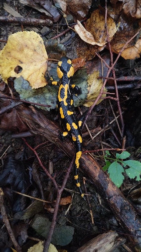



Research-grade observations from iNaturalist (within ~15 mi).
Events
Gallery
Official Identifiers
ČSÚ — Czech Statistical Office
- RÚIAN code
- CZ598143
- Population (Wikidata)
- 9,835
- Wikidata
- Q1010131
RÚIAN obec ID via Wikidata P782
Sources
- • Wikipedia
- • Wikidata
- • iNaturalist
- • Wikidata SPARQL (CC0) — population, area, elevation, inception, head of government, Commons image
- • ČSÚ — Czech Statistical Office — RÚIAN obec ID via Wikidata P782