Browse / Germany / Bayern / Aschaffenburg
Aschaffenburg
Bayerntown

Aschaffenburg
Total population
67,844
Demographic figures from Destatis. Overview below cites Wikipedia and may reference a different year.
City facts
Sister cities
Facts from Wikidata (CC0).
Overview
Aschaffenburg is a town in northwest Bavaria, Germany. The town of Aschaffenburg, despite being its administrative seat, is not part of the district of Aschaffenburg.
Read more on WikipediaHistory & geography
History
The name Aschaffenburg (Ascaffaburc, Ascapha or Ascaphaburg in the Middle Ages) originally meant "castle at the ash tree river" deriving from the river Aschaff that runs through parts of the town. The earliest remains of settlements in the area of Aschaffenburg date from the Stone Age. Aschaffenburg was originally a settlement of the Alamanni. Roman legions were stationed here. In c. 700 AD, the Ravenna Cosmography names two settlements in the region: Uburzis (Würzburg) and Ascapha (Aschaffenburg). Around 550, the area had been conquered by the Franks, and their Hausmeier built a castle here. In the 8th century, a Benedictine monastery was founded, dedicated to St. Michael, reportedly by Saint Boniface. This became the Kollegiatstift St. Peter und Alexander in the second half of the 10th century (957). In 869, King Louis the Younger married Liutgard of Saxony at Aschaffenburg. She also died here in 885 and was later laid to rest with her daughter Hildegard in the Stiftskirche. Ascaffinburg is mentioned first in 974 in a gift document by Otto II, in which he gave several villages including Wertheim am Main and a stretch of forest in the Spessart to the collegiate church. In the Middle Ages the town was known as Ascaffaburc, Ascapha or Ascaphaburg. A stone bridge over the Main was reportedly built by Archbishop Willigis in 989, who also made the town his second residence. The town (referred to in 975 as a civitas) was part of the Archbishopric of Mainz from 982, when Duke Otto died. A Vizedom is mentioned for the first time in 1122 as the top local representative of the Archbishop. In 1292 a synod was held here, and in 1447 an imperial diet, preliminary to that of Vienna, approved a concordat (sometimes called the Aschaffenburg Concordat). In the German Peasants' War…
Geography
The town is located on both sides of the Main in north-west Bavaria, bordering to Hesse. On a federal scale it is part of central Germany, just southeast of Frankfurt am Main. In the western part of the municipality, the smaller Aschaff flows into the Main. The region is also known as Bayerischer Untermain ("Bavarian Lower Main"). The climate is continental, typically with warm, dry summers and cold, damp winters. Aschaffenburg usually receives less snowfall during the winter than the nearby Spessart. Aschaffenburg comprises 10 Stadtteile: * Damm * Gailbach * Leider * Nilkheim * Obernau * Obernauer Kolonie (Obernauer Colony) * Österreicher Kolonie (Austrian Colony) * Schweinheim * Stadtmitte (town center) * Strietwald Nilkheim and Leider are the only Stadtteile that are located on the left bank of the river Main. The following municipalities border Aschaffenburg (clockwise, from the north): Johannesberg, Glattbach, Goldbach, Haibach, Bessenbach, Sulzbach am Main, Niedernberg, Großostheim, Stockstadt am Main and Mainaschaff.
Excerpted from the corresponding Wikipedia article (CC BY-SA).
Geography
Coordinates & boundaries from the US Census TIGER/Line shapefiles.
Climate
Air quality
Walkability
Amenities nearby
Wildlife & biodiversity
Earthquake history
Photos
Sights & places nearby
Notable people from here


People born within ~10 km, from Wikidata (CC0). Click any name for their Wikipedia article.
Nearby places in Bayern
- Goldbach2.4 mi away · pop. 9,823
- Richelbach22.7 mi away · pop. 570
- Amorbach23 mi away · pop. 4,145
- Retzbach30.5 mi away
- Rupboden32.4 mi away
- Arnstein36.6 mi away · pop. 8,343
- Oberbach41.7 mi away
- Eibelstadt41.8 mi away · pop. 2,873
- Darstadt43.2 mi away
- Dipbach43.9 mi away
- Westheim43.9 mi away · pop. 123
- Dettelbach46.8 mi away · pop. 6,949
Geography & sun
Elevation, sunrise/sunset and daylight from Open-Meteo. Solar climatology from NASA POWER.
Nearby airports
Public attention
Pageview totals from the Wikimedia Pageviews API.
Books about Aschaffenburg

Search results from Open Library.
Recent natural events nearby
Ground air-quality sensors
Recently spotted species

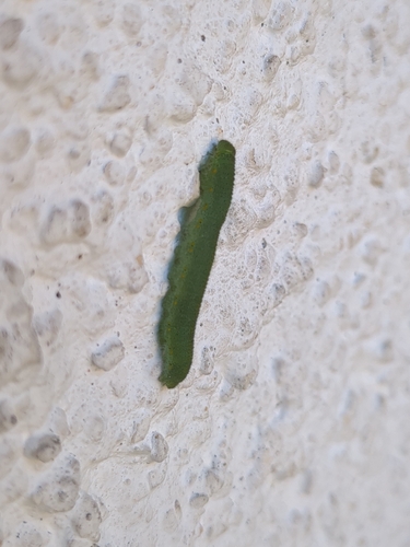
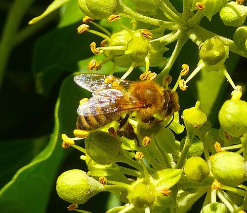

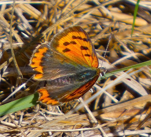
Research-grade observations from iNaturalist (within ~15 mi).
Events
Notable, recurring, and historical events associated with Aschaffenburg, sourced from Wikidata.
- Q139546566planned event
- Q136047519planned event
- Q136203100planned event
Source: Wikidata (CC0).
Gallery
Official Identifiers
Destatis — German Federal Statistical Office
- AGS
- 09661000
- Population (Wikidata)
- 72,918
- Wikidata
- Q3942
Amtlicher Gemeindeschlüssel (AGS) via Wikidata P439
Sources
- • Wikipedia
- • Wikidata
- • iNaturalist
- • Open-Meteo / sunrise-sunset.org
- • Wikipedia Pageviews API
- • Open Library
- • Wikidata SPARQL (CC0) — population, area, elevation, inception, head of government, Commons image
- • Destatis — German Federal Statistical Office — Amtlicher Gemeindeschlüssel (AGS) via Wikidata P439