Browse / Germany / Baden-Württemberg / Heidenheim an der Brenz
Heidenheim an der Brenz
Baden-Württembergtown

Heidenheim an der Brenz
Total population
46,419
Air quality index
Demographic figures from Destatis. Overview below cites Wikipedia and may reference a different year.
City facts
Sister cities
Facts from Wikidata (CC0).
Overview
Heidenheim an der Brenz, or just Heidenheim, is a town in Baden-Württemberg in southern Germany. It is located near the border with Bavaria, approximately 17 km south of Aalen and 33 km north of Ulm. Heidenheim is the largest town and the seat of the district of Heidenheim, and ranks third behind Aalen and Schwäbisch Gmünd in size among the towns in the region of East Württemberg. Heidenheim is the economic center for all the communities in Heidenheim district and is the headquarters of the Voith industrial company. The town's population in 2021 was just below the 50,000 mark. Heidenheim collaborates with the town of Nattheim in administrative matters.
Read more on WikipediaHistory & geography
History
There is evidence that human life existed within the city limits of Heidenheim as far back as 8,000 years ago. However, a permanent settlement was not established until approximately 1300 BC. Extensive ruins remain of settlements dating, predominantly, to the period from 1200 to 800 BC. At the time of the Roman Empire from about 85 AD onwards, Heidenheim was the location of Castle Aquileia with attached cavalry of more than 1,000 mounted soldiers. The unit, called ala II flavia milliaria was later, around 159 AD, moved further North to Aalen. At first, the castle marked the Eastern end of the Alb Limes. But it did not take long until a civilian settlement was founded at this strategically important spot, marked by the intersection of five Roman roads. This settlement was the largest Roman city in what is today Baden-Württemberg and archeological finds suggest that it covered an area of approximately 37 - 50 acres (15 - 20 hectares). More recently, excavations have found the remains of a representative Roman administrative building. Its exact function was not fully understood as of May 2005, but given Aquileias size, location and other indicators, it is believed that it was probably the capital of a Roman administrative district (see also Civitas). From 233 on, the Alamanni repeatedly attacked the Roman limes fortifications. The Roman surrender of the limes in 260 spelled the end of the Roman city of Heidenheim. It is not clear to what extent Romans stayed on under the new Alamannic rule but it is very likely that some remained. Nothing is known about Aquileia/Heidenheim during the period of the Great Migration. However, in the 8th century Heidenheim was mentioned (again) for the first time in official documents. The creation of the city in the Middle Ages went hand…
Geography
Heidenheim is situated between Albuch and the Härtsfeld region in the northeast corner of the Swabian Alb where the valley of the Brenz meets the Stubental at the foot of Hellenstein Mountain. The source of the Brenz is located in Königsbronn and enters Heidenheim from the northwest. It runs through the boroughs of Aufhausen and Schnaitheim before it gets to Heidenheim (proper). From there it continues on to the south through the borough of Mergelstetten, before it leaves the city limits to head for Herbrechtingen. Heidenheim shares borders with the following cities and towns, listed clockwise starting from the North: Aalen and Neresheim (both in Ostalb County), Nattheim (Heidenheim County), Syrgenstein (Dillingen County, Bavaria), as well as Herbrechtingen, Steinheim am Albuch and Königsbronn (all in Heidenheim County). Heidenheim an der Brenz consists of Heidenheim (proper) and the subdivisions (boroughs) of Schnaitheim, Mergelstetten, Oggenhausen and Großkuchen (annexed between 1910 and 1974). Each of the four boroughs includes their own neighbourhoods that either have a long history of their own or were created as new developments. But while these neighbourhoods received their names during construction, their boundaries have not been officially defined. Oggenhausen and Großkuchen became part of Heidenheim during the last district reform in the 1970s and are also municipalities under state administrative law. This designation entitles them to a borough council, elected by registered voters in municipal elections. The Municipal Council is headed by a president. Schnaitheim, to the north, was at one time a politically independent small town but is now Heidenheim's largest borough, officially known as Heidenheim-Schnaitheim. Expansion of both towns has now…
Excerpted from the corresponding Wikipedia article (CC BY-SA).
Geography
Coordinates & boundaries from the US Census TIGER/Line shapefiles.
Climate
10-year averages from ERA5 reanalysis (Open-Meteo).
Air quality
Current readings from Open-Meteo Air Quality API (Copernicus CAMS European reanalysis).
Walkability
Amenities nearby
Wildlife & biodiversity
Most-observed species
- Great TitParus major Linnaeus, 1758 · Aves1,258
- Eurasian Blue TitCyanistes caeruleus (Linnaeus, 1758) · Aves1,032
- Eurasian BlackbirdTurdus merula Linnaeus, 1758 · Aves921
- Eurasian Tree SparrowPasser montanus (Linnaeus, 1758) · Aves902
- European RobinErithacus rubecula (Linnaeus, 1758) · Aves845
- Eurasian NuthatchSitta europaea Linnaeus, 1758 · Aves733
- House SparrowPasser domesticus (Linnaeus, 1758) · Aves557
- Common ChaffinchFringilla coelebs Linnaeus, 1758 · Aves550
Citizen-science & research observations from the Global Biodiversity Information Facility (GBIF).
Earthquake history
Most recent
- M 3.4 — 2022-10-16Baden-Wurttemberg, Germany
- M 4 — 2022-07-092 km NNE of Grosselfingen, Germany
- M 3.1 — 2008-12-253 km NNW of Saulgau, Germany
- M 2.5 — 2008-12-122 km ESE of Nehren, Germany
- M 2.7 — 2008-07-091 km WSW of Dußlingen, Germany
- M 2.5 — 2008-07-032 km W of Dußlingen, Germany
Events from the USGS Earthquake Catalog (global) (FDSN Event Web Service).
Photos
Sights & places nearby
Notable people from here


People born within ~10 km, from Wikidata (CC0). Click any name for their Wikipedia article.
Nearby places in Baden-Württemberg
- Giengen an der Brenz5.7 mi away · pop. 19,018
- Ebnat8.7 mi away · pop. 3,300
- Treffelhausen12 mi away
- Weißenstein12.3 mi away
- Schnittlingen12.6 mi away
- Degenfeld12.9 mi away
- Nenningen13.5 mi away
- Stötten13.5 mi away
- Albeck14.1 mi away
- Weiler in den Bergen14.1 mi away
- Bargau14.3 mi away
- Amstetten-Dorf15.2 mi away
Geography & sun
Elevation, sunrise/sunset and daylight from Open-Meteo. Solar climatology from NASA POWER.
Nearby airports
Public attention
Pageview totals from the Wikimedia Pageviews API.
Books about this place
Recent natural events nearby
Ground air-quality sensors
Recently spotted species

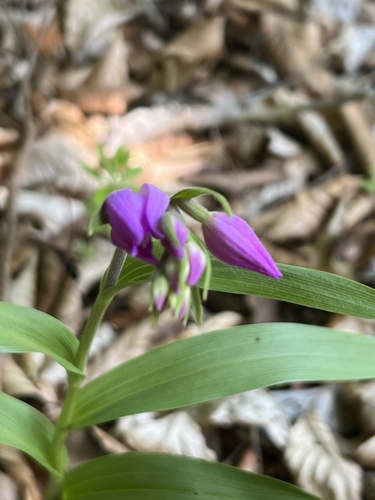



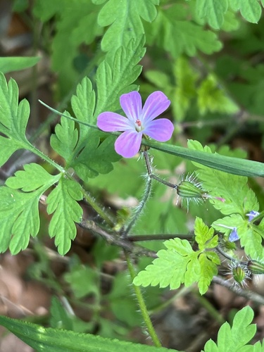
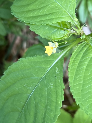


Research-grade observations from iNaturalist (within ~15 mi).
Events
Gallery
Geotagged photos within ~6 miles of Heidenheim an der Brenz, from Wikimedia Commons contributors.
 0 mi
0 mi 0 mi
0 mi.jpg) 0 mi
0 mi 0.1 mi
 0.1 mi
 0.1 mi
 0.1 mi
.jpg) 0.1 mi
0.1 mi 0.1 mi
 0.1 mi
 0.1 mi
 0.1 mi
 0.1 mi
 0.1 mi
 0.1 mi
 0.1 mi
 0.1 mi
 0.1 mi
 0.1 mi
.jpg) 0.1 mi
0.1 mi.jpg) 0.1 mi
0.1 mi.jpg) 0.1 mi
0.1 mi.jpg) 0.1 mi
0.1 mi.jpg) 0.1 mi
0.1 miPhotos via Wikimedia Commons — see each image page for license & attribution.
Official Identifiers
Destatis — German Federal Statistical Office
- AGS
- 08135019
- Population (Wikidata)
- 49,895
- Wikidata
- Q6869
Amtlicher Gemeindeschlüssel (AGS) via Wikidata P439
Sources
- • Wikipedia
- • Open-Meteo (ERA5 reanalysis)
- • Wikimedia Commons
- • Wikidata
- • Open-Meteo Air Quality (CAMS)
- • USGS Earthquake Catalog (global feed)
- • GBIF (Global Biodiversity Information Facility)
- • iNaturalist
- • Open-Meteo / sunrise-sunset.org
- • Wikipedia Pageviews API
- • Wikidata SPARQL (CC0) — population, area, elevation, inception, head of government, Commons image
- • Destatis — German Federal Statistical Office — Amtlicher Gemeindeschlüssel (AGS) via Wikidata P439