Browse / Germany / Bayern / Lohr am Main
Lohr am Main
Bayerntown

Lohr am Main
Total population
15,012
Air quality index
Demographic figures from Destatis. Overview below cites Wikipedia and may reference a different year.
City facts
Facts from Wikidata (CC0).
Overview
Lohr am Main or Loa is a town in the Main-Spessart district in the Regierungsbezirk of Lower Franconia (Unterfranken) in Bavaria, Germany and the seat of the Verwaltungsgemeinschaft of Lohr am Main. It has a population of around 15,000.
Read more on WikipediaHistory & geography
History
The town of Lohr am Main was settled no later than the 8th century, and by the time of its first documentary mention in 1295 it was already the main centre of the County of Rieneck. In 1333 Lohr was granted town rights, which can be explained by the disagreement about the inheritance of the Counts of Rieneck-Rothenfels, which had died out. Indeed, Lohr had been a "town" for quite some time already. The town lords were the Counts of Rieneck, who had been enfeoffed by the Archbishop of Mainz (evidence of this is only available beginning in 1366). In 1559, after the last Count of Rieneck, Philipp III’s death, the fief passed to the Archbishopric of Mainz. From 1603 to 1618, during the "Recatholization" many townsfolk fell victim to persecution as witches. The former Oberamt of the Prince-Bishopric of Würzburg was secularized in favour of Prince Primate von Dalberg's Principality of Aschaffenburg and passed along with this state in 1814 (by this time it had become a part of the Grand Duchy of Frankfurt) to the Kingdom of Bavaria. In the course of administrative reform in Bavaria, the current town-level municipality came into being with the Gemeindeedikt ("Municipal Edict") of 1818. In 1875, the Alte Mainbrücke (old Main bridge) was built. In 1936 came the new Lindig neighbourhood. In 1939, Sendelbach was amalgamated with the town. Between 1940 and 1945, under Nazi rule more than 600 children, women and men were deported to Sonnenstein and Grafeneck, as well as to the Auschwitz and Mauthausen concentration camps from what was then the Health and Care Institute (now the Regional Hospital for Psychiatry) as part of the Euthanasia programme, "Action T4". Since 1993, a bronze relief in the street by artist Rainer Stoltz serves as a memorial to these victims of the Nazi…
Geography
The municipal territory extends on both banks of the Main about halfway between Würzburg and Aschaffenburg in Lower Franconia. The town of Lohr lies on the eastern slope of the Spessart at a bend in the river Main, which swings towards the south here, forming the beginning of the Mainviereck ("Main Square" – the southern part of the Spessart). In Lohr, the river Lohr empties into the Main. Perhaps for its geographical location or the fact that two major valleys lead into the interior of the range, the town is known as the "Gateway to the Spessart" (Tor zum Spessart). The Main river valley is steep with an elevation change from 160 m above sea level at Gemünden dropping to 100 m above sea level at Hanau. The river Main in its natural state is a fast-moving stream unsuitable for shipping. In the 19th century the river was tamed and a system of dams and locks is now part of the Rhine-Main-Danube Canal connecting the North Sea with the Black Sea. The bedrock, with a depth of about 400 m, is made up mainly of sedimentary minerals. In the Spessart is found a great deal of bunter. This geological plain with a slight slope to the southeast is the product of a large continental sea that drained owing to a tectonic shift. In the east, the range is abutted by the Fränkische Platte (a flat, mostly agricultural region), whose geology is mainly Muschelkalk-based. The sandstone bedrock with strata of loess and clay in conjunction with an extensive forest provide for excellent water quality of the springs and groundwater of the region. The people of Lohr thus enjoy high-quality drinking water. Currently, large amounts of this water are pumped to areas as far away as Würzburg. Lohr am Main's Stadtteile are , Lindig, , , , , , and . The town has the following…
Excerpted from the corresponding Wikipedia article (CC BY-SA).
Geography
Coordinates & boundaries from the US Census TIGER/Line shapefiles.
Climate
10-year averages from ERA5 reanalysis (Open-Meteo).
Air quality
Current readings from Open-Meteo Air Quality API (Copernicus CAMS European reanalysis).
Walkability
Amenities nearby
Wildlife & biodiversity
Earthquake history
Most recent
- M 3.6 — 2014-05-172 km ESE of Pfungstadt, Germany
- M 3.4 — 2010-12-234 km WNW of Mainz, Germany
- M 3.4 — 2010-06-293 km NW of Hochheim am Main, Germany
- M 2.6 — 2008-05-063 km SSW of Völkershausen, Germany
- M 2.6 — 2006-09-242 km SE of Neustadt (Hessen), Germany
- M 3.2 — 2005-09-222 km SSW of Völkershausen, Germany
Events from the USGS Earthquake Catalog (global) (FDSN Event Web Service).
Photos
Sights & places nearby
Notable people from here
Geography & sun
Elevation, sunrise/sunset and daylight from Open-Meteo. Solar climatology from NASA POWER.
Nearby airports
Public attention
Pageview totals from the Wikimedia Pageviews API.
Books about Lohr am Main
Search results from Open Library.
Recent natural events nearby
Ground air-quality sensors
Recently spotted species



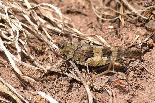





Research-grade observations from iNaturalist (within ~15 mi).
Events
Gallery
Official Identifiers
Destatis — German Federal Statistical Office
- AGS
- 09677155
- Population (Wikidata)
- 15,353
- Wikidata
- Q504774
Amtlicher Gemeindeschlüssel (AGS) via Wikidata P439
Sources
- • Wikipedia
- • Open-Meteo (ERA5 reanalysis)
- • Wikidata
- • Open-Meteo Air Quality (CAMS)
- • USGS Earthquake Catalog (global feed)
- • iNaturalist
- • Open-Meteo / sunrise-sunset.org
- • Wikipedia Pageviews API
- • Open Library
- • Wikidata SPARQL (CC0) — population, area, elevation, inception, head of government, Commons image
- • Destatis — German Federal Statistical Office — Amtlicher Gemeindeschlüssel (AGS) via Wikidata P439