Browse / Germany / Bayern / Miesbach
Miesbach
Bayerntown
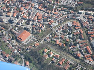
Miesbach
Total population
12,001
Demographic figures from Destatis. Overview below cites Wikipedia and may reference a different year.
City facts
Overview
Miesbach is a town in Bavaria, Germany, and is the capital of the Miesbach district. The district is at an altitude of 697 metres above sea level. It covers an area of approximately 863.50 km2 of alpine headlands and in 2017 had a population of 11,477. The town is located 48 km southeast of Munich. Lake Schliersee and Lake Tegernsee, around which are the internationally renowned spas, Bad Wiessee, Rottach-Egern and Tegernsee, are nearby. Miesbach was founded around the year 1000 and was for hundreds of years the seat of the County of Hohenwaldeck. In the 19th century, it became the centre of the conservation movement for the traditional costumes, the Tracht. Miesbach also has a rich history as a pilgrimage and a mining village, which can still be seen in the city landscape.
History & geography
Geography
Coordinates & boundaries from the US Census TIGER/Line shapefiles.
Climate
Air quality
Walkability
Amenities nearby
Wildlife & biodiversity
Earthquake history
Photos
Sights & places nearby
Notable people from here
Geography & sun
Nearby airports
Public attention
Books about this place
Recent natural events nearby
Ground air-quality sensors
Recently spotted species
Events
Gallery
Official Identifiers
Destatis — German Federal Statistical Office
- AGS
- 09182125
- Population (Wikidata)
- 12,109
- Wikidata
- Q269157
Amtlicher Gemeindeschlüssel (AGS) via Wikidata P439
Sources
- • Wikipedia
- • Wikidata SPARQL (CC0) — population, area, elevation, inception, head of government, Commons image
- • Destatis — German Federal Statistical Office — Amtlicher Gemeindeschlüssel (AGS) via Wikidata P439