Browse / Germany / Brandenburg / Templin
Templin
Brandenburgtown

Templin
Total population
13,681
Demographic figures from Destatis. Overview below cites Wikipedia and may reference a different year.
City facts
Overview
Templin is a small town in the Uckermark district of Brandenburg, Germany. Though it has a population of only 17,127 (2006), in terms of area it is, with 377.01 km2, the second largest town in Brandenburg and the seventh largest town in Germany. The town is located in the south of the rural Uckermark region and its capital Prenzlau, north of the Schorfheide-Chorin Biosphere Reserve. The municipality comprises the villages of Ahrensdorf, Bebersee, Beutel, Densow, Gandenitz, Gollin, Gross Dölln, Gross Väter, Grunewald, Hammelspring, Herzfelde, Hindenburg, Klosterwalde, Petznick, Röddelin, Storkow and Vietmannsdorf.
History & geography
Geography
Coordinates & boundaries from the US Census TIGER/Line shapefiles.
Climate
Air quality
Walkability
Amenities nearby
Wildlife & biodiversity
Earthquake history
Photos
Sights & places nearby
Notable people from here
Geography & sun
Elevation, sunrise/sunset and daylight from Open-Meteo. Solar climatology from NASA POWER.
Nearby airports
Public attention
Pageview totals from the Wikimedia Pageviews API.
Books about Templin

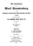
Search results from Open Library.
Recent natural events nearby
Ground air-quality sensors
Recently spotted species
Events
Gallery
Official Identifiers
Destatis — German Federal Statistical Office
- AGS
- 12073572
- Population (Wikidata)
- 15,604
- Wikidata
- Q519157
Amtlicher Gemeindeschlüssel (AGS) via Wikidata P439
Sources
- • Wikipedia
- • Open-Meteo / sunrise-sunset.org
- • Wikipedia Pageviews API
- • Open Library
- • Wikidata SPARQL (CC0) — population, area, elevation, inception, head of government, Commons image
- • Destatis — German Federal Statistical Office — Amtlicher Gemeindeschlüssel (AGS) via Wikidata P439