Browse / Germany / Bayern / Weißenburg in Bayern
Weißenburg in Bayern
Bayerntown

Weißenburg in Bayern
Total population
18,578
Founded
1296
Demographic figures from Destatis. Overview below cites Wikipedia and may reference a different year.
City facts
Sister cities
Facts from Wikidata (CC0).
Overview
Weißenburg in Bayern, formerly known as Weißenburg im Nordgau and Weißenburg am Sand, is a town in Middle Franconia, Germany. It is the capital of the district Weißenburg-Gunzenhausen, with a population of 18,345 as of 2024. Weißenburg was a free imperial city for 500 years.
Read more on WikipediaHistory & geography
History
The history of Weißenburg is generally traced back to the Roman fort that was built in the area towards the end of the first century. The settlement, which included Thermae, lay on the border of the Roman Empire and on the Tabula Peutingeriana from the 4th century it had the name Biriciana. Germanic tribes destroyed the fort and settled in what is still the city centre. The first mention of the name Weißenburg is in a deed dating from 867. The city became the seat of a royal residence during the reign of the Franks and according to legend, Charlemagne stayed there to supervise the construction of Fossa Carolina. The city became a Free Imperial City in 1296 and continued to grow until the Reformation. Following the example of Nuremberg the city joined the Protestant side but it suffered heavily in the ensuing wars. However, the rights of the city as a Free Imperial City and an Imperial Estate were restored in the final peace treaty and some growth resumed. Despite its insignificant size and economic importance, the city, like the other 50-odd free imperial cities, was virtually independent. Weißenburg lost its independence in 1802 and became part of the Bavarian kingdom in 1806. It was however saved from insignificance with the construction of a railway between Nuremberg and Augsburg which goes through the city and which supported industrialisation. Following World War II over 6,000 refugees and people expelled from the territories which Germany lost, settled in the city, and have since played an important role in its industry and culture. The many stages in the history of Weißenburg can still be seen today. There are many ruins from the Roman times. One of the finest is the remains of a Roman bath which was excavated in 1977 and has been turned into a museum. The…
Geography
Weißenburg is located in central Bavaria, in the south of the administrative region Mittelfranken. Large nearby cities are Ingolstadt (55.5 km), Nuremberg (61.7 km), Augsburg (85 km), Munich (134.6 km), and Würzburg (150.4 km). The municipality is divided into 27 Ortsteile: the main town and the 26 villages of Dettenheim, Emetzheim, Gänswirtshaus, Haardt, Hagenbuch, Hammermühle, Hattenhof, Häuser am Wülzburger Berg, Heuberg, Holzingen, Kattenhochstatt, Kehl, Laubenthal, Markhof, Niederhofen, Oberhochstatt, Potschmühle, Rohrwalk, Rothenstein (Weißenburg), Schleifer am Berg, Schmalwiesen, Stadelhof, Suffersheim, Weimersheim, Weißenhof and Wülzburg.
Excerpted from the corresponding Wikipedia article (CC BY-SA).
Geography
Coordinates & boundaries from the US Census TIGER/Line shapefiles.
Climate
Air quality
Walkability
Amenities nearby
Wildlife & biodiversity
Earthquake history
Photos
Sights & places nearby
Notable people from here
Nearby places in Bayern
- Sommerkeller3 mi away
- Pappenheim6.6 mi away · pop. 2,107
- Spalt10.2 mi away · pop. 5,227
- Thalmässing11.9 mi away · pop. 1,697
- Monheim14 mi away · pop. 2,340
- Merkendorf17.1 mi away · pop. 2,840
- Vorderheubühl17.4 mi away
- Oberheubühl17.5 mi away
- Allersberg19.4 mi away · pop. 5,176
- Irlahüll20.8 mi away · pop. 270
- Schloss21.1 mi away
- Harburg (Schwaben)21.2 mi away · pop. 1,811
Geography & sun
Elevation, sunrise/sunset and daylight from Open-Meteo. Solar climatology from NASA POWER.
Nearby airports
Public attention
Pageview totals from the Wikimedia Pageviews API.
Books about Weißenburg in Bayern
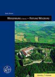

Search results from Open Library.
Recent natural events nearby
Ground air-quality sensors
Recently spotted species
Events
Gallery
Geotagged photos within ~6 miles of Weißenburg in Bayern, from Wikimedia Commons contributors.
 0 mi
0 mi_-_panoramio.jpg) 0 mi
0 mi 0 mi
0 mi 0 mi
0 mi 0 mi
0 mi 0 mi
0 mi 0 mi
0 mi 0 mi
0 mi 0 mi
0 mi 0 mi
0 mi 0.1 mi
 0.1 mi
.jpg) 0.1 mi
0.1 mi.jpg) 0.1 mi
0.1 mi 0.1 mi
 0.1 mi
 0.1 mi
 0.1 mi
 0.1 mi
 0.1 mi
 0.1 mi
 0.1 mi
 0.1 mi
 0.1 mi
Photos via Wikimedia Commons — see each image page for license & attribution.
Official Identifiers
Destatis — German Federal Statistical Office
- AGS
- 09577177
- Population (Wikidata)
- 18,931
- Wikidata
- Q44500
Amtlicher Gemeindeschlüssel (AGS) via Wikidata P439
Sources
- • Wikipedia
- • Wikimedia Commons
- • Wikidata
- • Open-Meteo / sunrise-sunset.org
- • Wikipedia Pageviews API
- • Open Library
- • Wikidata SPARQL (CC0) — population, area, elevation, inception, head of government, Commons image
- • Destatis — German Federal Statistical Office — Amtlicher Gemeindeschlüssel (AGS) via Wikidata P439