Browse / United States / Delaware / Wilmington
Wilmington
Delawarecity

Wilmington
Total population
73,173
Median home value
$245,100
Bachelor's+
Median income
$65,389
Air quality index
Demographic figures from US Census Bureau · ACS 5-year estimates. Overview below cites Wikipedia and may reference a different year.
City facts
Overview
Wilmington is the most populous city in the U.S. state of Delaware. It lies at the confluence of the Christina River and Brandywine Creek, near where the Christina flows into the Delaware River. The population was 70,898 at the 2020 census. It is the county seat of New Castle County and one of the major cities in the Philadelphia metropolitan area.
Read more on WikipediaHistory & geography
History
Wilmington is built on the site of the settlement Kristinehamn, which was planned by to be the capital of the colony of New Sweden, and Fort Christina, the first Swedish settlement in North America. The modern city also encompasses other Swedish settlements, such as Timmerön / Timber Island (along Brandywine Creek), Sidoland (South Wilmington), Strandviken (along the Delaware River near Simonds Gardens) and Översidolandet (along the Christina River, near Woodcrest and Ashley Heights). The area now known as Wilmington was settled by the Lenape (or Delaware Indian) band led by Sachem (Chief) Mattahorn just before Henry Hudson sailed up the Len-api Hanna (translated as "People Like Me River," now known as the Delaware River) in 1609. The area was called "Maax-waas Unk" or "Bear Place" after the Maax-waas Hanna (Bear River) that flowed by (present Christina River). It was called the Bear River because it flowed west to the "Bear People", who are now known as the People of Conestoga or the Susquehannocks. The Dutch heard and spelled the river and the place as Minguannan. When settlers and traders from the Swedish South Company under Peter Minuit arrived in March 1638 on the Fogel Grip and Kalmar Nyckel, they purchased Maax-waas Unk from Chief Mattahorn and built Fort Christina at the mouth of the Maax-waas Hanna (which the Swedes renamed the Christina River after Queen Christina of Sweden). The area was also known as "The Rocks", and is located near the foot of present-day Seventh Street. Fort Christina served as the headquarters for the colony of New Sweden which consisted of, for the most part, the lower Delaware River region (parts of present-day Delaware, Pennsylvania, and New Jersey), but few colonists settled there. Dr. Timothy Stidham (Swedish:Timen Lulofsson…
Geography
According to the United States Census Bureau, the city has a total area of , of which is land and is water. The total area is 36.25% water. The city sits at the confluence of the Christina and Delaware rivers, approximately southwest of Philadelphia. Wilmington Train Station, one of the southernmost stops on Philadelphia's SEPTA rail transportation system, is also served by Northeast Corridor Amtrak passenger trains. Wilmington is served by I-95 and I-495 within city limits. In addition, the twin-span Delaware Memorial Bridge, a few miles south of the city, provides direct highway access between Delaware and New Jersey, carrying the I-295 eastern bypass route around Wilmington and Philadelphia, as well as US 40, which continues eastward to Atlantic City, New Jersey. These transportation links and geographic proximity give Wilmington some of the characteristics of a satellite city to Philadelphia, but Wilmington's long history as Delaware's principal city, its urban core, and its independent value as a business destination makes it more properly considered a small but independent city in the Philadelphia metropolitan area. Wilmington lies along the Fall Line geological transition from the Mid-Atlantic Piedmont Plateau to the Atlantic Coastal Plain. East of Market Street, and along both sides of the Christina River, the Coastal Plain land is flat, low-lying, and in places marshy. The Delaware River here is an estuary at sea level (with twice-daily high and low tides), providing sea-level access for ocean-going ships. On the western side of Market Street, the Piedmont topography is rocky and hilly, rising to a point that marks the watershed between the Brandywine River and the Christina River. This watershed line runs along Delaware Avenue westward from 10th Street…
Excerpted from the corresponding Wikipedia article (CC BY-SA).
Demographics & economy
Race & ethnicity
Source: US Census Bureau — American Community Survey, 5-year estimates.
Geography
Coordinates & boundaries from the US Census TIGER/Line shapefiles.
Climate
10-year averages from ERA5 reanalysis (Open-Meteo).
Current forecast
Forecast for Wilmington, DE from NOAA NWS API.
Air quality
Current readings from Open-Meteo Air Quality API (Copernicus CAMS European reanalysis).
Industrial & pollution facilities
Natural hazard risk
Health (adults)
Walkability
Amenities nearby
Wildlife & biodiversity
Most-observed species
- Northern CardinalCardinalis cardinalis (Linnaeus, 1758) · Aves47,000
- American RobinTurdus migratorius Linnaeus, 1766 · Aves42,697
- Carolina WrenThryothorus ludovicianus (Latham, 1790) · Aves38,744
- Blue JayCyanocitta cristata (Linnaeus, 1758) · Aves38,629
- Song SparrowMelospiza melodia (A.Wilson, 1810) · Aves37,457
- Mourning DoveZenaida macroura (Linnaeus, 1758) · Aves37,451
- Red-bellied WoodpeckerMelanerpes carolinus (Linnaeus, 1758) · Aves32,909
- House FinchHaemorhous mexicanus (P.L.Statius Müller, 1776) · Aves31,340
Citizen-science & research observations from the Global Biodiversity Information Facility (GBIF).
Schools
Largest nearby schools
- Penn (William) High SchoolHigh · New Castle · 2,239 students · 18.1:1 ratio
- Odyssey Charter SchoolOther · Wilmington · 2,123 students · 13:1 ratio
- Delcastle Technical High SchoolHigh · Wilmington · 1,585 students · 12.4:1 ratio
- Las Americas ASPIRA AcademyOther · Newark · 1,341 students · 15.2:1 ratio
- Christiana High SchoolHigh · Newark · 1,256 students · 14.6:1 ratio
- Conrad Schools of ScienceHigh · Wilmington · 1,169 students · 18:1 ratio
- Mount Pleasant High SchoolHigh · Wilmington · 1,107 students · 14.4:1 ratio
- Dickinson (John) SchoolHigh · Wilmington · 1,058 students · 16.5:1 ratio
Public K–12 schools within ~10 mi from Urban Institute Education Data Portal (NCES Common Core of Data, 2022).
Earthquake history
Most recent
- M 4.1 — 2017-11-303 km NNE of Little Creek, Delaware
- M 2.64 — 2015-01-254 km ESE of Downingtown, Pennsylvania
- M 2.78 — 2009-07-013 km ESE of Pennsville, New Jersey
- M 3.37 — 2008-12-272 km NNE of Landisville, Pennsylvania
Events from the USGS Earthquake Catalog (global) (FDSN Event Web Service).
Photos
Sights & places nearby
Notable people from here


People born within ~10 km, from Wikidata (CC0). Click any name for their Wikipedia article.
Nearby places in Delaware
Geography & sun
Nearby airports
Public attention
Books about this place
Recent natural events nearby
- Little Schloss RX Prescribed Fire, Shenandoah, VirginiaWildfires · 2026-06-10 · 175 mi
Wildfires, storms and other events from NASA EONET (last 12 months, within 250 mi).
Ground air-quality sensors
Recently spotted species
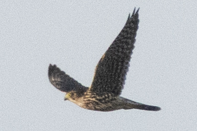
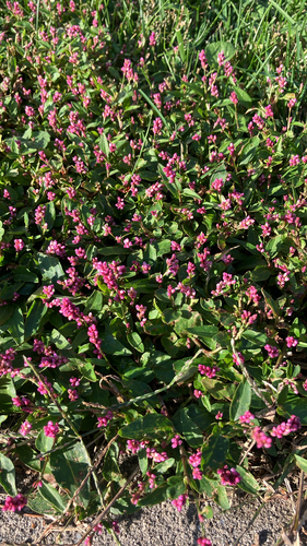
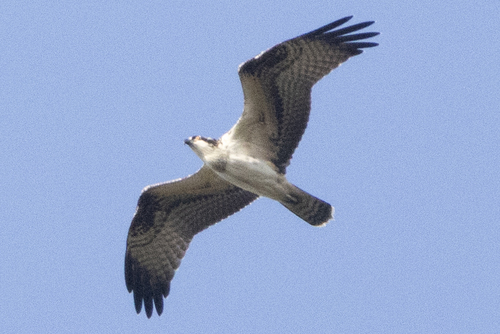
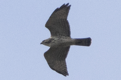
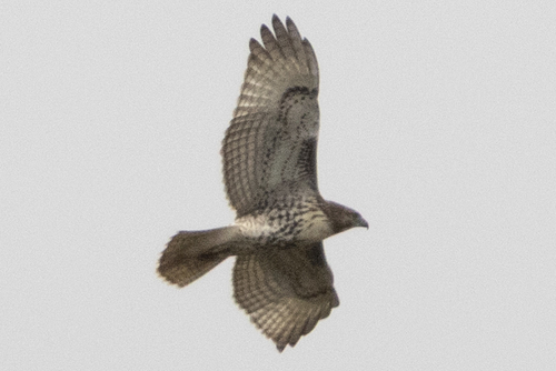

Research-grade observations from iNaturalist (within ~15 mi).
Nearest stream gauge
Live readings from USGS NWIS · measured 2026-06-13 20:36 UTC.
Events
Notable, recurring, and historical events associated with Wilmington, sourced from Wikidata.
- 135th National Puzzlers' League conventionSep 1, 1957recurring event edition
Source: Wikidata (CC0).
Gallery
Geotagged photos within ~6 miles of Wilmington, from Wikimedia Commons contributors.
 0.3 mi
 0.3 mi
 0.3 mi
 0.3 mi
 0.3 mi
 0.3 mi
 0.3 mi
 0.3 mi
 0.3 mi
 0.3 mi
 0.3 mi
 0.4 mi
 0.4 mi
 0.4 mi
.jpg) 0.4 mi
0.4 mi.jpg) 0.4 mi
0.4 mi 0.4 mi
 0.4 mi
 0.4 mi
_at_Delaware_State_Route_9A_(Christiana_Avenue)_in_Wilmington,_New_Castle_County,_Delaware.jpg) 0.4 mi
0.4 mi 0.4 mi
 0.5 mi
 0.5 mi
 0.5 mi
Photos via Wikimedia Commons — see each image page for license & attribution.
Sources
- • Wikipedia
- • US Census Bureau (ACS 5-year estimates)
- • Open-Meteo (ERA5 reanalysis)
- • NOAA National Weather Service
- • Wikimedia Commons
- • Wikidata
- • Open-Meteo Air Quality (CAMS)
- • USGS Earthquake Catalog (global feed)
- • USGS NWIS (water data)
- • NCES via Urban Institute Education Data Portal
- • GBIF (Global Biodiversity Information Facility)
- • iNaturalist
- • NASA EONET