Browse / Denmark / Southern Denmark / Odense
Odense
Southern Denmarkcity

Odense
Total population
178,210
Founded
1355
Demographic figures from Statistics Denmark. Overview below cites Wikipedia and may reference a different year.
City facts
Facts from Wikidata (CC0).
Overview
Odense is the third largest city in Denmark and the largest city on the island of Funen. As of 1 January 2026, the city proper had a population of 187,558 while Odense Municipality had a population of 213,168, making it the fourth largest municipality in Denmark. Eurostat and OECD have used a definition for the Metropolitan area of Odense, which includes all municipalities in the Province of Funen, with a total population of 504,066 as of 1 July 2022.
Read more on WikipediaHistory & geography
History
: For the Catholic ecclesiastical history, see Roman Catholic bishopric of Odense Odense is one of Denmark's oldest cities. Archaeological excavations in the vicinity show proof of settlement for over 4,000 years since at least the Stone Age. Today, Odense's Møntergården Museum has many artefacts related to the early Viking history in the Odense area. The Vikings built numerous fortifications along the river banks to defend it against invaders coming in from the coast. The city celebrated its thousandth anniversary in 1988, commemorating the first mention of the town's name in a letter dated 18 March 988 from the German emperor Otto III which granted rights to Odense and neighbouring settlements. The first church in Odense appears to have been St Mary's, probably built in the late 12th century. The territory, previously part of the vast Archbishopric of Hamburg, was created a Catholic diocese in 988. The first recorded bishops of Odense were Odinkar Hvide and Reginbert, who was consecrated by Archbishop Æthelnoth of Canterbury, in 1022. Recent excavations have shown that from the early 11th century, the town developed in the area around Albani Torv, Fisketorvet, Overgade and Vestergade. The priory no longer exists, although a church has been situated on the site since about 900. At the beginning of the 12th century, Benedictine monks from England founded St Canute's Abbey. It was here the English monk Ælnoth wrote Denmark's first literary work, Vita et Passio S. Canuti (The Life and Passion of St Canute). In the Middle Ages, a number of churches and monasteries were built in the town. St Canute's Church (Skt. Knuds Kirke), now the cathedral, dates from the end of the 13th century and was closely connected to the Benedictine Order. The town's other old churches are…
Geography
Odense is situated in the northeastern centre of the island of Funen. By road, Odense is located north of Svendborg, to the south of Aarhus, to the southwest of Copenhagen, east of Esbjerg and southeast of Kolding. Suburbs of Odense include Stige to the north, Seden, Bullerup and Agedrup to the northeast, Blommenslyst to the west, Bellinge to the southwest, and Neder Holluf and Højby to the south. It is part of the Special Area of Conservation No. SPC 94, Odense Fjord under the EU Habitat and Birds Directives and has been subject to close monitoring, with the target to reach at least "good" ecological status by 2015. The island is low-lying, the highest point of Østerhoved only reaching six metres above the sea. There is a 25 hectare forest on the northern part of the island while the southern part consists of coastal meadows. Odense has a temperate oceanic climate, classified as Köppen zone Cfb. Mild summers feature average maximum temperatures exceeding 20 °C (68 °F), while winters are characterised by minimum temperatures dropping just below freezing. The hottest months on average are July and August with highs of 21 °C (70 °F) and daily mean temperatures of 17 °C (63 °F) and 16 °C (61 °F) respectively. The coldest months are January and February, with a daily mean temperature of 0 °C (32 °F), and lows of −2 °C (28 °F) and −3 °C (26 °F) respectively. |date=November 2015 |source 2 = IEM}}
Excerpted from the corresponding Wikipedia article (CC BY-SA).
Geography
Coordinates & boundaries from the US Census TIGER/Line shapefiles.
Climate
10-year averages from ERA5 reanalysis (Open-Meteo).
Air quality
Walkability
Amenities nearby
Wildlife & biodiversity
Earthquake history
Photos
Sights & places nearby
Notable people from here


People born within ~10 km, from Wikidata (CC0). Click any name for their Wikipedia article.
Nearby places in Southern Denmark
- Næsbyhoved-Broby4 mi away · pop. 1,524
- Lumby4 mi away · pop. 792
- Over Holluf4.2 mi away · pop. 1,546
- Vejrup4.3 mi away
- Blommenslyst4.9 mi away · pop. 466
- Holmstrup5 mi away
- Bellinge5.1 mi away · pop. 4,598
- Vejruplund5.7 mi away · pop. 244
- Brændekilde5.8 mi away · pop. 321
- Klintebjerg6.1 mi away
- Lunde6.4 mi away · pop. 367
- Fangel6.5 mi away · pop. 464
Geography & sun
Elevation, sunrise/sunset and daylight from Open-Meteo. Solar climatology from NASA POWER.
Nearby airports
Public attention
Pageview totals from the Wikimedia Pageviews API.
Books about Odense


Search results from Open Library.
Recent natural events nearby
Ground air-quality sensors
Recently spotted species








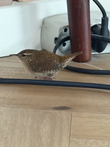
Research-grade observations from iNaturalist (within ~15 mi).
Events
Notable, recurring, and historical events associated with Odense, sourced from Wikidata.
- Q43250861festival
Source: Wikidata (CC0).
Gallery
Official Identifiers
DST — Statistics Denmark
- Kommunekode
- 461
- Population (Wikidata)
- 197,480
- Wikidata
- Q21146
Municipality code via Wikidata P1168
Sources
- • Wikipedia
- • Open-Meteo (ERA5 reanalysis)
- • Wikidata
- • iNaturalist
- • Open-Meteo / sunrise-sunset.org
- • Wikipedia Pageviews API
- • Open Library
- • DST — Statistics Denmark — Municipality code via Wikidata P1168