Browse / Denmark / Southern Denmark / Svendborg
Svendborg
Southern Denmarktown

Svendborg
Total population
27,521
Demographic figures from Statistics Denmark. Overview below cites Wikipedia and may reference a different year.
City facts
Sister cities
Facts from Wikidata (CC0).
Overview
Svendborg is a town on the island of Funen in south-central Denmark, and the seat of Svendborg Municipality. With a population of 27,593, Svendborg is Funen's second largest city. In 2000 Svendborg was declared "Town of the year" in Denmark, and in 2003 it celebrated its 750th anniversary as a market town. By road, Svendborg is located 195 kilometres (121 mi) southwest of Copenhagen, 183 kilometres (114 mi) south of Aarhus, 44.2 kilometres (27.5 mi) south of Odense, and 28.5 kilometres (17.7 mi) east of Faaborg.
Read more on WikipediaHistory & geography
History
In the light of archaeological discoveries, Svendborg appears to have been established in the first half of the 12th century or even earlier. The first recorded mention of Svendborg occurred in 1229 in a deed of gift by Valdemar the Victorious, where he refers to the fortification as Swinæburgh. The name is thought to consist of the elements "svin" meaning "pig" and "borg" meaning "fortification". In 1236, the Greyfriars monastery in Svendborg was established. The Greyfriars would be part of the city for the next 300 years, until the Protestant reformation in 1536. The ruins of the monastery were partly excavated beside the railway in 2007. In 1253, the city was granted market town privileges by King Christopher I. In the Middle Ages, the city was fortified with walls and moats. The defense system also included a few of forts. Most historical facts about the medieval defense system, including the locations of fortifications, are disputed, as little archaeological evidence has been generated. In spite of this, it is a popular theory that the three towers in the coat of arms are the three fortifications ("Skattertårnet", "Kyseborg" and a third one unnamed). Thanks to its seafarers, in the late Middle Ages Svendborg became one of the most important trading centres in Scandinavia. During the time of the Protestant reformation and the Count's Feud in the 1530s, the citizens of Svendborg joined forces with the King. Ørkild Castle, located just east of Svendborg, was property of the bishop of Odense, who was less than popular among the citizens of the city. The tension resulted in the castle being seized and burned down by an angry mob in collaboration with the King's forces. The King's forces would later, after ending their north-going campaign on Funen, return to pillage…
Geography
Svendborg lies on the south coast of Funen. By road, Svendborg is located southwest of Copenhagen, south of Odense, southeast of Middelfart, and south-southeast of Faaborg. The Port of Svendborg is accessed by several channels, feeding through the islands of Tåsinge and Thurø. Svendborg Sund approaches the town from the southwest, along which ferries coming from Ærøskøbing pass the smaller islands of Drejø, Hjortø, and Skarø. Between Tåsinge and Thurø is Thurø Sund, which passes Bregninge forest (Bregninge Skov) on the northeast coast of Tåsinge, approaching the port of Svendborg from the south. From the east, between mainland Funen and the island of Thurø, is the narrow Skårupøre Sund. To the west of Svendborg are several lakes, including Sørup Lake (Sørup Sø), northwest of the centre, and Hvidkilde Lake (Hvidkilde Sø), northwest of the centre of Svendborg. Several forested areas lie to the north-northwest of Svendborg, including Græsholmene, Løvehave, and Ravnebjerg Skov.
Excerpted from the corresponding Wikipedia article (CC BY-SA).
Geography
Coordinates & boundaries from the US Census TIGER/Line shapefiles.
Climate
10-year averages from ERA5 reanalysis (Open-Meteo).
Air quality
Walkability
Amenities nearby
Wildlife & biodiversity
Earthquake history
Photos
Sights & places nearby
Notable people from here


People born within ~10 km, from Wikidata (CC0). Click any name for their Wikipedia article.
Nearby places in Southern Denmark
- Troense2.4 mi away · pop. 1,433
- Gammel Nyby2.6 mi away · pop. 52
- Thurø By2.6 mi away · pop. 3,302
- Bregninge2.9 mi away · pop. 196
- Skårup3.9 mi away · pop. 1,788
- Strammelse4.1 mi away · pop. 185
- Ollerup4.4 mi away · pop. 1,403
- Landet4.5 mi away · pop. 290
- Kirkeby4.6 mi away · pop. 600
- Lundby5 mi away · pop. 275
- Åbyskov5 mi away · pop. 277
- Vejstrup5 mi away · pop. 432
Geography & sun
Elevation, sunrise/sunset and daylight from Open-Meteo. Solar climatology from NASA POWER.
Nearby airports
Public attention
Pageview totals from the Wikimedia Pageviews API.
Books about Svendborg

Search results from Open Library.
Recent natural events nearby
Ground air-quality sensors
Recently spotted species

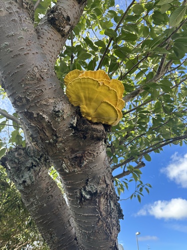



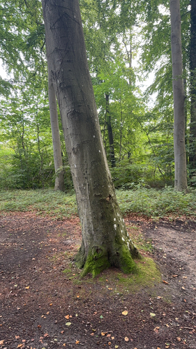


Research-grade observations from iNaturalist (within ~15 mi).
Events
Gallery
Sources
- • Wikipedia
- • Open-Meteo (ERA5 reanalysis)
- • Wikidata
- • iNaturalist
- • Open-Meteo / sunrise-sunset.org
- • Wikipedia Pageviews API
- • Open Library