Browse / Algeria / El Bayadh / Ain Djedida
Ain Djedida
El Bayadhvillage
Air quality index
Demographic figures from Office National des Statistiques (Algeria). Overview below cites Wikipedia and may reference a different year.
City facts
Overview
Found in El Bayadh, Algeria, Ain Djedida is classified as a village in public datasets. Its coordinates of 33.635°, 1.354° place it in the warm-temperate zone of the northern hemisphere. Up-to-date population figures for this locality are not available in the open datasets we monitor. Solar-resource estimates put the area at about 2,046 kWh/m² of solar irradiance per year with sunshine for roughly 80% of daylight hours. Based on its warm temperate position, residents likely encounter warm summers and cool winters. The sections below expand on demographics, weather, terrain, hazards and nearby points of interest using publicly available datasets.
Summary composed automatically from structured open data on this page. See our Terms for details.
History & geography
Geography
Coordinates & boundaries from the US Census TIGER/Line shapefiles.
Climate
Air quality
Current readings from Open-Meteo Air Quality API (Copernicus CAMS European reanalysis).
Walkability
Amenities nearby
Wildlife & biodiversity
Most-observed species
- Common RavenCorvus corax Linnaeus, 1758 · Aves2
- Trumpeter FinchBucanetes githagineus (M.H.K.Lichtenstein, 1823) · Aves2
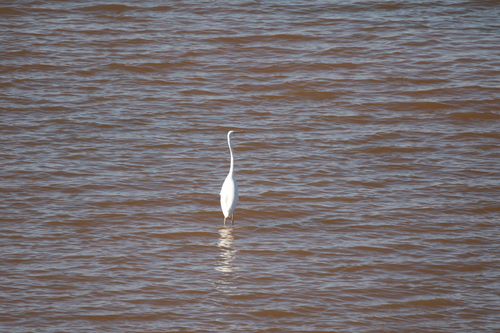
- Little Egret/Western Reef-HeronEgretta garzetta (Linnaeus, 1766) · Aves1
- Ruddy ShelduckTadorna ferruginea (Pallas, 1764) · Aves1
- Euphorbia nicaeensis All.Euphorbia nicaeensis All. · Magnoliopsida1
- Arabian oxeyeAnvillea garcinii (Burm.) DC. · Magnoliopsida1
- Centaurea oranensis Greuter & M.V.Agab.Centaurea oranensis Greuter & M.V.Agab. · Magnoliopsida1
- Fool's Water-cressHelosciadium nodiflorum (L.) W.D.J.Koch · Magnoliopsida1
Citizen-science & research observations from the Global Biodiversity Information Facility (GBIF).
Earthquake history
Most recent
- M 4.5 — 2012-05-1826 km WSW of Aflou, Algeria
- M 3.7 — 2004-06-0110 km ESE of Aflou, Algeria
Events from the USGS Earthquake Catalog (global) (FDSN Event Web Service).
Photos
Sights & places nearby
Notable people from here
Nearby places in El Bayadh
- Sidi Ameur10.3 mi away · pop. 3,634
- Stitten11.2 mi away · pop. 6,022
- Boualem12.2 mi away · pop. 7,578
- سيدي احمد بلعباس ⵙⵉⴷⵉ ⵃⵎⴻⴷ ⴱⴻⵍⵄⴻⴱⴰⵙ13 mi away
- Maghssel13 mi away
- Boukhoubza Bouhafs13.9 mi away
- قرية الحوض ⵇⴻⵔⵢⴻⵜ ⵍⵃⵓⴹ14.9 mi away
- دير الحوسين ⴷⵉⵔ ⵍⵃⵓⵙⵉⵏ18.5 mi away
- طواليل ⵟⵡⴰⵍⵉⵍ18.8 mi away
- Ghassoul19.8 mi away
- مشرية الصغيرة ⵎⴻⵛⵔⵉⵢⴰ ⵜⴰⵎⴻⵥⵢⴰⵏⵜ19.9 mi away
- Sidi Taifour20 mi away
Geography & sun
Elevation, sunrise/sunset and daylight from Open-Meteo. Solar climatology from NASA POWER.
Nearby airports
Public attention
Books about this place
Recent natural events nearby
Ground air-quality sensors
Recently spotted species
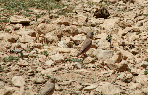
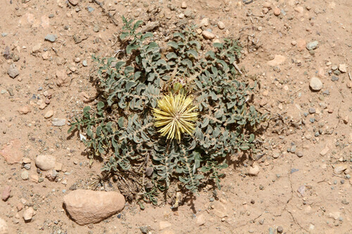
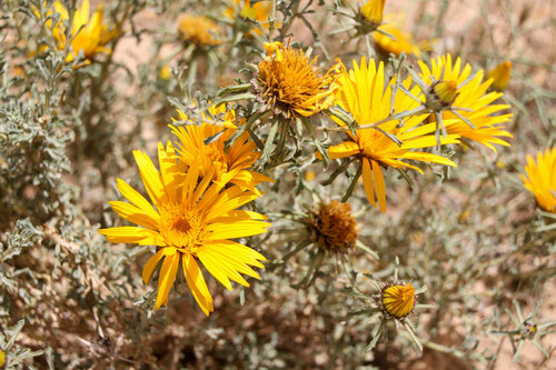
Research-grade observations from iNaturalist (within ~15 mi).
Events
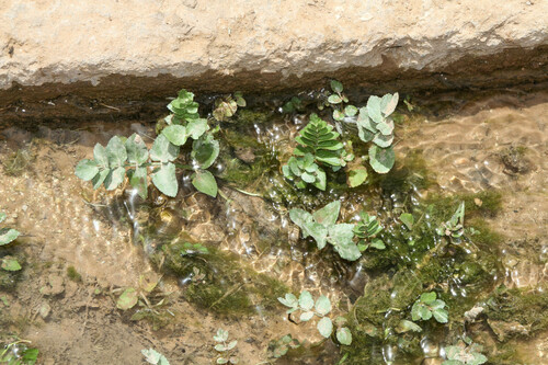
Gallery
Geotagged photos within ~6 miles of Ain Djedida, from Wikimedia Commons contributors.


Photos via Wikimedia Commons — see each image page for license & attribution.
Sources
- • Wikimedia Commons
- • Wikidata
- • Open-Meteo Air Quality (CAMS)
- • USGS Earthquake Catalog (global feed)
- • GBIF (Global Biodiversity Information Facility)
- • iNaturalist
- • Open-Elevation
- • Open-Meteo / sunrise-sunset.org