Browse / Algeria / Touggourt / M'Naguer
M'Naguer
Touggourttown

M'Naguer
Total population
14,179
Demographic figures from Office National des Statistiques (Algeria). Overview below cites Wikipedia and may reference a different year.
City facts
Facts from Wikidata (CC0).
Overview
M'Naguer is a town and commune in Taibet District, Touggourt Province, Algeria. According to the 2008 census it has a population of 14,179, up from 11,243 in 1998, and an annual population growth rate of 2.4%.
Read more on WikipediaHistory & geography
Geography
M'Naguer lies at an elevation of surrounded by palm groves, forming one of many scattered oases lying between Touggourt and El Oued. Beyond the oasis are the sand dunes of the Grand Erg Oriental desert.
Excerpted from the corresponding Wikipedia article (CC BY-SA).
Geography
Coordinates & boundaries from the US Census TIGER/Line shapefiles.
Climate
Air quality
Walkability
Amenities nearby
Wildlife & biodiversity
Most-observed species
- Cream-colored CourserCursorius cursor (Latham, 1787) · Aves1
Citizen-science & research observations from the Global Biodiversity Information Facility (GBIF).
Earthquake history
Events from the USGS Earthquake Catalog (global) (FDSN Event Web Service).
Photos
Sights & places nearby
Notable people from here
Nearby places in Touggourt
- الخبنة 2 (ⵍⵅⵓⴱⵏⴰ 2)3.2 mi away
- Oum Zebed3.6 mi away
- الخبنة 1 (ⵍⵅⵓⴱⵏⴰ 1)3.8 mi away
- Taibet4.1 mi away · pop. 20,174
- MSAN4.1 mi away
- Sidi Mehdi15.1 mi away
- Meggarine15.7 mi away · pop. 13,751
- Tebesbest15.7 mi away · pop. 35,032
- El Ksour17.4 mi away
- Sidi Slimane18.7 mi away
- Moggar19.2 mi away
- Tamacine21.3 mi away
Geography & sun
Nearby airports
Public attention
Books about this place
Recent natural events nearby
Ground air-quality sensors
Recently spotted species
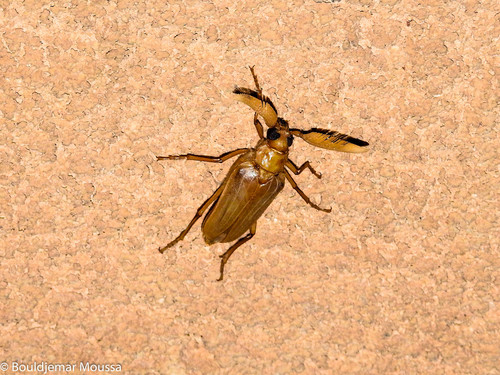
Research-grade observations from iNaturalist (within ~15 mi).
Events
Gallery
Sources
- • Wikipedia
- • Wikidata
- • USGS Earthquake Catalog (global feed)
- • GBIF (Global Biodiversity Information Facility)
- • iNaturalist