Browse / Algeria / El Bayadh / Rogassa
Rogassa
El Bayadhvillage
Demographic figures from Office National des Statistiques (Algeria). Overview below cites Wikipedia and may reference a different year.
City facts
Overview
Rogassa is a village in El Bayadh, Algeria. Coordinates of 34.018°, 0.926° situate Rogassa in the warm-temperate zone of the northern hemisphere. No reliable population estimate is published for this entry in the open data we rely on. The latitude suggests warm summers and cool winters. Solar-resource estimates put the area at about 1,955 kWh/m² of solar irradiance per year with sunshine for roughly 76% of daylight hours. Additional figures on demographics, climate, geography and points of interest appear in the sections that follow, all drawn from open public datasets.
Summary composed automatically from structured open data on this page. See our Terms for details.
History & geography
Geography
Coordinates & boundaries from the US Census TIGER/Line shapefiles.
Climate
Air quality
Walkability
Amenities nearby
Wildlife & biodiversity
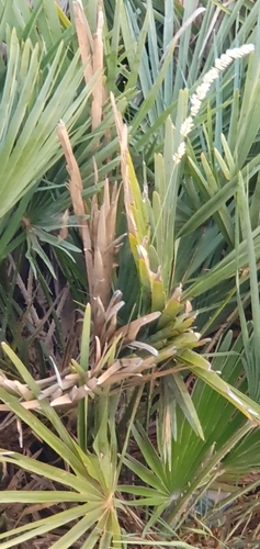
Most-observed species
- European Fan PalmChamaerops humilis L. · Liliopsida1
Citizen-science & research observations from the Global Biodiversity Information Facility (GBIF).
Earthquake history
Most recent
- M 4.5 — 2012-05-1826 km WSW of Aflou, Algeria
Events from the USGS Earthquake Catalog (global) (FDSN Event Web Service).
Photos
Sights & places nearby
Notable people from here
Nearby places in El Bayadh
- Cheguig13.5 mi away
- بوغرارة ⴱⵓⵖⵔⴰⵔⴰ18.3 mi away
- شعبة سليماني ⵛⴻⵄⴱⴻⵜ ⵙⵍⵉⵎⴰⵏⵉ18.6 mi away
- Kef Lahmar20.4 mi away · pop. 20,000
- قرية الحوض ⵇⴻⵔⵢⴻⵜ ⵍⵃⵓⴹ21.7 mi away
- ليغن ⵍⵍⵉⵖⴻⵏ21.8 mi away
- Stitten24.9 mi away · pop. 6,022
- مشرية الصغيرة ⵎⴻⵛⵔⵉⵢⴰ ⵜⴰⵎⴻⵥⵢⴰⵏⵜ31 mi away
- Sidi Ameur33.8 mi away · pop. 3,634
- Maghssel35.2 mi away
- طواليل ⵟⵡⴰⵍⵉⵍ36.2 mi away
- وافڤ ⵡⴰⴼⴻⴳ37.3 mi away
Geography & sun
Elevation, sunrise/sunset and daylight from Open-Meteo. Solar climatology from NASA POWER.
Nearby airports
Public attention
Books about this place
Recent natural events nearby
Ground air-quality sensors
Recently spotted species
Research-grade observations from iNaturalist (within ~15 mi).
Events
Gallery
Geotagged photos within ~6 miles of Rogassa, from Wikimedia Commons contributors.


Photos via Wikimedia Commons — see each image page for license & attribution.
Sources
- • Wikimedia Commons
- • Wikidata
- • USGS Earthquake Catalog (global feed)
- • GBIF (Global Biodiversity Information Facility)
- • iNaturalist
- • Open-Meteo / sunrise-sunset.org