Browse / Algeria / Médéa / Tafraout
Tafraout
Médéavillage
Total population
8,901
Demographic figures from Office National des Statistiques (Algeria). Overview below cites Wikipedia and may reference a different year.
City facts
Overview
Tafraout, a small village in Médéa, Algeria, forms part of the country's settled landscape. The population stands at approximately 8,901. The settlement sits at 35.972°, 3.353°, a warm-temperate location in the northern hemisphere. Solar-resource estimates put the area at about 1,910 kWh/m² of solar irradiance per year with sunshine for roughly 75% of daylight hours. Based on its warm temperate position, residents likely encounter warm summers and cool winters. Read on for charts and tables covering demographics, climate, hazards, schools, wildlife and other open-data indicators for Tafraout.
Summary composed automatically from structured open data on this page. See our Terms for details.
History & geography
Geography
Coordinates & boundaries from the US Census TIGER/Line shapefiles.
Climate
Air quality
Walkability
Amenities nearby
Wildlife & biodiversity
Most-observed species
- Common Pill WoodlouseArmadillidium vulgare (Latreille, 1804) · Malacostraca1
Citizen-science & research observations from the Global Biodiversity Information Facility (GBIF).
Earthquake history
Most recent
- M 4.8 — 2025-03-1819 km SW of Lakhdaria, Algeria
- M 4 — 2022-12-07northern Algeria
- M 4.8 — 2022-11-1224 km NE of Berrouaghia, Algeria
- M 4.1 — 2022-03-1816 km ENE of Berrouaghia, Algeria
- M 4.4 — 2020-08-134 km SSE of Chiffa, Algeria
- M 4.3 — 2019-08-2318 km SW of Lakhdaria, Algeria
Events from the USGS Earthquake Catalog (global) (FDSN Event Web Service).
Photos
Sights & places nearby
Notable people from here
Nearby places in Médéa
- Chellalet El Adhaoura4.1 mi away · pop. 57,300
- Kef Lakhdar4.5 mi away · pop. 4,403
- Ouled Hadhria5.6 mi away
- El M'Rabtine9.9 mi away
- Ain Ouksir10.5 mi away · pop. 5,366
- Djouab12.2 mi away
- Ouled H'Mida Tehata12.6 mi away
- Ouled Sidi Ameur15.5 mi away
- El Khochakhchia15.6 mi away
- Aïn El Gharbia16 mi away
- Bousekene16.5 mi away
- El Feraihia16.6 mi away
Geography & sun
Elevation, sunrise/sunset and daylight from Open-Meteo. Solar climatology from NASA POWER.
Nearby airports
Public attention
Books about this place
Recent natural events nearby
Ground air-quality sensors
Recently spotted species
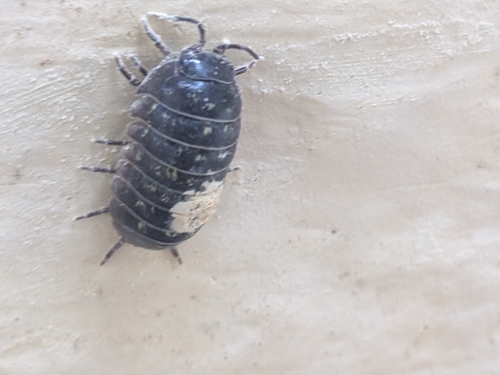
Research-grade observations from iNaturalist (within ~15 mi).
Events
Gallery
Sources
- • Wikidata
- • USGS Earthquake Catalog (global feed)
- • GBIF (Global Biodiversity Information Facility)
- • iNaturalist
- • Open-Meteo / sunrise-sunset.org