Browse / Egypt / El Beheira / Abu Huminus
Abu Huminus
El Beheiratown

Abu Huminus
Total population
36,801
Air quality index
Demographic figures from CAPMAS (Egypt). Overview below cites Wikipedia and may reference a different year.
City facts
Overview
Abu Hummus, also Abu Humus, Abu Hommos, Abu Homos, Abou Homs is a town in Beheira Governorate, Egypt, an administrative center of markaz Abu Hummus.
Read more on WikipediaHistory & geography
Geography
Located midway between the city of Alexandria and the western branch of the Nile Delta, south of Lake Idku, Abu Hummus spans between the Cairo-Alexandria Agricultural Road and the El-Mahmoudeya Canal. The town has a Local court, City Town Hall, and a railway station. In 1911 Nakhla meteorite landed in the town. Many people witnessed the meteorite approaching from the northwest, inclination about °, along with the track marked with a column of white smoke. Several explosions were heard before it fell to Earth in an area of in diameter, and about forty pieces were recovered; the fragments were buried in the ground up to a metre deep.
Excerpted from the corresponding Wikipedia article (CC BY-SA).
Geography
Coordinates & boundaries from the US Census TIGER/Line shapefiles.
Climate
Air quality
Current readings from Open-Meteo Air Quality API (Copernicus CAMS European reanalysis).
Walkability
Amenities nearby
Wildlife & biodiversity
Most-observed species
- Black-shouldered KiteElanus caeruleus (Desfontaines, 1789) · Aves4
- Cattle EgretBubulcus ibis (Linnaeus, 1758) · Aves3
- Hooded CrowCorvus cornix Linnaeus, 1758 · Aves3
- Eurasian HoopoeUpupa epops Linnaeus, 1758 · Aves3
- Pied KingfisherCeryle rudis (Linnaeus, 1758) · Aves2
- Black-crowned Night-HeronNycticorax nycticorax (Linnaeus, 1758) · Aves2
- Little Egret/Western Reef-HeronEgretta garzetta (Linnaeus, 1766) · Aves2
- Common BulbulPycnonotus barbatus (Desfontaines, 1789) · Aves2
Citizen-science & research observations from the Global Biodiversity Information Facility (GBIF).
Earthquake history
Events from the USGS Earthquake Catalog (global) (FDSN Event Web Service).
Photos
Sights & places nearby
Notable people from here

People born within ~10 km, from Wikidata (CC0). Click any name for their Wikipedia article.
Nearby places in El Beheira
- Ezbet al Gurn0.5 mi away
- Kafr Azzaz0.9 mi away
- Mahattet Abu Hummus1.2 mi away
- Qumbaniyat Luqin7.7 mi away
- Ib‘ādīyat Damanhūr8.1 mi away
- Ezbet Osman Murtada9 mi away
- An Nashw al Bahri9.2 mi away
- Damanhur10.3 mi away · pop. 227,943
- Kafr al Dawar10.8 mi away
- Ezbet Michel Hamawi11 mi away
- Qarāqiş11.7 mi away
- Manshiyat al Awqaf11.8 mi away
Geography & sun
Elevation, sunrise/sunset and daylight from Open-Meteo. Solar climatology from NASA POWER.
Nearby airports
Public attention
Pageview totals from the Wikimedia Pageviews API.
Books about this place
Recent natural events nearby
Ground air-quality sensors
Recently spotted species
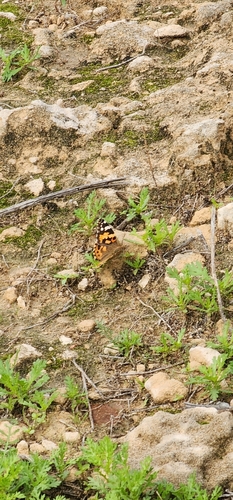
Research-grade observations from iNaturalist (within ~15 mi).
Events
Gallery
Sources
- • Wikipedia
- • Wikidata
- • Open-Meteo Air Quality (CAMS)
- • USGS Earthquake Catalog (global feed)
- • GBIF (Global Biodiversity Information Facility)
- • iNaturalist
- • Open-Meteo / sunrise-sunset.org
- • Wikipedia Pageviews API