Browse / Eritrea / Northern Red Sea / Massawa
Massawa
Northern Red Seacity
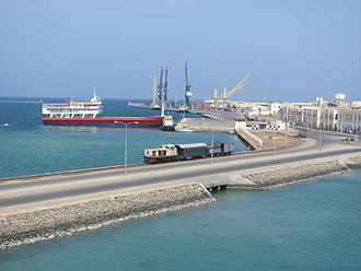
Massawa
Total population
45,975
Demographic figures from National Statistics Office (Eritrea). Overview below cites Wikipedia and may reference a different year.
City facts
Overview
Massawa or Mitsiwa is a port city in the Northern Red Sea region of Eritrea, located on the Red Sea at the northern end of the Gulf of Zula beside the Dahlak Archipelago. It has been a historically important port for many centuries. Massawa has been ruled or occupied by a succession of polities during its history, including the Dahlak Sultanate, the Ottoman Empire, the Khedivate of Egypt and the Kingdom of Italy.
History & geography
Geography
Coordinates & boundaries from the US Census TIGER/Line shapefiles.
Climate
Air quality
Walkability
Amenities nearby
Wildlife & biodiversity
Earthquake history
Photos
Sights & places nearby
Notable people from here
Nearby places in Northern Red Sea
- Słupiec2608.8 mi away · pop. 600
- Rataje Słupskie2610.2 mi away · pop. 670
- Ruszcza2611 mi away
- Sworoń2611.1 mi away
- Trzcianka-Kolonia2611.4 mi away
- Przeczów2611.8 mi away · pop. 90
- Trzebica2612.2 mi away · pop. 224
- Ossala2612.5 mi away · pop. 400
- Zawidza2613.1 mi away
- Zborówek2613.3 mi away · pop. 155
- Wymysłów2613.3 mi away · pop. 90
- Zysławice2613.9 mi away
Geography & sun
Elevation, sunrise/sunset and daylight from Open-Meteo. Solar climatology from NASA POWER.
Nearby airports
Public attention
Pageview totals from the Wikimedia Pageviews API.
Books about Massawa

Search results from Open Library.
Recent natural events nearby
Ground air-quality sensors
Recently spotted species
Events
Gallery
Sources
- • Wikipedia
- • Open-Elevation
- • Open-Meteo / sunrise-sunset.org
- • Wikipedia Pageviews API
- • Open Library