Browse / Spain / Balearic Islands / Artà
Artà
Balearic Islandsvillage

Artà
Total population
6,569
Demographic figures from INE (Spain). Overview below cites Wikipedia and may reference a different year.
City facts
Sister cities
Facts from Wikidata (CC0).
Overview
Artà is a municipality on Mallorca, one of the Balearic Islands, Spain. The small town of the same name is the administrative seat of this municipality in the region (comarca) of Llevant.
Read more on WikipediaHistory & geography
History
Artà was first mentioned in 1232 under the name Yartân in the Llibre de repartiment de mallorca (Jaume I). Later it was also written down as Jartan or Jertan. The origin of the name is derived from "Gertan", the Arab word for garden. This extraordinary landscape has been inhabited since the colonization of Mallorca, as witnessed by the archaeological finds in this area:Ses Païsses and Sa Canova. They date from the time 1300–100 BC. The coins, seals and vessels of the Talaiotic culture may be seen in the Artà Regional Museum at Plaça d'Espanya. Little is known about the Artà region from the Roman or pre-Islamic period. It is believed, however, that the old fortress on the town's hill dates to before the Islamic-Arab possession of the island. In the Arabian era from the 10th to the 13th century and even during the early days of Catalan rule, the fortress was known as the Almudaina, which means something like "castle" or "fortress". Today the one-meter thick fortress wall with its nine towers, including the main tower of Sant Miquel, surrounds the pilgrimage church of Santuari de Sant Salvador with its outbuildings. The church houses a multicoloured, carved, wooden, Romanesque statue of the Virgin Mary, which, according to the tradition of the White canons was brought to the island by James I during the conquest of Majorca. A Calvary staircase of 180 steps links the parish church (Esglèsia Parroquial) of Transfiguració del Senyor at the foot of the town's hill with the 1832 baroque church of Sant Salvador on the 182-metre high Calvary Hill or Puig de Sant Salvador. The 1573 late Gothic style church of La Transfiguració replaced the ancient parish church consecrated in 1248 on the site of an earlier mosque. During the Arab or Moorish era the peninsula of Yartan…
Geography
Artà lies in the northeast of the island of Mallorca, around 60 km from the island's capital of Palma. The Massís d’Artà, the highest and most compact massif in the eastern mountain chain of the Serres de Llevant, occupies more than half the area of the municipality. The municipality is located on the western part of peninsula of Artà and is bordered in the west by the Bay of Alcúdia (Badia d’Alcúdia), and in the north by the Mediterranean sea where its coast lies opposite the neighbouring island of Menorca. The coast of Artà stretches for 25 kilometres and, so far, has escaped being developed. Particularly noteworthy are the beach and sand dune formations of sa Canova d’Artà, the flat coastal strip near the settlement of Colònia de Sant Pere, the high rocky coves of the Cap de Ferrutx and a large number of smaller bays that extend from s’Arenalet des Verger to Cala Torta. To the east and southeast the municipality of Artà is bordered by the communities of Capdepera and Son Servera. Until the 19th century both belonged, together with the district of Artà, to the so-called Peninsula of Artà. Hence why the caves on the east coast of Mallorca in the municipality of Capdepera are called the Caves of Artà (Coves d' Artà). To the southwest are the municipalities of Sant Llorenç des Cardassar and Petra. The Torrent de na Borges, with its hamlet of Son Serra de Marina, forms the western border of Artà with the municipality of Santa Margalida. The following villages are part of the municipality of Artà: * Artà (5803 / 6406) * Colònia de Sant Pere (483 / 483) * Urbanització Betlem (51 / 51) * Urbanització Montferrutx (114 / 114) * Urbanització Sant Pere (34 / 34) * Urbanització s’Estanyol (25 / 25) The figures in brackets give the population as at 1 January…
Excerpted from the corresponding Wikipedia article (CC BY-SA).
Geography
Coordinates & boundaries from the US Census TIGER/Line shapefiles.
Climate
Air quality
Walkability
Amenities nearby
Wildlife & biodiversity
Most-observed species
- House SparrowPasser domesticus (Linnaeus, 1758) · Aves1,902
- Common Wood-PigeonColumba palumbus Linnaeus, 1758 · Aves1,758
- Sardinian WarblerCurruca melanocephala (J.F.Gmelin, 1789) · Aves1,666
- Eurasian BlackbirdTurdus merula Linnaeus, 1758 · Aves1,552
- Audouin's GullIchthyaetus audouinii (Payraudeau, 1826) · Aves1,552
- Yellow-legged GullLarus michahellis J.F.Naumann, 1840 · Aves1,504
- Cetti's WarblerCettia cetti (Temminck, 1820) · Aves1,201
- European StonechatSaxicola rubicola (Linnaeus, 1766) · Aves1,089
Citizen-science & research observations from the Global Biodiversity Information Facility (GBIF).
Earthquake history
Most recent
- M 3.1 — 2005-01-214 km WNW of Vilafranca de Bonany, Spain
- M 2.5 — 2001-11-0339 km NW of Ciutadella, Spain
- M 3.8 — 2001-11-0238 km NW of Ciutadella, Spain
- M 2.5 — 2001-10-1451 km N of Port de Pollença, Spain
Events from the USGS Earthquake Catalog (global) (FDSN Event Web Service).
Photos
Sights & places nearby
Notable people from here
Nearby places in Balearic Islands
- Capdepera4.4 mi away · pop. 3,424
- Son Jordi5 mi away
- Port Vell5 mi away
- Son Servera5.1 mi away · pop. 4,919
- sa Font de sa Cala5.4 mi away · pop. 149
- Canyamel5.4 mi away · pop. 431
- sa Costa de Canyamel5.6 mi away · pop. 95
- Cala Rajada5.9 mi away · pop. 6,762
- Cala Agulla6 mi away · pop. 607
- Cala Bona6.1 mi away · pop. 1,204
- Cala Millor6.5 mi away · pop. 5,443
- Sant Llorenç des Cardassar6.8 mi away · pop. 3,033
Geography & sun
Elevation, sunrise/sunset and daylight from Open-Meteo. Solar climatology from NASA POWER.
Nearby airports
Public attention
Pageview totals from the Wikimedia Pageviews API.
Books about this place
Recent natural events nearby
Ground air-quality sensors
Recently spotted species
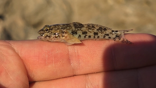
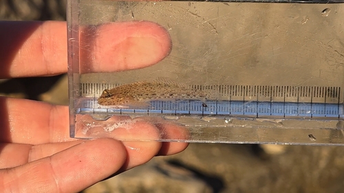
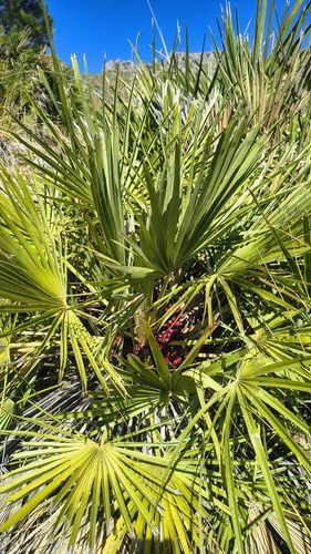
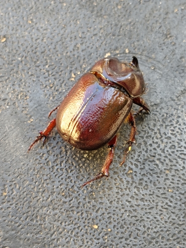
Research-grade observations from iNaturalist (within ~15 mi).
Events
Gallery
Sources
- • Wikipedia
- • Wikidata
- • USGS Earthquake Catalog (global feed)
- • GBIF (Global Biodiversity Information Facility)
- • iNaturalist
- • Open-Meteo / sunrise-sunset.org
- • Wikipedia Pageviews API