Browse / Ethiopia / Somali / Hursu
Hursu
Somalivillage
Demographic figures from Ethiopian Statistical Service. Overview below cites Wikipedia and may reference a different year.
City facts
Facts from Wikidata (CC0).
Overview
Hurso is a town in eastern Ethiopia. Located in the Shinile Zone of the Somali Region about 40 km west of Dire Dawa, it has a longitude and latitude of 9°36′N 41°38′E and an altitude of 1130 meters above sea level. It is one of four towns in Erer woreda.
Read more on WikipediaHistory & geography
History
Hurso, in eastern Ethiopia, is home to about 5,000 Somali of the Gurgura clan, formerly fruit farmers and agropastoralists. Hurso's lands were seized by the Derg, the Marxist government of Mengistu Haile Mariam, which ruled Ethiopia from 1974 to 1991 in the aftermath of the 1977-78 Ogaden War. In this war, Somalia unsuccessfully attempted to annex the ethnically Somali lands of Ethiopia. These lands consisted of the semi-arid Ogaden, the rich pastures of the Haud, and other lowlands off the eastern edge of the Ethiopian highlands. Hurso is now known (if it is known at all), as the site of a large military training center of the newly refederated Ethiopia. It is remembered by its inhabitants as an almost heavenly place of permanent water, good grazing, and bountiful orchards. Today, it is a desolate stop on the railway from Addis Ababa to Djibouti, where people eke out an existence gathering and selling firewood (considered one step above begging), running tiny shops and teahouses, and selling meager amounts of onions, potatoes, and bananas. According to one elder:"Hurso was a big village, with many, many kinds of fruit -- lemons, oranges, papayas, mangos. We have a proverb: `Hurso-the Rome of the Gurgura.' Today the people are returnees and refugees. Women sell firewood. The life of the children is so hard. I was born here and lived 25 years before I left here. Today I see only empty land." People speak of the land as if they still own it; "This is Ahmed's garden;" "This is Amina's garden." Although the lands were taken almost 20 years ago, the community is still intensely loyal and passionate about them. People cling to the lands both because they are good, fertile lands, and because they still consider them to be their lands. Until there is an option for creating…
Excerpted from the corresponding Wikipedia article (CC BY-SA).
Geography
Coordinates & boundaries from the US Census TIGER/Line shapefiles.
Climate
Air quality
Walkability
Amenities nearby
Wildlife & biodiversity
Earthquake history
Photos
Sights & places nearby
Notable people from here
Nearby places in Somali
Geography & sun
Elevation, sunrise/sunset and daylight from Open-Meteo. Solar climatology from NASA POWER.
Nearby airports
Public attention
Pageview totals from the Wikimedia Pageviews API.
Books about this place
Recent natural events nearby
Ground air-quality sensors
Recently spotted species
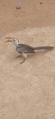
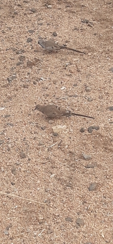

Research-grade observations from iNaturalist (within ~15 mi).
Events
Gallery
Sources
- • Wikipedia
- • Wikidata
- • iNaturalist
- • Open-Meteo / sunrise-sunset.org
- • Wikipedia Pageviews API