Browse / Ethiopia / Amhara / Mota
Mota
Amharatown
Demographic figures from Ethiopian Statistical Service. Overview below cites Wikipedia and may reference a different year.
City facts
Facts from Wikidata (CC0).
Overview
Mota is a town in northwest Ethiopia. It is located in the Misraq Gojjam Zone of the Amhara Region on the secondary road that links Dejen with Bahir Dar overlooking the Abay River. The town has a latitude and longitude of 11°5′N 37°52′E with an elevation of 2,487 meters above sea level.
Read more on WikipediaHistory & geography
History
Due to the presence of Sebara Dildiy, one of only two bridges across the Abay River until the late 19th century, Mota became a major commercial center. Described by at least one group of European travellers as "the most considerable market" in Gojjam; it attracted merchants from as far away as Begemder, Gondar and Tigray. To reinstate the commerce prior to the bridge being broken, an organization named Bridges to Prosperity is building a 100-meter suspended pedestrian bridge to provide safe access Those crossing the river are able to obtain cotton cloth, cattle, and horses. Likewise, Mota was the seat of an important royal fiefdom during the Gondarine period, and a notable place for asylum in the early 19th century. The artist Aleqa Elyas Hailu, believed to be Ethiopia's first foreign-trained artist, was born in Mota around 1861. He worked mostly in Shewa where he decorated manuscripts and many churches, although he also decorated one in his native town. His son Aleqa Gebre Ezgziabher Elyas was a man of literature, writing the Royal Chronicle of Lij Iyasu and the Empress Zewditu. During the 1930s, its market day was on Thursday. During the East African Campaign, units of Gideon Force managed to bluff the Italian garrison into surrendering 24 April 1941. In October 2009, zonal officials announced that construction of 47-km road connecting Mota and Digua Tsion had begun, with a budget of over 147 million Birr and completion expected by September 2010.
Excerpted from the corresponding Wikipedia article (CC BY-SA).
Geography
Coordinates & boundaries from the US Census TIGER/Line shapefiles.
Climate
Air quality
Walkability
Amenities nearby
Wildlife & biodiversity
Most-observed species
- geladaTheropithecus gelada (Rüppell, 1835) · Mammalia1
Citizen-science & research observations from the Global Biodiversity Information Facility (GBIF).
Earthquake history
Events from the USGS Earthquake Catalog (global) (FDSN Event Web Service).
Photos
Sights & places nearby
Notable people from here
Nearby places in Amhara
- Kulmersk107.2 mi away
- Santa Rita da Valeria6544.3 mi away
- Nhamundá6558.8 mi away · pop. 20,136
- Bom Socorro6559.4 mi away
- Vila Amazônia6560.7 mi away
- Espírito Santo6564.1 mi away
- Cutipanã6566.2 mi away
- Benedito6566.5 mi away
- Santo Antônio do Tracajá6568.1 mi away
- Santa Maria do Mamoriacá6572.6 mi away
- Marajó6573.8 mi away
- Vila Santa Maria6580.2 mi away
Geography & sun
Elevation, sunrise/sunset and daylight from Open-Meteo. Solar climatology from NASA POWER.
Nearby airports
Public attention
Pageview totals from the Wikimedia Pageviews API.
Books about this place
Recent natural events nearby
Ground air-quality sensors
Recently spotted species
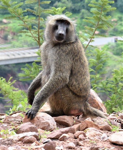
Research-grade observations from iNaturalist (within ~15 mi).
Events
Gallery
Sources
- • Wikipedia
- • Wikidata
- • USGS Earthquake Catalog (global feed)
- • GBIF (Global Biodiversity Information Facility)
- • iNaturalist
- • Open-Meteo / sunrise-sunset.org
- • Wikipedia Pageviews API