Browse / Ethiopia / SNNPR / Sawla
Sawla
SNNPRtown
Demographic figures from Ethiopian Statistical Service. Overview below cites Wikipedia and may reference a different year.
City facts
Facts from Wikidata (CC0).
Overview
Sawla is a town in southern Ethiopia. Located in Gofa Zone of the Southern Nations, Nationalities and Peoples' Region, this town has a latitude and longitude of 6°18′N 36°53′E with an elevation of 1,395 metres (4,577 ft) above sea level. It is surrounded by Demba Gofa woreda.
Read more on WikipediaHistory & geography
History
The Founding of Sawla (Felege Neway). The town was founded in 1959 during the reign of Emperor Haile Selassie. The main factors for its founding were its conducive climate and environment, fertile soil, suitability for expansion of infrastructure, the presence of an airport at that time, availability of water and different spices including coffee, and its importance as a business center. In 1963 the Gofa Awuraja was transferred to Sawla from Bulki and this played a role for the relatively fast structural development of the town. The ancient name of Sawla is Felege Newaye. Sawla town has its present name from “Sa'a’’ ‘’wula” a Gofa word that means "the gate of land." This name was given because Sawla was serving as the center of business for the surrounding districts. In 2002/2003 the Southern Nations Nationality Peoples Regional State Works and Urban Development Bureau study has classified it as one of the city administrations in the region. Sawla is a reform and has a municipal status urban kebelle. The town got the first plan in 1965, and the current plan in 2002. Records at the Nordic Africa Institute website provide details of the primary and secondary school in Sawla in 1968. A study to build a road to connect Sawla with Ameya in Ela woreda was conducted in 1996. On 1 July 2008, the Ethiopian House of Peoples' Representatives voted to ratify a US$9 million loan agreement signed with the Arab Bank for Economic Development in Africa for the implementation of a rural electrification project linking Sawla and Key Afer in Hamer Bena woreda. The cost of this project would total US$43.89 million, of which the OPEC Fund for International Development has promised US$20 million, while the Ethiopian government will provide US$14 million.
Excerpted from the corresponding Wikipedia article (CC BY-SA).
Geography
Coordinates & boundaries from the US Census TIGER/Line shapefiles.
Climate
Air quality
Walkability
Amenities nearby
Wildlife & biodiversity
Most-observed species
- Benguella Grassland FrogPtychadena anchietae (Bocage, 1868) · Amphibia1
- Largen's Clawed FrogXenopus largeni Tinsley, 1995 · Amphibia1
- HamerkopScopus umbretta Gmelin, 1789 · Aves1
Citizen-science & research observations from the Global Biodiversity Information Facility (GBIF).
Earthquake history
Most recent
- M 4.3 — 2022-04-0324 km ENE of Jinka, Ethiopia
- M 4.4 — 2006-11-0138 km ENE of Jinka, Ethiopia
- M 4.7 — 2005-07-0732 km NNE of Arba Minch, Ethiopia
Events from the USGS Earthquake Catalog (global) (FDSN Event Web Service).
Photos
Sights & places nearby
Notable people from here
Nearby places in SNNPR
Geography & sun
Elevation, sunrise/sunset and daylight from Open-Meteo. Solar climatology from NASA POWER.
Nearby airports
Public attention
Pageview totals from the Wikimedia Pageviews API.
Books about this place
Recent natural events nearby
Ground air-quality sensors
Recently spotted species
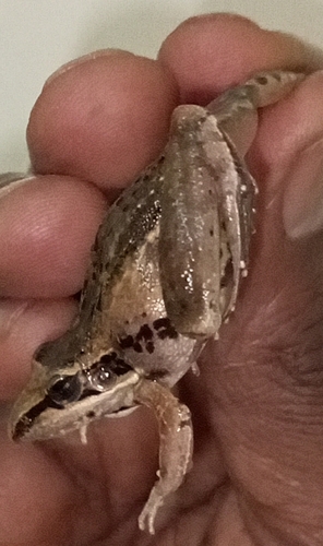
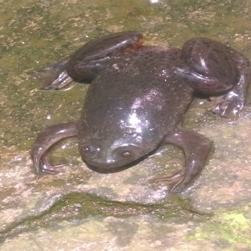
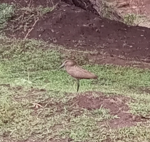
Research-grade observations from iNaturalist (within ~15 mi).
Events
Gallery
Sources
- • Wikipedia
- • Wikidata
- • USGS Earthquake Catalog (global feed)
- • GBIF (Global Biodiversity Information Facility)
- • iNaturalist
- • Open-Meteo / sunrise-sunset.org
- • Wikipedia Pageviews API