Browse / Ethiopia / Amhara / Shano
Shano
Amharatown
Demographic figures from Ethiopian Statistical Service. Overview below cites Wikipedia and may reference a different year.
City facts
Overview
Sheno (Shanoo) is a town in central Ethiopia. Located in the Kaba Shewa Zone, Oromia, it has an elevation of 2,918 meters above sea level. It is the administrative center of Kembibit woreda. The main buildings in the city that can be shown is the new building built by a German philanthropist organization Menschen für Menschen. Older buildings that are serving as school and city administration were the remnants from the Italian camping site during the 5 years stay of the Italians.
Read more on WikipediaHistory & geography
Geography
Coordinates & boundaries from the US Census TIGER/Line shapefiles.
Climate
Air quality
Walkability
Amenities nearby
Wildlife & biodiversity
Most-observed species
- White-collared PigeonColumba albitorques Rüppell, 1837 · Aves15
- Pied CrowCorvus albus Statius Muller, 1776 · Aves12
- Black KiteMilvus migrans (Boddaert, 1783) · Aves11
- Moorland ChatPinarochroa sordida (Rüppell, 1837) · Aves11
- Augur BuzzardButeo augur (Ruppell, 1836) · Aves9
- Cape CrowCorvus capensis Lichtenstein, 1823 · Aves9
- Brown-rumped SeedeaterCrithagra tristriata (Rüppell, 1840) · Aves9
- Thekla's LarkGalerida theklae A.E.Brehm, 1857 · Aves9
Citizen-science & research observations from the Global Biodiversity Information Facility (GBIF).
Earthquake history
Most recent
- M 4.5 — 2026-09-166 km NW of Āwash, Ethiopia
- M 4.6 — 2026-08-0913 km ENE of Metahāra, Ethiopia
- M 4.4 — 2026-07-2114 km NW of Āwash, Ethiopia
- M 4 — 2026-06-2541 km NW of Metahāra, Ethiopia
- M 4.5 — 2026-05-229 km NE of Metahāra, Ethiopia
- M 4.3 — 2026-05-1011 km N of Metahāra, Ethiopia
Events from the USGS Earthquake Catalog (global) (FDSN Event Web Service).
Photos
Sights & places nearby
Notable people from here
Nearby places in Amhara
- Kulmersk179.8 mi away
- Santa Rita da Valeria6637.4 mi away
- Bom Socorro6652.2 mi away
- Nhamundá6652.7 mi away · pop. 20,136
- Vila Amazônia6653.7 mi away
- Espírito Santo6657.3 mi away
- Cutipanã6659.9 mi away
- Benedito6660.2 mi away
- Santo Antônio do Tracajá6660.6 mi away
- Marajó6666.1 mi away
- Santa Maria do Mamoriacá6666.3 mi away
- Vila Santa Maria6673.8 mi away
Geography & sun
Elevation, sunrise/sunset and daylight from Open-Meteo. Solar climatology from NASA POWER.
Nearby airports
Public attention
Pageview totals from the Wikimedia Pageviews API.
Books about this place
Recent natural events nearby
Ground air-quality sensors
Recently spotted species


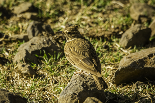

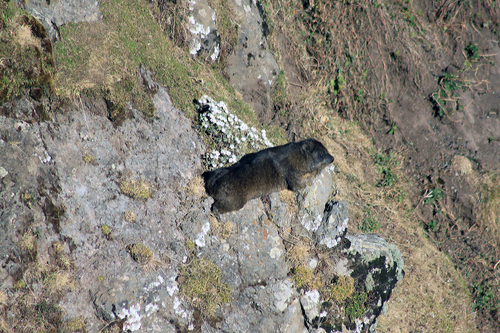
Research-grade observations from iNaturalist (within ~15 mi).
Events
Gallery
Sources
- • Wikipedia
- • Wikidata
- • USGS Earthquake Catalog (global feed)
- • GBIF (Global Biodiversity Information Facility)
- • iNaturalist
- • Open-Meteo / sunrise-sunset.org
- • Wikipedia Pageviews API