Browse / Finland / Pirkanmaa / Pirkkala
Pirkkala
Pirkanmaatown

Pirkkala
Total population
19,832
Founded
1922
Demographic figures from Statistics Finland. Overview below cites Wikipedia and may reference a different year.
City facts
Facts from Wikidata (CC0).
Overview
Pirkkala is a municipality in Finland, located in the Pirkanmaa region. It lies to the southwest of the regional capital, Tampere. The population of Pirkkala is approximately 21,000, while the metropolitan area has a population of approximately 428,000. It is the 48th most populous municipality in Finland.
Read more on WikipediaHistory & geography
History
The former parish of Suur-Pirkkala (Great Pirkkala) is mentioned in historical writings from the 14th century. It occupied over half of Pirkanmaa, a region nowadays populated by about 526,000 inhabitants. Suur-Pirkkala began to split when new parishes and municipalities were founded and wanted independence. In 1922 the Pirkkala was split into Pohjois- (Northern) and Etelä-Pirkkala (Southern Pirkkala) due to a movement in Southern Pirkkala led by agronomist Hannes Palmroth of the Partola Estate to gain independence from the more industrial North. In 1938 the name of Northern Pirkkala was changed to Nokia and after an appeal to the President of Finland Kyösti Kallio in 1939, Southern Pirkkala reverted to its original name Pirkkala. The present-day province of Pirkanmaa that was founded in the 1950s is named after Pirkkala as it was in the center of the region that was more or less the same area as the historic Great Pirkkala
Excerpted from the corresponding Wikipedia article (CC BY-SA).
Geography
Coordinates & boundaries from the US Census TIGER/Line shapefiles.
Climate
Air quality
Walkability
Amenities nearby
Wildlife & biodiversity
Earthquake history
Photos
Sights & places nearby
Notable people from here


People born within ~10 km, from Wikidata (CC0). Click any name for their Wikipedia article.
Geography & sun
Elevation, sunrise/sunset and daylight from Open-Meteo. Solar climatology from NASA POWER.
Nearby airports
Public attention
Pageview totals from the Wikimedia Pageviews API.
Books about Pirkkala
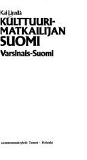
Search results from Open Library.
Recent natural events nearby
Ground air-quality sensors
Recently spotted species
Events
Gallery
Sources
- • Wikipedia
- • Wikidata
- • Open-Meteo / sunrise-sunset.org
- • Wikipedia Pageviews API
- • Open Library
- • Wikidata SPARQL (CC0) — population, area, elevation, inception, head of government, Commons image