Browse / France / Provence-Alpes-Côte d'Azur / Prads-Haute-Bléone
Prads-Haute-Bléone
Provence-Alpes-Côte d'Azurvillage

Prads-Haute-Bléone
Total population
175
Founded
1978
Demographic figures from INSEE. Overview below cites Wikipedia and may reference a different year.
City facts
Facts from Wikidata (CC0).
Overview
Prads-Haute-Bléone is a commune in the Alpes-de-Haute-Provence department and in the Provence-Alpes-Côte d'Azur region in southeastern France.
Read more on WikipediaHistory & geography
History
In ancient times, Bodiontiques (Bodiontici) lived in the Valley of the Bléone, and were therefore the Gallic people who lived in the valleys of the current commune of Prads-Haute-Bléone. The Bodiontiques, who were defeated by Augustus at the same time as other peoples present on the Trophy of the Alps (before 14 BC) are attached to the Roman province of Alpes Maritimae at its inception. The communities of Blegiers, Champourcin, Chanolles, Chavailles, Mariaud and Prads were all of the Bailli of Digne. The locality of Prads appears for the first time in charters in the High Middle Ages, as Prato, dependent upon the Abbey of Saint Victor in Marseille. The Abbey of Cistercian monks of Notre-Dame de Faillefeu (or meadows: the Abbot was called "the Abbot of the meadows") was founded in 1144 As with many municipalities of the department, Prads acquired schools well before the Jules Ferry laws: in 1863, it had three, located in Prads, la Favière and Tercier. These schools provided a primary education to boys. While the Falloux Laws of 1851, required the opening of a girls school in communes with more than 800 inhabitants, Prads maintained a girls school in the 1860s, but that school closed before the end of the Second Empire. It is only since the Ferry Laws that Prads girls have attended school regularly. In the Middle Ages, during the 12th century, the village of Blégiers (Bligerium) moved to the Roche-de-Blégiers, on a hilltop site. Its population increased from 81 feus in 1315, with another 14 in 1471. At this time, it was still part of the Chapter of Digne that owned the domain and the Church of the Roche-de-Blégiers, before selling these in 1476 to the . From that date, it was the Bishop who appointed the responsible chaplain of the souls of this parish, and who…
Geography
The neighboring communes of Prads-Haute-Bléone are Méolans-Revel, Allos, Villars-Colmars, Thorame-Basse, Draix, La Javie, Beaujeu and Verdaches. The village lies on the right bank of the Bléone, which has its source in the northeastern part of the commune and flows southwest through the middle of the commune. The municipality of Prads-Haute-Bléone extends over . It is composed of nine hamlets ranging in elevation from 800 to 1,450 metres. The main settlement of Prads is at , and the highest peak is the Tête de l'Estrop at in the Massif des Trois-Évêchés at the border with Méolans-Revel. This is also the highest summit of the Provence Alps and Prealps. It is common with the type of high valleys of the Southern Alps, enjoying a climate which is very sunny, cold, dry, and with a snow line at approximately . During the two last major glaciations, Riss glaciation and Würm glaciation, major glaciers occupied the valleys of the commune. A first glacier, reduced, occupied the top of the Valley of the Galebre (formerly commune of Mariaud). A great glacier flowed into the Bléone Valley; It received tributaries from the glacier valleys of the ravine of Bussing, Riou and the ravine of Jet des Eaux and Riou de l’Aune. The Riss glacier descended to Blegiers; the Würm glaciation was less thick and stopped below Heyre. The valleys of the southern entrance to the town (Champourcin, Chanolles, Blegiers) are situated in limestone mountains of the Jurassic period. Further upstream and to left bank of the Bléone, the Carton and the Chau ridges are more recent limestone formations of the Upper Cretaceous. In front of these formations at the right bank, the Galabre ridge which separates the Bléone Valley is composed of Bathonian limestone. This has beds of marl, alternating with…
Excerpted from the corresponding Wikipedia article (CC BY-SA).
Geography
Coordinates & boundaries from the US Census TIGER/Line shapefiles.
Climate
Air quality
Walkability
Amenities nearby
Wildlife & biodiversity
Most-observed species
- Stinking HelleboreHelleborus foetidus L. · Magnoliopsida304
- Common ChaffinchFringilla coelebs Linnaeus, 1758 · Aves292
- Eurasian BlackbirdTurdus merula Linnaeus, 1758 · Aves273
- Great TitParus major Linnaeus, 1758 · Aves247
- Marbled WhiteMelanargia galathea Linnaeus, 1758 · Insecta230
- House SparrowPasser domesticus (Linnaeus, 1758) · Aves229
- European RobinErithacus rubecula (Linnaeus, 1758) · Aves221
- Eurasian Blue TitCyanistes caeruleus (Linnaeus, 1758) · Aves220
Citizen-science & research observations from the Global Biodiversity Information Facility (GBIF).
Earthquake history
Most recent
- M 2.5 — 2025-03-201 km WSW of Cantaron, France
- M 3.1 — 2025-03-181 km ESE of Tourrette-Levens, France
- M 3.3 — 2025-03-182 km N of Berre-les-Alpes, France
- M 3.9 — 2024-12-098 km WNW of Acceglio, Italy
- M 4.1 — 2023-11-2110 km WSW of Acceglio, Italy
- M 4.1 — 2023-05-1616 km W of Pleyne, Italy
Events from the USGS Earthquake Catalog (global) (FDSN Event Web Service).
Photos
Sights & places nearby
Notable people from here
Geography & sun
Elevation, sunrise/sunset and daylight from Open-Meteo. Solar climatology from NASA POWER.
Nearby airports
Public attention
Pageview totals from the Wikimedia Pageviews API.
Books about this place
Recent natural events nearby
Ground air-quality sensors
Recently spotted species
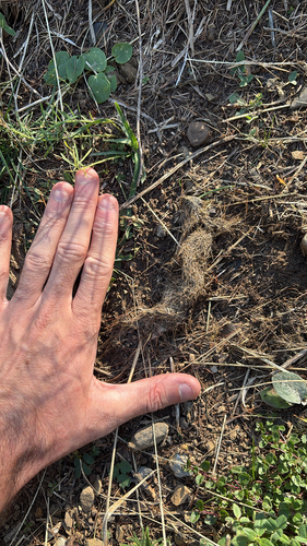
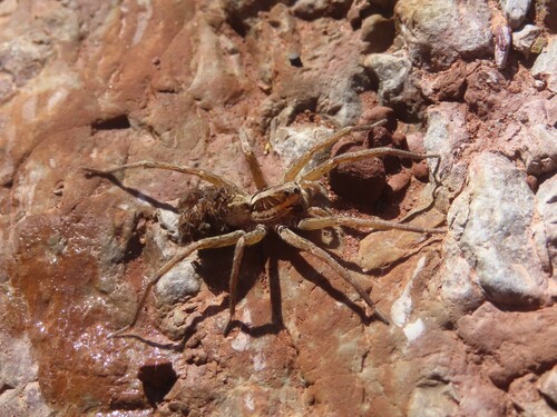
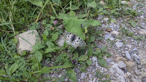
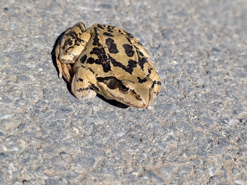
Research-grade observations from iNaturalist (within ~15 mi).
Events
Gallery
Official Identifiers
INSEE — French National Institute of Statistics
- INSEE code
- 04155
- Department
- 04
- Region
- 93
- Population (Wikidata)
- 172
geo.api.gouv.fr
Sources
- • Wikipedia
- • Wikidata
- • USGS Earthquake Catalog (global feed)
- • GBIF (Global Biodiversity Information Facility)
- • iNaturalist
- • Open-Meteo / sunrise-sunset.org
- • Wikipedia Pageviews API
- • INSEE — French national statistics, via geo.api.gouv.fr (official commune code, population, surface, department, region)
- • INSEE — French National Institute of Statistics — geo.api.gouv.fr