Browse / United States / Georgia / Blairsville
Blairsville
Georgiacity

Blairsville
Total population
902
Median home value
$212,500
Bachelor's+
Median income
$30,357
Demographic figures from US Census Bureau · ACS 5-year estimates. Overview below cites Wikipedia and may reference a different year.
City facts
Facts from Wikidata (CC0).
Overview
Blairsville is a city in and the county seat of Union County, on the northern border of Georgia, United States. It was founded near the Nottely River, which was dammed in 1942 as part of the Tennessee Valley Authority project, forming Lake Nottely. As of the 2020 census, the city had a population of 616.
Read more on WikipediaHistory & geography
History
During the 1830s, the United States conducted Indian Removal of the Cherokee Nation and other Southeast tribes, to what was designated as Indian Territory west of the Mississippi River. This area along the Nottely River was part of the large Cherokee territory and the leader Goingsnake was born here in 1758. After American settlers moved into this area, in 1835 the Georgia General Assembly designated Blairsville as the Union County seat. The town is named after American Revolutionary War veteran James Blair. The neighboring city of Dahlonega was known as the first site of gold in the United States, but the Blairsville area was known to have the purest gold in the mountains of northern Georgia. Assayers in Washington, D.C. could tell by looking that gold ore was from the Coosa Mines because it was “the yellowest gold” submitted and its brilliant color set it apart. This area of northern Georgia was still rural and isolated before World War II. During the Great Depression, under the President Franklin D. Roosevelt administration, the Nottely River was selected as part of the Tennessee Valley Authority projects. The river was dammed in order to form a reservoir to generate hydroelectric power. It also created a lake with recreational opportunities. This was one of the projects that produced electrification in a rural area. Blairsville's newspaper, the North Georgia News, was first published in 1909. United Community Banks, Inc., one of the largest financial institutions in the Southeast U.S., was founded in Blairsville in 1949.
Geography
U.S. Routes 19 and 76, as well as Georgia State Route 515 (Zell Miller Mountain Parkway), are the main highways through the city. U.S. 19 leads north to Murphy, North Carolina and south to Dahlonega. U.S. 76 and GA-515 run through the city together, leading northeast to Young Harris and west to Blue Ridge. Atlanta is to the south via U.S. 19. According to the United States Census Bureau, the city has a total area of , all land. Blairsville has a humid subtropical climate, yet due to its elevation of , typically records far lower temperatures at night than what is encountered in much of the Southeastern U.S., and has slightly higher precipitation totals ( annually) than most locations in the state; the average diurnal temperature variation exceeds in each of the spring and autumn months. Snow usually occurs several times every year. The average annual snowfall is 4 inches. The monthly daily mean temperature ranges from in January to in July. There are 7.6 days of highs and 4.6 days where the high fails to rise above freezing annually.
Excerpted from the corresponding Wikipedia article (CC BY-SA).
Demographics & economy
Race & ethnicity
Source: US Census Bureau — American Community Survey, 5-year estimates.
Geography
Coordinates & boundaries from the US Census TIGER/Line shapefiles.
Climate
Air quality
Industrial & pollution facilities
Natural hazard risk
Health (adults)
Age-adjusted prevalence estimates from CDC PLACES (latest release).
Walkability
Amenities nearby
Wildlife & biodiversity
Most-observed species
- American CrowCorvus brachyrhynchos C.L.Brehm, 1822 · Aves3,896
- Tufted TitmouseBaeolophus bicolor (Linnaeus, 1766) · Aves3,597
- Carolina ChickadeePoecile carolinensis (Audubon, 1834) · Aves3,269
- Northern CardinalCardinalis cardinalis (Linnaeus, 1758) · Aves3,203
- Carolina WrenThryothorus ludovicianus (Latham, 1790) · Aves3,059
- Blue JayCyanocitta cristata (Linnaeus, 1758) · Aves3,036
- Eastern TowheePipilo erythrophthalmus (Linnaeus, 1758) · Aves2,585
- White-breasted NuthatchSitta carolinensis Latham, 1790 · Aves2,304
Citizen-science & research observations from the Global Biodiversity Information Facility (GBIF).
Schools
Largest nearby schools
- Union County High SchoolHigh · Blairsville · 887 students · 13.9:1 ratio
- Union County Primary SchoolElementary · Blairsville · 776 students · 14.4:1 ratio
- Union County Middle SchoolMiddle · Blairsville · 679 students · 14.4:1 ratio
- Union County Elementary SchoolElementary · Blairsville · 616 students · 14.7:1 ratio
Public K–12 schools within ~10 mi from Urban Institute Education Data Portal (NCES Common Core of Data, 2022).
Earthquake history
Most recent
- M 2.65 — 2026-03-2410 km SSW of Dillsboro, North Carolina
- M 2.57 — 2025-07-102 km E of Greenback, Tennessee
- M 4.1 — 2025-05-1021 km SE of Greenback, Tennessee
- M 2.51 — 2023-11-047 km WSW of Bryson City, North Carolina
- M 2.94 — 2022-01-2116 km NNE of Eton, Georgia
- M 2.72 — 2021-10-2419 km NNW of Lake Santeetlah, North Carolina
Events from the USGS Earthquake Catalog (global) (FDSN Event Web Service).
Photos
Sights & places nearby
Notable people from here

People born within ~10 km, from Wikidata (CC0). Click any name for their Wikipedia article.
Nearby places in Georgia
Geography & sun
Elevation, sunrise/sunset and daylight from Open-Meteo. Solar climatology from NASA POWER.
Nearby airports
Public attention
Pageview totals from the Wikimedia Pageviews API.
Books about Blairsville
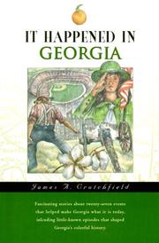
Search results from Open Library.
Recent natural events nearby
Ground air-quality sensors
Recently spotted species
Nearest stream gauge
Events
Gallery
Sources
- • Wikipedia
- • US Census Bureau (ACS 5-year estimates)
- • Wikidata
- • USGS Earthquake Catalog (global feed)
- • NCES via Urban Institute Education Data Portal
- • GBIF (Global Biodiversity Information Facility)
- • CDC PLACES
- • Open-Meteo / sunrise-sunset.org
- • Wikipedia Pageviews API
- • Open Library