Browse / Equatorial Guinea / Bioko Norte / Malabo
Malabo
Bioko Nortecity

Malabo
Total population
297,000
Founded
1827
Demographic figures from INEGE Equatorial Guinea. Overview below cites Wikipedia and may reference a different year.
City facts
Sister cities
Facts from Wikidata (CC0).
Overview
Malabo is a city that served as the capital city of Equatorial Guinea from 1968 to 2 January 2026, located in the province of Bioko Norte. It is located on the north coast of the island of Bioko. In 2018, the city had a population of approximately 297,000 inhabitants.
Read more on WikipediaHistory & geography
History
In 1472, in an attempt to find a new route to India, the Portuguese navigator Fernão do Pó, encountered the island of Bioko, which he called Formosa. Later, the island was named after its discoverer, Fernando Pó. At the beginning of the 16th century, specifically in 1507, the Portuguese Ramos de Esquivel made a first attempt at colonization on the island of Fernando Pó. He established a factory in Concepción (now Riaba) and developed plantations of sugarcane. With the Treaties of San Ildefonso in 1777 and El Pardo in 1778, during the reign of the Spanish King Charles III, the Portuguese gave to the Spanish the islands of Fernando Pó, Annobón, and the right to conduct trade in the mainland, an area of influence of approximately 800 000 km2 in Africa, in exchange for the Colonia del Sacramento in Río de la Plata and the Santa Catarina Island off the Brazilian coast (occupied by the Spaniards) during a recent war trying to stop Portuguese expansion in the Viceroyalty of the Río de la Plata. The area stretched from the Niger Delta to the mouth of Ogooué River, now in Gabon, and included, besides the islands of Fernando Pó and Annobón, the islets of Corisco and Elobeyes. Spain was uninterested in those lands because it already had vast colonies in other parts of the world, Spain lost interest in Spanish Guinea in 1827 and authorized the British to use the island as a base for suppressing the African slave trade. In 1821, the Nelly approached the island of Fernando Pó. He found it abandoned and founded the establishments of Melville Bay (now Riaba) and San Carlos (now Luba). Some years later, another British captain, William Fitzwilliam Owen, decided to colonize the island and in the north of it — on the site of the present capital — erected a base for British ships…
Geography
Malabo is situated in the north of the island of Bioko, at coordinates 3° 45' 7.43" North and 8° 46' 25.32" East. The south of Malabo is limited by the Cónsul River and just across the river, south-west, is the hospital. West of the city, located about 9 km from the center of Malabo, is renewed Malabo International Airport. In the coastal region north of the city are the bays and capes. The elder is the punta de la Unidad Africana located just behind the Malabo Government Building and which occupies the entire eastern part of the Bay of Malabo. Another cape of importance is punta Europa located in the west of the city near to the airport. Malabo features a tropical monsoon climate (Köppen Am). Malabo receives on average of rain per year. The city has a pronounced, albeit short, sunnier (but still cloudy) dry season from December through February. January is normally its driest month with of rain falling on average. It also has a very long cloudy wet season that covers the remaining nine months from March to November. On average, the months hit hardest by the wet season are September and October, which receive of rain and showers between them. Daytime temperatures do not vary at all day to day, and vary only a few degrees throughout the entire year. At night, the average low temperature is in every month of the year but January to April have a slightly higher diurnal range because it is clearer. Nonetheless, with only 1,020 hours of sunshine per year, Malabo is one of the cloudiest, wettest and most lightning-prone capitals of the world, and experiences much fog and haze even when it is not raining in the driest months.
Excerpted from the corresponding Wikipedia article (CC BY-SA).
Geography
Coordinates & boundaries from the US Census TIGER/Line shapefiles.
Climate
10-year averages from ERA5 reanalysis (Open-Meteo).
Air quality
Walkability
Amenities nearby
Wildlife & biodiversity
Most-observed species
- Northern Double-collared SunbirdCinnyris reichenowi Sharpe, 1891 · Aves100
- Pied CrowCorvus albus Statius Muller, 1776 · Aves93
- Village WeaverPloceus cucullatus (Statius Muller, 1776) · Aves82
- Yellow-rumped TinkerbirdPogoniulus bilineatus (Sundevall, 1850) · Aves79
- Yellow-billed TuracoTauraco macrorhynchus (Fraser, 1839) · Aves76
- Northern Gray-headed SparrowPasser griseus (Vieillot, 1817) · Aves74
- African Palm-SwiftCypsiurus parvus (M.H.K.Lichtenstein, 1823) · Aves69
- Gray ApalisApalis cinerea (Sharpe, 1891) · Aves69
Citizen-science & research observations from the Global Biodiversity Information Facility (GBIF).
Earthquake history
Events from the USGS Earthquake Catalog (global) (FDSN Event Web Service).
Photos
Sights & places nearby
Notable people from here


People born within ~10 km, from Wikidata (CC0). Click any name for their Wikipedia article.
Nearby places in Bioko Norte
Geography & sun
Elevation, sunrise/sunset and daylight from Open-Meteo. Solar climatology from NASA POWER.
Nearby airports
Public attention
Pageview totals from the Wikimedia Pageviews API.
Books about Malabo


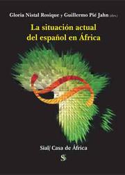
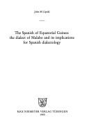

Search results from Open Library.
Recent natural events nearby
Ground air-quality sensors
Recently spotted species
Events
Gallery
Geotagged photos within ~6 miles of Malabo, from Wikimedia Commons contributors.
 0.6 mi
 0.7 mi
 0.7 mi
 0.7 mi
 0.7 mi
_-_ponentes.jpg) 0.7 mi
0.7 mi 0.7 mi
_-_p%C3%BAblico.jpg) 0.7 mi
0.7 mi.jpg) 0.7 mi
0.7 mi 1 mi
1 mi.jpg) 1.1 mi
1.1 mi 1.2 mi
 1.2 mi
 1.2 mi
 1.2 mi
.jpg) 1.2 mi
1.2 mi.jpg) 1.2 mi
1.2 mi.jpg) 1.2 mi
1.2 mi.jpg) 1.2 mi
1.2 mi.jpg) 1.2 mi
1.2 mi.jpg) 1.2 mi
1.2 mi.jpg) 1.3 mi
1.3 mi.jpg) 1.3 mi
1.3 mi.jpg) 1.3 mi
1.3 miPhotos via Wikimedia Commons — see each image page for license & attribution.
Sources
- • Wikipedia
- • Open-Meteo (ERA5 reanalysis)
- • Wikimedia Commons
- • Wikidata
- • USGS Earthquake Catalog (global feed)
- • GBIF (Global Biodiversity Information Facility)
- • Open-Meteo / sunrise-sunset.org
- • Wikipedia Pageviews API
- • Open Library