Browse / Greece / Crete / Kissamos
Kissamos
Cretetown

Kissamos
Total population
5,000
Air quality index
Demographic figures from ELSTAT. Overview below cites Wikipedia and may reference a different year.
City facts
Facts from Wikidata (CC0).
Overview
Kissamos is a town and a municipality in the west of the island of Crete, Greece. It is part of the Chania regional unit and of the former Kissamos Province which covers the northwest corner of the island. The town of Kissamos is also known as Kastelli Kissamou and often known simply as Kastelli after the Venetian castle that was there. It is now a port and fishing harbour, with a regular ferry from the Peloponnese via Kythira. A town museum is located in the old Venetian governor's palace and there have been important archaeological finds in the town, including fine mosaics, dating from the Roman city of Kisamos. The head town of the municipality is Kastelli-Kissamos itself.
Read more on WikipediaHistory & geography
History
Strabo said that ancient Cisamus was dependent on Aptera and was its naval arsenal. The Peutinger Table distinguishes two port towns in Crete called Cisamus, Modern Kissamos (at 35°29′38″N 23°39′25″E) is much further west than where Aptera is now placed (at 35°27′46″N 24°8′31″E). It was excluded already by Pashley in 1837 as being, of the two ancient maritime Cretan cities named Kisamos, the one associated with Aptera. In the past, when the port of Aptera was thought to be present-day Kissamos, some supposed Aptera to be identical with Polyrrhenia, and Kissamos to be the port of Polyrrhenia. However, Strabo and other ancient sources say that Polyrrhenia's port was at Phalasarna on the west coast.
Excerpted from the corresponding Wikipedia article (CC BY-SA).
Geography
Coordinates & boundaries from the US Census TIGER/Line shapefiles.
Climate
10-year averages from ERA5 reanalysis (Open-Meteo).
Air quality
Current readings from Open-Meteo Air Quality API (Copernicus CAMS European reanalysis).
Walkability
Amenities nearby
Wildlife & biodiversity
Most-observed species
- Eurasian GriffonGyps fulvus (Hablizl, 1783) · Aves179
- Hooded CrowCorvus cornix Linnaeus, 1758 · Aves167
- Italian SparrowPasser italiae (Vieillot, 1817) · Aves154
- Common BuzzardButeo buteo (Linnaeus, 1758) · Aves148
- Barn SwallowHirundo rustica Linnaeus, 1758 · Aves147
- Great TitParus major Linnaeus, 1758 · Aves135
- Eurasian Collared-DoveStreptopelia decaocto (Frivaldszky, 1838) · Aves127
- Sardinian WarblerCurruca melanocephala (J.F.Gmelin, 1789) · Aves125
Citizen-science & research observations from the Global Biodiversity Information Facility (GBIF).
Earthquake history
Most recent
- M 4.4 — 2026-07-0724 km WNW of Palaióchora, Greece
- M 5.2 — 2026-06-2015 km S of Kastrí, Greece
- M 4.9 — 2026-06-2012 km S of Kastrí, Greece
- M 4.3 — 2026-06-1961 km SW of Palaióchora, Greece
- M 4.1 — 2026-05-2018 km WNW of Agía Galíni, Greece
- M 4.3 — 2026-03-1628 km SSE of Palaióchora, Greece
Events from the USGS Earthquake Catalog (global) (FDSN Event Web Service).
Photos
Sights & places nearby
Notable people from here


People born within ~10 km, from Wikidata (CC0). Click any name for their Wikipedia article.
Nearby places in Crete
Geography & sun
Elevation, sunrise/sunset and daylight from Open-Meteo. Solar climatology from NASA POWER.
Nearby airports
Public attention
Pageview totals from the Wikimedia Pageviews API.
Books about Kissamos
Search results from Open Library.
Recent natural events nearby
Ground air-quality sensors
Recently spotted species
Research-grade observations from iNaturalist (within ~15 mi).
Events
Gallery
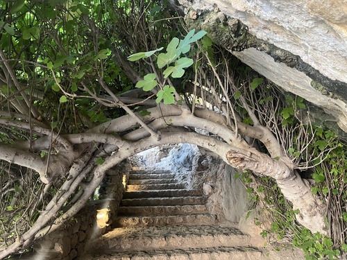
Geotagged photos within ~6 miles of Kissamos, from Wikimedia Commons contributors.
 0 mi
0 mi 0.3 mi
.jpg) 0.3 mi
0.3 mi.jpg) 0.3 mi
0.3 mi.jpg) 0.3 mi
0.3 mi 0.3 mi
 0.3 mi
 0.4 mi
 0.4 mi
 0.4 mi
 0.5 mi
 0.5 mi
 0.5 mi
 0.5 mi
 0.5 mi
 0.7 mi
 0.8 mi
 0.9 mi
 1.4 mi
 1.4 mi
 1.4 mi
 1.4 mi
 1.4 mi
 1.4 mi
Photos via Wikimedia Commons — see each image page for license & attribution.
Official Identifiers
ELSTAT — Hellenic Statistical Authority
- ELSTAT code
- 7405010101
- Population (Wikidata)
- 2,925
- Wikidata
- Q1021629
ELSTAT geographical code via Wikidata P1116
Sources
- • Wikipedia
- • Open-Meteo (ERA5 reanalysis)
- • Wikimedia Commons
- • Wikidata
- • Open-Meteo Air Quality (CAMS)
- • USGS Earthquake Catalog (global feed)
- • GBIF (Global Biodiversity Information Facility)
- • iNaturalist
- • Open-Meteo / sunrise-sunset.org
- • Wikipedia Pageviews API
- • Open Library
- • ELSTAT — Hellenic Statistical Authority — ELSTAT geographical code via Wikidata P1116