Browse / Croatia / Istria / Umag
Umag
Istriatown

Umag
Total population
6,751
Demographic figures from Croatian Bureau of Statistics. Overview below cites Wikipedia and may reference a different year.
City facts
Sister cities
Facts from Wikidata (CC0).
Overview
Umag is a coastal town in Istria, Croatia. Located in the northwestern part of Croatia, near the border with Slovenia, situated on the Adriatic Sea in the county of Istria. Umag is known for its historic old town, Mediterranean climate, and tourism industry. The town has a long history dating back to Roman times and developed as an important regional settlement due to its strategic coastal position.
Read more on WikipediaHistory & geography
History
Umag was mentioned for the first time in the 7th century by an anonymous citizen from Ravenna, but it already existed in Roman times. Proof of this is found in the numerous remains of Roman villas, the so-called villa rustica uncovered all along the coast. The town's history is closely linked to the settlement of Sipar, whose ruins can be found on a narrow cape four kilometres north of Umag. In the 9th century, the fortified settlement of Sipar was devastated by invaders, the Neretva pirates. However, after this unfortunate incident Umag grew in significance thanks also to its location, a small islet separated from the mainland by a narrow channel. It was actually this location that safeguarded the settlement from the continuous invasions down through the centuries. The Roman period of relative prosperity was interspersed with one of insecurity caused primarily by frequent invasions, outbreaks of plague, cholera, and malaria. The number of its inhabitants declined rapidly. Umag became part of the reigns of Odoacer, Theodoric, and was also ruled by the Langobards. From the 6th to the 8th centuries it fell under Byzantine dominion, followed by the rule of the Lombards in 751 and Francs in 774. The subsequent period was marked by insecurity and frequent changes of government ranging from the Patriarchs of Grado and Aquileia to the Bishops of Trieste. However, the increasingly powerful Venetian Republic imposed its rule over Istria, forcing Umag and other western Istrian towns to swear loyalty to Venice. In fact, in 1269, the Commune of Umag swore loyalty to Venice which from that time on 1797 was to appoint governors of Umag from among its nobility. This period was by no means a peaceful one. Century-old clashes with Genoa brought about more destruction and looting. In…
Geography
It is the westernmost town of Croatia, and it includes Bašanija, the westernmost point of Croatia.
Excerpted from the corresponding Wikipedia article (CC BY-SA).
Geography
Coordinates & boundaries from the US Census TIGER/Line shapefiles.
Climate
Air quality
Walkability
Amenities nearby
Wildlife & biodiversity
Earthquake history
Photos
Sights & places nearby
Notable people from here


People born within ~10 km, from Wikidata (CC0). Click any name for their Wikipedia article.
Nearby places in Istria
- Vilanija2.8 mi away · pop. 284
- Zambratija3 mi away · pop. 438
- Vardica3.4 mi away · pop. 68
- Lovrečica3.4 mi away · pop. 123
- Kršete5.1 mi away · pop. 94
- Plovanija5.8 mi away · pop. 248
- Bibali7.9 mi away · pop. 105
- Baredine7.9 mi away · pop. 62
- Bijele Zemlje9.8 mi away · pop. 70
- Marušići10 mi away · pop. 147
- Kovači11.7 mi away · pop. 65
- Valentići11.8 mi away · pop. 75
Geography & sun
Elevation, sunrise/sunset and daylight from Open-Meteo. Solar climatology from NASA POWER.
Nearby airports
Public attention
Pageview totals from the Wikimedia Pageviews API.
Books about Umag
Search results from Open Library.
Recent natural events nearby
Ground air-quality sensors
Recently spotted species


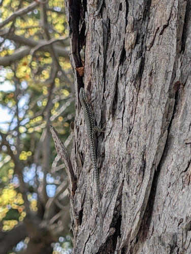






Research-grade observations from iNaturalist (within ~15 mi).
Events
Gallery
Sources
- • Wikipedia
- • Wikidata
- • iNaturalist
- • Open-Meteo / sunrise-sunset.org
- • Wikipedia Pageviews API
- • Open Library