Browse / United States / Iowa / Anamosa
Anamosa
Iowacity

Anamosa
Total population
5,629
Median home value
$172,600
Bachelor's+
Median income
$60,650
Founded
1838
Demographic figures from US Census Bureau · ACS 5-year estimates. Overview below cites Wikipedia and may reference a different year.
City facts
Facts from Wikidata (CC0).
Overview
Anamosa is a city in Jones County, Iowa, United States. The population was 5,450 at the 2020 census. It is the county seat of Jones County.
Read more on WikipediaHistory & geography
History
What is now Anamosa was founded as the settlement of Buffalo Forks in 1838 and incorporated as Lexington in 1856. Lexington was a popular name for towns at that time, so when Lexington chose to become incorporated as a city in 1877, the name was changed to Anamosa to avoid mail delivery confusion. There are many stories on how Anamosa was chosen as a name. Some believe it was named for a local Native American girl named Anamosa, meaning "white fawn", while others say it means "You walk with me." The romantic origin of the naming of the town of Anamosa comes from its early history. A Native American family was passing through town in 1842. The family stayed at the Ford House. The little girl, a Native American Princess, named Anamosa, endeared herself to the townspeople and following the family's departure from town, local citizens decided to name their town after her. The Wapsipinicon River flows through Anamosa. According to legend, a Native American maiden and her lover threw themselves off a bluff overlooking the Wapsipinicon River; one was named Wapsi, the other Pinicon. Origins of this legend are unconfirmed. Anamosa was named the Pumpkin Capital of Iowa by the Iowa State Legislature in 1993 and hosts Pumpkinfest, a pumpkin festival and weigh-off, each October. The Anamosa Boot Hill Cemetery is still open today and is northwest of the town.
Geography
According to the United States Census Bureau, the city has a total area of , of which is land and is water. The Wapsipinicon River flows through the city of Anamosa. Anamosa is served by U.S. Route 151 and Iowa Highway 64.
Excerpted from the corresponding Wikipedia article (CC BY-SA).
Demographics & economy
Race & ethnicity
Source: US Census Bureau — American Community Survey, 5-year estimates.
Geography
Coordinates & boundaries from the US Census TIGER/Line shapefiles.
Climate
Current forecast
Forecast for Anamosa, IA from NOAA NWS API.
Air quality
Industrial & pollution facilities
Natural hazard risk
Health (adults)
Age-adjusted prevalence estimates from CDC PLACES (latest release).
Walkability
Amenities nearby
Wildlife & biodiversity
Schools
Largest nearby schools
- Strawberry HillElementary · Anamosa · 442 students · 13.4:1 ratio
- Anamosa High SchoolHigh · Anamosa · 397 students · 14.7:1 ratio
- Monticello High SchoolHigh · Monticello · 366 students · 14.1:1 ratio
- Anamosa Middle SchoolMiddle · Anamosa · 344 students · 11.9:1 ratio
- Monticello Middle SchoolMiddle · Monticello · 299 students · 14.9:1 ratio
- Shannon Elementary SchoolElementary · Monticello · 144 students · 12:1 ratio
Public K–12 schools within ~10 mi from Urban Institute Education Data Portal (NCES Common Core of Data, 2022).
Earthquake history
Photos
Sights & places nearby
Notable people from here


People born within ~10 km, from Wikidata (CC0). Click any name for their Wikipedia article.
Geography & sun
Elevation, sunrise/sunset and daylight from Open-Meteo. Solar climatology from NASA POWER.
Nearby airports
Public attention
Pageview totals from the Wikimedia Pageviews API.
Books about Anamosa

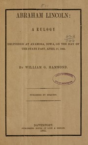


Search results from Open Library.
Recent natural events nearby
Ground air-quality sensors
Recently spotted species
Nearest stream gauge
Events
Gallery
Sources
- • Wikipedia
- • US Census Bureau (ACS 5-year estimates)
- • NOAA National Weather Service
- • Wikidata
- • NCES via Urban Institute Education Data Portal
- • CDC PLACES
- • Open-Meteo / sunrise-sunset.org
- • Wikipedia Pageviews API
- • Open Library