Browse / United States / Iowa / Dubuque
Dubuque
Iowacity

Dubuque
Total population
59,174
Median home value
$204,800
Bachelor's+
Median income
$65,845
Demographic figures from US Census Bureau · ACS 5-year estimates. Overview below cites Wikipedia and may reference a different year.
- Freeze Warning · SevereFreeze Warning issued October 17 at 2:24AM CDT until October 17 at 9:00AM CDT by NWS Quad Cities IA IL
Source: NOAA National Weather Service.
City facts
Sister cities
Facts from Wikidata (CC0).
Overview
Dubuque is a city in Dubuque County, Iowa, United States, and its county seat. The population was 59,667 at the 2020 census. Settled in 1788 and chartered in 1833, Dubuque is the oldest city in Iowa. It was named after French-Canadian trader and miner Julien Dubuque. The city lies along the Mississippi River at the convergence of the Iowa, Illinois, and Wisconsin borders, a region locally known as the Tri-State Area.
Read more on WikipediaHistory & geography
History
Spain gained control of the Louisiana Territory west of the Mississippi River following the 1763 defeat of the French; the British took over all territory to the east. The first permanent European settler in what is now Dubuque was Quebecois pioneer Julien Dubuque, who arrived in 1785. In 1788, he received permission from the Spanish government and the local Meskwaki people to mine the area's rich lead deposits. Control of Louisiana and Dubuque's mines shifted briefly back to France in 1800, then to the United States in 1803, following the Louisiana Purchase. The Meskwaki continued to mine with the full support of the U.S. government until 1830 when the Meskwaki were illegally pushed out of the mine region by American prospectors. The city of Dubuque was named after Julien Dubuque, who settled at the southern end of a large flat plain adjacent to the Mississippi River. The city was officially chartered in 1833 as part of the unorganized territory of the U.S., and is the oldest city in Iowa. The region was designated as the Iowa Territory in 1838 and was included in the newly created State of Iowa in 1846. After the lead resources were exhausted, the city became home to numerous industries. Dubuque became a center for the timber industry because of its proximity to forests in Minnesota and Wisconsin, and was later dominated by various mill working businesses. Also important were boat building, brewing, and later, the railroad industry. In 1874, the Diamond Jo Line moved its company headquarters to Dubuque. Diamond Jo Line established a shipyard at Eagle Point in 1878. Just two years later, the company was the largest employer in Dubuque, putting 78 people to work, 75 of whom worked at the shipyard earning their collective $800$1,000 per week in wages. Between 1860 and…
Geography
According to the United States Census Bureau, the city has a total area of , of which are land and are covered by water. Lake Peosta Channel separates Chaplain Schmitt Island from the mainland. Downtown Dubuque is the city's central business district, housing many government and cultural institutions. It serves as the transportation and commercial hub, located along the Mississippi River in east-central Dubuque. Notable neighborhoods include Fenelon Place Residential Historic District, Jackson Park, Old Main Street and the Dubuque Millworking Historic District. The Port of Dubuque features the Grand Harbor Resort, Alliant Energy Amphitheater, and Grand River Center. Historic landmarks like the Shot Tower and the Dubuque County Courthouse reflect the city's regional importance. The North End, settled by German immigrants in the late 19th century, remains a working-class area with factories and key sites including Bee Branch Creek, Eagle Point Park, Holy Ghost Catholic Church, Linwood Cemetery, Lock and Dam No. 11, Mathias Ham House and Sacred Heart Catholic Church. The South End, historically Irish American, features Irish pubs, churches, and neighborhoods with "old money" homes, including St. Pius X Seminary, St. Raphael's Cathedral, Mines of Spain State Recreation Area and the Wartburg Theological Seminary. The West End, developed after World War II, is a suburban area that grew with the baby boom, featuring shopping centers like Plaza 20 and Kennedy Mall. It includes middle-class neighborhoods, parks, schools, and industrial areas, extending into the suburbs of Asbury and Peosta. Notable sites include the Dubuque Arboretum and Botanical Gardens and Emmaus University. Image:Red Stone.JPG|Redstone Bed & Breakfast Image:Mississippi River Bridge.JPG|Mississippi…
Excerpted from the corresponding Wikipedia article (CC BY-SA).
Demographics & economy
Race & ethnicity
Source: US Census Bureau — American Community Survey, 5-year estimates.
Geography
Coordinates & boundaries from the US Census TIGER/Line shapefiles.
Climate
Current forecast
Forecast for Dubuque, IA from NOAA NWS API.
Air quality
Industrial & pollution facilities
Natural hazard risk
Health (adults)
Age-adjusted prevalence estimates from CDC PLACES (latest release).
Walkability
Amenities nearby
Wildlife & biodiversity
Most-observed species
- Northern CardinalCardinalis cardinalis (Linnaeus, 1758) · Aves3,682
- Black-capped ChickadeePoecile atricapillus (Linnaeus, 1766) · Aves3,450
- American RobinTurdus migratorius Linnaeus, 1766 · Aves3,287
- American GoldfinchSpinus tristis (Linnaeus, 1758) · Aves3,169
- Downy WoodpeckerDryobates pubescens (Linnaeus, 1766) · Aves3,085
- House SparrowPasser domesticus (Linnaeus, 1758) · Aves3,077
- Mourning DoveZenaida macroura (Linnaeus, 1758) · Aves2,908
- Red-bellied WoodpeckerMelanerpes carolinus (Linnaeus, 1758) · Aves2,852
Citizen-science & research observations from the Global Biodiversity Information Facility (GBIF).
Schools
Largest nearby schools
- Hempstead High SchoolHigh · Dubuque · 1,584 students · 14.5:1 ratio
- Dubuque Senior High SchoolHigh · Dubuque · 1,435 students · 10.6:1 ratio
- Eleanor Roosevelt Middle SchoolMiddle · Dubuque · 1,093 students · 14:1 ratio
- George Washington Middle SchoolMiddle · Dubuque · 624 students · 11.8:1 ratio
- Eisenhower Elementary SchoolElementary · Dubuque · 566 students · 15.7:1 ratio
- John Kennedy Elementary SchoolElementary · Dubuque · 541 students · 13.5:1 ratio
- Carver Elementary SchoolElementary · Dubuque · 535 students · 15.7:1 ratio
- Thomas Jefferson Middle SchoolMiddle · Dubuque · 459 students · 8.8:1 ratio
Public K–12 schools within ~10 mi from Urban Institute Education Data Portal (NCES Common Core of Data, 2022).
Earthquake history
Events from the USGS Earthquake Catalog (global) (FDSN Event Web Service).
Photos
Sights & places nearby
Notable people from here


People born within ~10 km, from Wikidata (CC0). Click any name for their Wikipedia article.
Nearby places in Iowa
- Sageville3.5 mi away
- Sherrill8.3 mi away
- Epworth12 mi away · pop. 1,894
- Zwingle14 mi away
- Bernard14.3 mi away · pop. 112
- La Motte14.7 mi away
- Farley15.9 mi away · pop. 1,889
- Cascade20.4 mi away · pop. 2,375
- New Vienna21 mi away · pop. 372
- Worthington22.2 mi away
- Andrew24.6 mi away · pop. 423
- Colesburg26.9 mi away · pop. 545
Geography & sun
Nearby airports
Public attention
Books about this place
Recent natural events nearby
Ground air-quality sensors
Recently spotted species

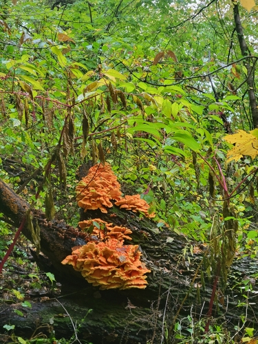

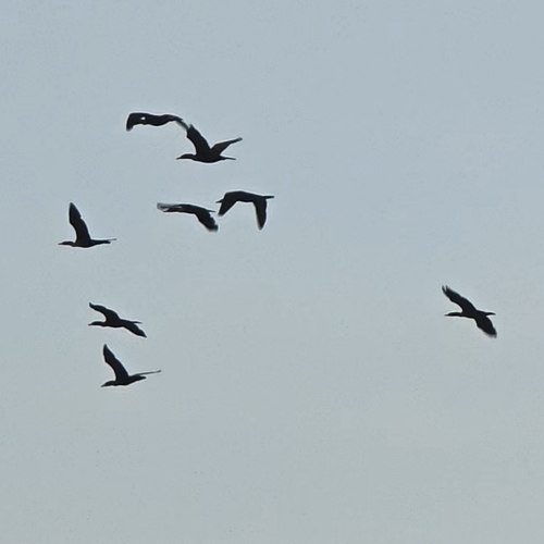
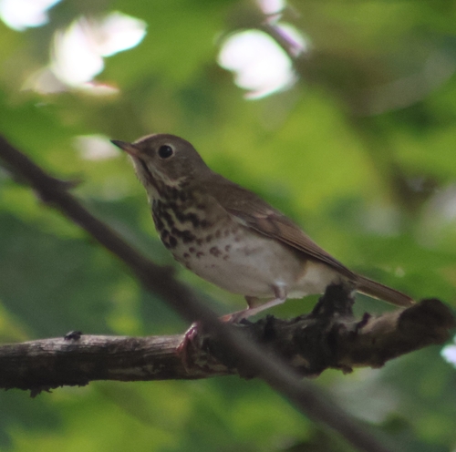




Research-grade observations from iNaturalist (within ~15 mi).
Nearest stream gauge
Live readings from USGS NWIS · measured 2026-10-17 03:30 UTC.
Events
Gallery
Sources
- • Wikipedia
- • US Census Bureau (ACS 5-year estimates)
- • NOAA National Weather Service
- • Wikidata
- • USGS Earthquake Catalog (global feed)
- • USGS NWIS (water data)
- • NCES via Urban Institute Education Data Portal
- • GBIF (Global Biodiversity Information Facility)
- • iNaturalist
- • CDC PLACES