Browse / United States / Iowa / Stone City
Stone City
IowaCDP

Stone City
Total population
154
Demographic figures from US Census Bureau · ACS 5-year estimates. Overview below cites Wikipedia and may reference a different year.
- Flood Watch · SevereFlood Watch issued September 18 at 1:56PM CDT until September 19 at 7:00PM CDT by NWS Quad Cities IA IL
Source: NOAA National Weather Service.
City facts
Facts from Wikidata (CC0).
Overview
Stone City is an unincorporated community and census-designated place in Jones County, Iowa, United States. Stone City began as a company town for the workers of the local quarries. Stone City is known for its Anamosa Limestone quarries, historic limestone architecture, and 1930s art colony. Its population was 186 persons in the 2020 census.
Read more on WikipediaHistory & geography
History
Stone City was founded in 1850 along the banks of the Wapsipinicon River. Early settlers discovered dolomite and limestone at the location. In its earliest history Stone City was known as the Anamosa Quarries. Later the area became known as the Stone City Quarries. In the late 1800s, Henry Dearborn, John Green, and John Ronen each opened limestone quarries in the area. As the railroad system expanded westward, distribution of limestone to bordering states increased. Stone City limestone became the primary building material for railroad bridges, bridge piers, and foundations for major buildings. Each year from 1859 to 1895, more than 150,000 railroad car shipments of limestone were sent from Stone City. As the quarry business flourished, a city of stone emerged as hundreds of people settled in the area. Overlooking the town, Green built his twelve-room mansion containing seven Italian marble fireplaces, hand-painted murals, two baths, and a conservatory. Once the house was complete, Green erected more of the city – a railway station, a post office, schoolhouse, a blacksmith shop, water tower, and several houses, all made of stone. In 1905 Portland cement began to be produced in Waterloo, Iowa. The use of Portland cement in place of quarried stone had an adverse effect on the economy of the Stone City and one by one the quarries began to shut down. During the next half century, nature reclaimed most of the quarries. Columbia Hall was purchased in the 1930s and torn down in 1938 to use the stone elsewhere. In 1963 the Green Mansion was tragically damaged by fire and torn down in the 1990s. Stone City was once the location of an art colony. In 1932, Grant Wood, Edward Rowan, and Adrian Dornbush established Stone City Art Colony. With little more than $100 and a…
Geography
Stone City is located at (42.105427, -91.350196). According to the United States Census Bureau, the community has a total area of .
Excerpted from the corresponding Wikipedia article (CC BY-SA).
Demographics & economy
Geography
Coordinates & boundaries from the US Census TIGER/Line shapefiles.
Climate
Current forecast
Forecast for Stone City, IA from NOAA NWS API.
Air quality
Industrial & pollution facilities
Natural hazard risk
Health (adults)
Age-adjusted prevalence estimates from CDC PLACES (latest release).
Walkability
Amenities nearby
Wildlife & biodiversity
Schools
Largest nearby schools
- Strawberry HillElementary · Anamosa · 442 students · 13.4:1 ratio
- Anamosa High SchoolHigh · Anamosa · 397 students · 14.7:1 ratio
- Anamosa Middle SchoolMiddle · Anamosa · 344 students · 11.9:1 ratio
Public K–12 schools within ~10 mi from Urban Institute Education Data Portal (NCES Common Core of Data, 2022).
Earthquake history
Photos
Sights & places nearby
Notable people from here


People born within ~10 km, from Wikidata (CC0). Click any name for their Wikipedia article.
Geography & sun
Elevation, sunrise/sunset and daylight from Open-Meteo. Solar climatology from NASA POWER.
Nearby airports
Public attention
Pageview totals from the Wikimedia Pageviews API.
Books about Stone City


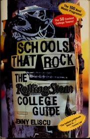


Search results from Open Library.
Recent natural events nearby
Ground air-quality sensors
Recently spotted species
Nearest stream gauge
Events
Gallery
Sources
- • Wikipedia
- • NOAA National Weather Service
- • Wikidata
- • NCES via Urban Institute Education Data Portal
- • CDC PLACES
- • Open-Meteo / sunrise-sunset.org
- • Wikipedia Pageviews API
- • Open Library