Browse / United States / Idaho / Ammon
Ammon
Idahocity

Ammon
Total population
19,064
Median home value
$381,800
Bachelor's+
Median income
$86,121
Founded
1888
Demographic figures from US Census Bureau · ACS 5-year estimates. Overview below cites Wikipedia and may reference a different year.
- Flash Flood Watch · SevereFlash Flood Watch issued September 18 at 2:52AM MDT until September 18 at 10:00PM MDT by NWS Pocatello ID
Source: NOAA National Weather Service.
City facts
Facts from Wikidata (CC0).
Overview
Ammon is a suburb city in Bonneville County, Idaho, United States. As of the 2010 US Census, the population of Ammon was 13,816. By the 2020 census, Ammon's population had grown to 17,694. It lies directly to the east of Idaho Falls and to the west of the Ammon foothills, and is the second most populous city in the Idaho Falls metropolitan area.
Read more on WikipediaHistory & geography
History
Ammon was founded by members of the Church of Jesus Christ of Latter-day Saints in 1888. It was originally called South Iona because it was the dependent branch in the south end of the Iona, Idaho ward. The area was made a ward in the church in 1889 with Arthur M. Rawson as bishop, who renamed the town in honor of Ammon, a figure in the LDS book of scripture, the Book of Mormon. Since it was now independent of the Iona Ward, a new name seemed appropriate. On February 9, 1893, the name of the town was changed from South Iona Ward to Ammon. By 1930 the village of Ammon had 270 inhabitants, but the total district of Ammon, which is how the name is usually used and is closer to the modern borders, had a population of about 1100. Ammon was an early agricultural center and later was home to several general stores, a grain elevator and a brickyard. The city was officially incorporated on October 10, 1905. It became a Second Class City under Idaho law in 1963. In the early 1900s a spur line was built by the Union Pacific Railroad to the Ammon Elevator. Beginning in the 1940s housing divisions have aided the city's growth and it has become a suburb for the adjacent city of Idaho Falls. Building boomed in the 1990s in both the business and housing sectors, and the city was one of the fastest growing in Idaho from 2000 to 2010.
Geography
According to the United States Census Bureau, the city has a total area of , of which, is land and is water.
Excerpted from the corresponding Wikipedia article (CC BY-SA).
Demographics & economy
Race & ethnicity
Source: US Census Bureau — American Community Survey, 5-year estimates.
Geography
Coordinates & boundaries from the US Census TIGER/Line shapefiles.
Climate
Current forecast
Forecast for Ammon, ID from NOAA NWS API.
Air quality
Industrial & pollution facilities
Natural hazard risk
Health (adults)
Walkability
Amenities nearby
Wildlife & biodiversity
Schools
Earthquake history
Photos
Sights & places nearby
Notable people from here


People born within ~10 km, from Wikidata (CC0). Click any name for their Wikipedia article.
Geography & sun
Elevation, sunrise/sunset and daylight from Open-Meteo. Solar climatology from NASA POWER.
Nearby airports
Public attention
Pageview totals from the Wikimedia Pageviews API.
Books about Ammon
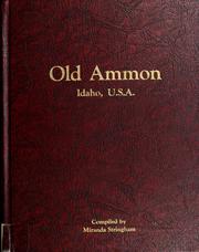
Search results from Open Library.
Recent natural events nearby
Ground air-quality sensors
Recently spotted species
Nearest stream gauge
Events
Gallery
Sources
- • Wikipedia
- • US Census Bureau (ACS 5-year estimates)
- • NOAA National Weather Service
- • Wikidata
- • Open-Meteo / sunrise-sunset.org
- • Wikipedia Pageviews API
- • Open Library