Browse / United States / Idaho / Emmett
Emmett
Idahocity

Emmett
Total population
8,275
Median home value
$342,000
Bachelor's+
Median income
$58,750
Demographic figures from US Census Bureau · ACS 5-year estimates. Overview below cites Wikipedia and may reference a different year.
City facts
Facts from Wikidata (CC0).
Overview
Emmett is a city in Gem County, Idaho, United States. The population was 7,647 at the 2020 census, up from 6,557 in 2010. It is the county seat and the only city in the county. Emmett is part of the Boise metropolitan area.
Read more on WikipediaHistory & geography
History
Emmett is a town on the southern bank of the Payette River that grew up around a ferry crossing of the Payette River. Emmett was originally called Martinsville, named after Nathaniel Martin who, along with Jonathan Smith, built the ferry crossing. Next, the name was changed to "Emmettville," because it was primarily a post office named after Emmett Cahalan, the son of Tom Cahalan, an early settler of the area. The post office was later moved but the town retained the name. A few years later the "ville" was dropped and the post office and town became simply Emmett. In 1883 James Wardwell had the town platted, and in 1900 the town was incorporated as Emmett. Later, in March 1902, the Idaho Northern Railroad came to the valley. After the closing of the mines in 1906, the power lines were extended to Emmett. A series of irrigation projects made it possible for more rapid expansion of the town as the major service center for a farming and fruit-growing valley. In the early 1900s fruit packers adopted the label of "Gem of Plenty" because of the fertility of the valley. During the mining era the valley was known as the "garden" for the mining regions. While campaigning for a return to Congress in 1934, Robert M. McCracken died in an automobile accident near Emmett. His vehicle went through a guard rail and tumbled down Freezeout Hill. Until 2001, the city was home to a Boise Cascade manufacturing facility. The Black Canyon diversion dam on the Payette River, built in the early 1920s, is east of the city. Rising some above sea level, Squaw Butte, named by [Confederate Settlers new to the area]; Native Americans who used this area as their winter resort, stands at the north end of the valley. The Payette River was named after Francois Payette, a fur trader from Quebec who…
Geography
According to the United States Census Bureau, the city has a total area of , of which is land and is water. It is located south of the Payette River, at an elevation of above sea level. Emmett experiences a semi-arid climate (Köppen BSk) with cold, moist winters and hot, dry summers.
Excerpted from the corresponding Wikipedia article (CC BY-SA).
Demographics & economy
Race & ethnicity
Source: US Census Bureau — American Community Survey, 5-year estimates.
Geography
Coordinates & boundaries from the US Census TIGER/Line shapefiles.
Climate
Current forecast
Forecast for Emmett, ID from NOAA NWS API.
Air quality
Industrial & pollution facilities
Natural hazard risk
Health (adults)
Age-adjusted prevalence estimates from CDC PLACES (latest release).
Walkability
Amenities nearby
Wildlife & biodiversity
Schools
Largest nearby schools
- EMMETT HIGH SCHOOLHigh · EMMETT · 737 students · 24.6:1 ratio
- EMMETT MIDDLE SCHOOLMiddle · EMMETT · 533 students · 19:1 ratio
- KENNETH J CARBERRY ELEMENTARYElementary · EMMETT · 489 students · 18.1:1 ratio
- SHADOW BUTTE ELEMENTARY SCHOOLElementary · EMMETT · 463 students · 18.5:1 ratio
- BUTTE VIEW SCHOOLElementary · EMMETT · 205 students · 20.5:1 ratio
- BLACK CANYON JR/SR HIGH SCHOOLHigh · EMMETT · 119 students · 11.9:1 ratio
- PAYETTE RIVER TECHNICAL ACADEMYHigh · EMMETT
Public K–12 schools within ~10 mi from Urban Institute Education Data Portal (NCES Common Core of Data, 2022).
Earthquake history
Photos
Sights & places nearby
Notable people from here


People born within ~10 km, from Wikidata (CC0). Click any name for their Wikipedia article.
Nearby places in Idaho
- Letha7.9 mi away · pop. 109
- Star11.7 mi away · pop. 14,745
- Middleton12.5 mi away · pop. 10,649
- Avimor13.3 mi away · pop. 586
- Eagle14.1 mi away · pop. 32,855
- Horseshoe Bend14.9 mi away · pop. 758
- Hidden Springs15.7 mi away
- Garden City17 mi away · pop. 12,654
- Caldwell17.6 mi away · pop. 73,092
- New Plymouth17.7 mi away · pop. 1,794
- Notus18.3 mi away · pop. 573
- Meridian18.4 mi away · pop. 139,736
Geography & sun
Elevation, sunrise/sunset and daylight from Open-Meteo. Solar climatology from NASA POWER.
Nearby airports
Public attention
Pageview totals from the Wikimedia Pageviews API.
Books about Emmett

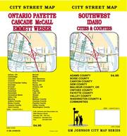
Search results from Open Library.
Recent natural events nearby
Ground air-quality sensors
Recently spotted species
Nearest stream gauge
Events
Gallery
Sources
- • Wikipedia
- • US Census Bureau (ACS 5-year estimates)
- • NOAA National Weather Service
- • Wikidata
- • NCES via Urban Institute Education Data Portal
- • CDC PLACES
- • Open-Meteo / sunrise-sunset.org
- • Wikipedia Pageviews API
- • Open Library