Browse / Ireland / Wexford / Ferns
Ferns
Wexfordtown

Ferns
Total population
1,317
Demographic figures from Central Statistics Office (Ireland). Overview below cites Wikipedia and may reference a different year.
City facts
Facts from Wikidata (CC0).
Overview
Ferns is a historic town in north County Wexford, Ireland. It is 11 km (7 mi) north of Enniscorthy. The remains of Ferns Castle are in the centre of the town. The town is in a civil parish of the same name.
Read more on WikipediaHistory & geography
History
Ferns is believed to have been established in the 6th century, when a monastery was founded in 598 dedicated to St Mogue of Clonmore (St. Aidan), who was a Bishop of Ferns. The town became the capital of the Kingdom of Leinster, and also the Capital of Ireland when the kings of that southern part of the province established their seat of power there. It was a very large city, but shrank after a fire destroyed most of it. The city stretched all the way past the River Bann (tributary of the River Slaney), and it is speculated that had it not burned, it would be one of Ireland's biggest cities today. King Dermot MacMurrough founded St. Mary's Abbey as a house of Augustinian canons c. 1158 and was buried there in 1171. Ferns Castle, an Anglo-Norman fortress, was built in the middle of the 13th century by William, Earl Marshall. In the time of Elizabeth I, it was granted to Sir Thomas Maisterson from Nantwich, Cheshire, who became a considerable force in the county. Today about half of the castle still stands. The town also contains the 13th-century St Edan's Cathedral (Church of Ireland) This was a big aisled cathedral with a long chancel. The present east wall of the cathedral is the original east wall; the cathedral ran further to the west, towards the entrance to the cemetery. It has been suggested that the ruined building to the east, which has a row of fine Gothic windows, might have been built to house the effigy of Bishop John St John, now on the porch of the church. The 19th-century population peaked in 1851, but never reached the levels of medieval times. Lewis's Topography of 1834 claimed the town "consists chiefly of one irregular street, and contains 106 houses indifferently built, retaining no trace of its ancient importance". The Abbey, St.Peter's Church…
Excerpted from the corresponding Wikipedia article (CC BY-SA).
Geography
Coordinates & boundaries from the US Census TIGER/Line shapefiles.
Climate
Air quality
Walkability
Amenities nearby
Wildlife & biodiversity
Earthquake history
Photos
Sights & places nearby
Notable people from here
Nearby places in Wexford
Geography & sun
Elevation, sunrise/sunset and daylight from Open-Meteo. Solar climatology from NASA POWER.
Nearby airports
Public attention
Pageview totals from the Wikimedia Pageviews API.
Books about Ferns
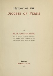
Search results from Open Library.
Recent natural events nearby
Ground air-quality sensors
Recently spotted species
Events
Gallery
Sources
- • Wikipedia
- • Wikidata
- • Open-Meteo / sunrise-sunset.org
- • Wikipedia Pageviews API
- • Open Library