Browse / United States / Illinois / Cairo
Cairo
Illinoiscity

Cairo
Total population
1,682
Median home value
$32,000
Bachelor's+
Median income
$41,912
Founded
1818
Demographic figures from US Census Bureau · ACS 5-year estimates. Overview below cites Wikipedia and may reference a different year.
- Special Weather Statement · ModerateSpecial Weather Statement issued June 11 at 1:10AM CDT by NWS Paducah KY
Source: NOAA National Weather Service.
City facts
Facts from Wikidata (CC0).
Overview
Cairo is the southernmost city in the U.S. state of Illinois and the county seat of Alexander County. A river city, Cairo has the lowest elevation of any location in Illinois and is the state's only city to be surrounded by levees. The city is named after Egypt's capital on the Nile and is located in the river-crossed area of Southern Illinois. It is coterminous with Cairo Precinct.
Read more on WikipediaHistory & geography
History
Cairo was named after the Egyptian city of the same name because its location at the confluence of the Ohio and Mississippi Rivers was reminiscent of the Nile Delta. The first municipal charter for Cairo and the Bank of Cairo were issued in 1818, but without any settlement and without any depositors. A second and successful effort to establish a town was made by the Cairo City and Canal Company in 1836–37, with a large levee built to encircle the site. who planned to make it the terminus of the projected Illinois Central Railroad, which finally arrived there in 1855. Cairo had been growing as an important river port for steamboats, which traveled all the way south to New Orleans. The city had been designated as a port of delivery by Act of Congress in 1854. A new city charter was written in 1857, and Cairo flourished as trade with Chicago to the north spurred development. By 1860, the population exceeded 2,000. During the Civil War, Admiral Andrew Hull Foote made Cairo the naval station for the Mississippi River Squadron on September 6, 1861. Since Cairo had no land available for base facilities, the navy yard repair shop machinery was afloat aboard wharf-boats, old steamers, tugs, flat-boats, and rafts. In January 1862, General Ulysses S. Grant occupied the city, and had Fort Defiance constructed to protect the confluence. Cairo became an important Union supply base and training center for the remainder of the war. After the Civil War, the city became a hub for railroad shipping in the region, which added to its economy. By 1900, several railroad lines branched from Cairo. In addition to shipping and railroads, a major industry in Cairo was the operation of ferries. Into the late 19th century, nearly 250,000 railroad cars could be ferried across the river in as…
Geography
Cairo is located at the confluence of the Ohio River with the Mississippi, near Mounds, Illinois. The elevation above sea level is . The lowest point in the state of Illinois is located in Cairo at the Mississippi River. In the 2021 census, Cairo has a total area of , of which (or 76.72%) is land and (or 23.28%) is water. The city of Cairo has a humid subtropical climate (Köppen Cfa) and has many characteristics of a city in the Upper South. Summers are hot and humid, with a daily average in July of . Temperatures reach on an average of 40 days annually. Winters are generally cool with mild periods, though extended stretches of cold can occur. Cairo's winter is typically mild by Illinois standards. The January daily average is . Precipitation is spread relatively uniformly throughout the year. On average, Cairo's low elevation and proximity to the Mississippi and Ohio rivers prevent strong winter lows and plunging temperatures. During the summer months, those similar features retain heat and humidity, creating muggy conditions.
Excerpted from the corresponding Wikipedia article (CC BY-SA).
Demographics & economy
Race & ethnicity
Source: US Census Bureau — American Community Survey, 5-year estimates.
Geography
Coordinates & boundaries from the US Census TIGER/Line shapefiles.
Climate
Current forecast
Forecast for Cairo, IL from NOAA NWS API.
Air quality
Industrial & pollution facilities
Natural hazard risk
Health (adults)
Age-adjusted prevalence estimates from CDC PLACES (latest release).
Walkability
Amenities nearby
Wildlife & biodiversity
Most-observed species
- Northern CardinalCardinalis cardinalis (Linnaeus, 1758) · Aves864
- American CrowCorvus brachyrhynchos C.L.Brehm, 1822 · Aves781
- Red-winged BlackbirdAgelaius phoeniceus (Linnaeus, 1766) · Aves713
- Mourning DoveZenaida macroura (Linnaeus, 1758) · Aves643
- Bald EagleHaliaeetus leucocephalus (Linnaeus, 1766) · Aves587
- Turkey VultureCathartes aura (Linnaeus, 1758) · Aves575
- Red-bellied WoodpeckerMelanerpes carolinus (Linnaeus, 1758) · Aves567
- Tufted TitmouseBaeolophus bicolor (Linnaeus, 1766) · Aves565
Citizen-science & research observations from the Global Biodiversity Information Facility (GBIF).
Schools
Largest nearby schools
- Cairo Elementary SchoolElementary · Cairo · 182 students · 15.2:1 ratio
- Cairo Jr/Sr High SchoolHigh · Cairo · 120 students · 10.9:1 ratio
Public K–12 schools within ~10 mi from Urban Institute Education Data Portal (NCES Common Core of Data, 2022).
Earthquake history
Most recent
- M 2.64 — 2026-05-158 km NW of Tiptonville, Tennessee
- M 2.84 — 2026-03-023 km NW of Marston, Missouri
- M 2.52 — 2025-12-3012 km WNW of Newbern, Tennessee
- M 2.73 — 2025-11-097 km SE of Ridgely, Tennessee
- M 2.6 — 2025-11-015 km SW of Puxico, Missouri
- M 3.07 — 2025-09-064 km S of Puxico, Missouri
Events from the USGS Earthquake Catalog (global) (FDSN Event Web Service).
Photos
Sights & places nearby
Notable people from here


People born within ~10 km, from Wikidata (CC0). Click any name for their Wikipedia article.
Nearby places in Illinois
- Olmsted13.3 mi away
- Joppa23.2 mi away · pop. 259
- Mill Creek23.4 mi away · pop. 37
- East Cape Girardeau25.8 mi away
- Buncombe34.1 mi away · pop. 329
- Cobden36.6 mi away · pop. 1,170
- Makanda42.5 mi away
- Carbondale49.5 mi away · pop. 21,857
- Crab Orchard53.6 mi away · pop. 394
- Harrison55.3 mi away · pop. 830
- Herrin55.4 mi away · pop. 12,226
- Blairsville55.7 mi away · pop. 231
Geography & sun
Elevation, sunrise/sunset and daylight from Open-Meteo. Solar climatology from NASA POWER.
Nearby airports
Public attention
Pageview totals from the Wikimedia Pageviews API.
Books about Cairo


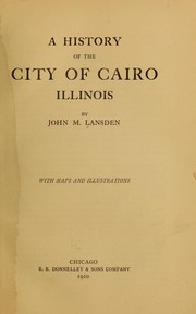
Search results from Open Library.
Recent natural events nearby
Ground air-quality sensors
Recently spotted species
Nearest stream gauge
Events
Gallery
Sources
- • Wikipedia
- • US Census Bureau (ACS 5-year estimates)
- • NOAA National Weather Service
- • Wikidata
- • USGS Earthquake Catalog (global feed)
- • NCES via Urban Institute Education Data Portal
- • GBIF (Global Biodiversity Information Facility)
- • CDC PLACES
- • Open-Meteo / sunrise-sunset.org
- • Wikipedia Pageviews API
- • Open Library
Notes: Climate data unavailable; Nearby POIs unavailable; Photos unavailable; Air quality unavailable; Earthquake data unavailable; Walkability unavailable; Wildlife observations unavailable; EPA pollution data unavailable; Livability counts unavailable; FEMA NRI data unavailable