Browse / United States / Illinois / Chenoa
Chenoa
Illinoiscity

Chenoa
Total population
1,647
Median home value
$124,700
Bachelor's+
Median income
$65,769
Founded
1854
Demographic figures from US Census Bureau · ACS 5-year estimates. Overview below cites Wikipedia and may reference a different year.
City facts
Facts from Wikidata (CC0).
Overview
Chenoa is a city in McLean County, Illinois, United States. The population was 1,695 at the 2020 census. The city is located at the intersections of Interstate 55, Historic Route 66, and U.S. Route 24. Founded in 1854 by Matthew T. Scott, Chenoa was created to provide a retail and trade center for his farm tenants as well as a grain shipping facility. The Chenoa Centennial was celebrated in 1954. The town is situated in a highly productive agricultural area. The town school system closed at the end of the 2004 school year, consolidating with the nearby Prairie Central school district.
Read more on WikipediaHistory & geography
History
The Town of Chenoa was laid out on May 13, 1856, by Matthew T. Scott. At this time, the Chicago and Alton Railroad had been running trains for almost two years but the survey for the east-west Toledo, Peoria and Oquawka (soon to be the Toledo, Peoria and Western) had not reached McLean County. Scott anticipated the place where the railroads would cross and platted the town which he called Chenoa. Scott (February 24, 1828 - May 21, 1891) was the son of a Kentucky banker, and, by the time he reached Illinois, was an experienced land developer who led a group of well-financed investors. The European settlement history of Chenoa began in 1854 when Matthew T. Scott began buying thousands of acres of land in this area. There has been much discussion about the meaning of the name Chenoa. Mid-nineteenth century histories explain that it was a Native American word for "Kentucky" and could therefore be rendered as "Dark and Bloody Ground." Professor of linguistics Edward Callary makes it clear that this is incorrect and that this meaning is unknown in Kentucky. Others explain that Chenoa is a Cherokee word meaning "Dove" or "White Dove." Again, this is not the case. Dove in Cherokee is "waya" and white dove "unega waya." There is also the often-repeated story that Scott had originally wanted the name to read "Chenowa," but the railroad had mistakenly dropped the letter "w." This, again, is not true. The railroad had no say in the naming of Chenoa; the spelling "Chenoa" is exactly how Scott recorded the name when he first laid out the town. However, "Chenoka" or "Chenoa" is one of many Native American names for the Kentucky River and this may explain how Scott got the idea that the word could be translated as Kentucky. The plan of Chenoa is complex because it is the blending of…
Geography
According to the 2020 census, Chenoa has a total area of , of which (or 98.18%) is land and (or 1.82%) is water. Situated in McLean County, the area surrounding Chenoa boasts some of the richest soil in the world. Only patches of farmland in Argentina, southern Ukraine and along the Yellow River in China match the fertile ground that covers much of the northern half of Illinois, particularly a high-yielding band through the state's midsection. McLean County is traditionally the state's leading corn and soybean producer. The Matthew T. Scott House was built as a home for Matthew T. Scott, who promoted and developed much of the surrounding area. It is closely associated with many events in the history of Chenoa. What appears today to be one building is, in fact, a blending of two structures. The oldest part is at the rear of the house and was built in 1855 as a post and I-beam cottage. The more formal front of the house was added in 1863 and is a true balloon frame structure built around a central hall with an impressive staircase. The foundation of both is of Joliet dolomite. It was here that the first Adlai E. Stevenson I (1835–1914), who held many important government positions and would become the 23rd Vice President of the United States from 1893 to 1897, courted Scott's sister-in-law, Letitia Green; their wedding took place in this house in 1866. By 1980, the house was in poor condition and seemed likely to be demolished. It was then bought and restored by Mrs. Elizabeth Stevenson Ives, a great niece of Matthew T. Scott. In 1982 it was placed on the National Register of Historic Places. Chenoa has a Humid continental climate (Köppen climate classification Dfa), with hot, humid summers and cold, slightly drier winters. The frost-free Growing season averages…
Excerpted from the corresponding Wikipedia article (CC BY-SA).
Demographics & economy
Race & ethnicity
Source: US Census Bureau — American Community Survey, 5-year estimates.
Geography
Coordinates & boundaries from the US Census TIGER/Line shapefiles.
Climate
Current forecast
Forecast for Chenoa, IL from NOAA NWS API.
Air quality
Industrial & pollution facilities
Natural hazard risk
Health (adults)
Age-adjusted prevalence estimates from CDC PLACES (latest release).
Walkability
Amenities nearby
Wildlife & biodiversity
Schools
Largest nearby schools
- EPG Middle SchoolMiddle · Gridley · 381 students · 15.2:1 ratio
- Prairie Central Primary WestElementary · Chenoa · 278 students · 17.4:1 ratio
- Lexington Elem SchoolElementary · Lexington · 218 students · 12.1:1 ratio
- Lexington High SchoolHigh · Lexington · 158 students · 12.2:1 ratio
- Lexington Jr High SchoolMiddle · Lexington · 113 students · 18.8:1 ratio
Public K–12 schools within ~10 mi from Urban Institute Education Data Portal (NCES Common Core of Data, 2022).
Earthquake history
Photos
Sights & places nearby
Notable people from here


People born within ~10 km, from Wikidata (CC0). Click any name for their Wikipedia article.
Geography & sun
Elevation, sunrise/sunset and daylight from Open-Meteo. Solar climatology from NASA POWER.
Nearby airports
Public attention
Pageview totals from the Wikimedia Pageviews API.
Books about Chenoa

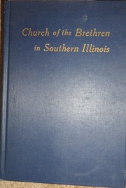

Search results from Open Library.
Recent natural events nearby
Ground air-quality sensors
Recently spotted species
Nearest stream gauge
Events
Gallery
Sources
- • Wikipedia
- • US Census Bureau (ACS 5-year estimates)
- • NOAA National Weather Service
- • Wikidata
- • NCES via Urban Institute Education Data Portal
- • CDC PLACES
- • Open-Meteo / sunrise-sunset.org
- • Wikipedia Pageviews API
- • Open Library