Browse / United States / Illinois / Chillicothe
Chillicothe
Illinoiscity

Chillicothe
Total population
5,900
Median home value
$132,900
Bachelor's+
Median income
$66,132
Demographic figures from US Census Bureau · ACS 5-year estimates. Overview below cites Wikipedia and may reference a different year.
City facts
Facts from Wikidata (CC0).
Overview
Chillicothe is a town on the Illinois River in Peoria County, Illinois, United States. As of the 2020 census, Chillicothe had a population of 6,128. Chillicothe is just north of the city of Peoria and is part of the Peoria Metropolitan Statistical Area.
Read more on WikipediaHistory & geography
History
The name Chillicothe comes from the name of the Chalahgawtha sect of the Shawnee nation. Along with Peoria, Chillicothe grew due to river traffic and quickly became a stop for barge and railroad traffic traveling to and from Chicago and St. Louis. In the late 1800s, the Atchison, Topeka and Santa Fe Railway was building its mainline from Chicago to Kansas City and selected Chillicothe as its crossing point of the Illinois River. The railroad quickly became an establishment in Chillicothe as a crew change point and a notable stop in Central Illinois. Chillicothe today still remains a key point on the Southern Transcon route between Chicago and Los Angeles with high frequency intermodal freight trains moving through daily. On November 5, 1988, Vice President George H.W. Bush, Representative Robert H. Michel, & Governor James Thompson stopped in Chillicothe to close out Election '88 in Illinois. Governor Thompson declared the day "Ilion Crabel Day" in honor of the city's record breaking city clerk. Crabel, elected in 1923, served as city clerk for 66 years until 1989. Chillicothe is the host to The Summer Camp Music Festival, a multi-day music festival created by Jay Goldberg Events & Entertainment that is held annually at Three Sisters Park.
Geography
According to the 2010 census, Chillicothe has a total area of , of which (or 94.74%) is land and (or 5.26%) is water. Chillicothe is located on the Illinois River and on the parallel Iowa Interstate Railroad (IAIS) branch, from Bureau to Peoria, which was formerly the Rock Island Railroad. Crossing the IAIS and the Illinois River at Chillicothe is the former Santa Fe Railroad, now owned by BNSF Railway. Almost 4 miles outside of town the BNSF Railway operates one of the most notable civil engineering points on the Chillicothe Subdivision. Edelstein Hill is one of the steepest climbs on the railway system and attracts many railfans to see locomotives pulling intermodal trains up the hill. The Illinois River runs both north and south connecting Chicago with St. Louis. Barge traffic is occasional as it is an efficient means of transportation for some bulk products. Eight miles to the north is Sparland and three miles to the south is Rome. Peoria is 20 miles to the south.
Excerpted from the corresponding Wikipedia article (CC BY-SA).
Demographics & economy
Race & ethnicity
Source: US Census Bureau — American Community Survey, 5-year estimates.
Geography
Coordinates & boundaries from the US Census TIGER/Line shapefiles.
Climate
Current forecast
Forecast for Chillicothe, IL from NOAA NWS API.
Air quality
Industrial & pollution facilities
Natural hazard risk
Health (adults)
Age-adjusted prevalence estimates from CDC PLACES (latest release).
Walkability
Amenities nearby
Wildlife & biodiversity
Schools
Largest nearby schools
- Dunlap High SchoolHigh · Dunlap · 1,375 students · 18.1:1 ratio
- Hickory Grove Elementary SchoolElementary · Dunlap · 801 students · 19.5:1 ratio
- Il Valley Central High SchoolHigh · Chillicothe · 647 students · 13.8:1 ratio
- Mossville Elementary SchoolElementary · Mossville · 420 students · 16.8:1 ratio
- South Elementary SchoolElementary · Chillicothe · 399 students · 14.8:1 ratio
- Banner Elementary SchoolElementary · Dunlap · 381 students · 18.1:1 ratio
- Dunlap Grade SchoolElementary · Dunlap · 258 students · 16.1:1 ratio
- Chillicothe Jr HighMiddle · Chillicothe · 239 students · 18.4:1 ratio
Public K–12 schools within ~10 mi from Urban Institute Education Data Portal (NCES Common Core of Data, 2022).
Earthquake history
Photos
Sights & places nearby
Notable people from here


People born within ~10 km, from Wikidata (CC0). Click any name for their Wikipedia article.
Geography & sun
Elevation, sunrise/sunset and daylight from Open-Meteo. Solar climatology from NASA POWER.
Nearby airports
Public attention
Pageview totals from the Wikimedia Pageviews API.
Books about Chillicothe
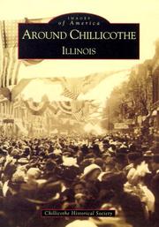


Search results from Open Library.
Recent natural events nearby
Ground air-quality sensors
Recently spotted species
Nearest stream gauge
Events
Notable, recurring, and historical events associated with Chillicothe, sourced from Wikidata.
Source: Wikidata (CC0).
Gallery
Sources
- • Wikipedia
- • US Census Bureau (ACS 5-year estimates)
- • NOAA National Weather Service
- • Wikidata
- • NCES via Urban Institute Education Data Portal
- • CDC PLACES
- • Open-Meteo / sunrise-sunset.org
- • Wikipedia Pageviews API
- • Open Library