Browse / United States / Illinois / Farmer City
Farmer City
Illinoiscity

Farmer City
Total population
1,885
Median home value
$138,500
Bachelor's+
Median income
$67,067
Founded
1837
Air quality index
Demographic figures from US Census Bureau · ACS 5-year estimates. Overview below cites Wikipedia and may reference a different year.
City facts
Facts from Wikidata (CC0).
Overview
Farmer City is a city in DeWitt County, Illinois, United States. The population was 1,828 at the 2020 census.
Read more on WikipediaHistory & geography
History
The Kickapoo and Potawatomi Native American tribes lived on the prairie and woodlands around Salt Creek and other local streams. The westward push of traders and adventurers led to settlers around 1825. Dennis Hurley is believed to be the first white settler in the area. Hurley built a cabin in the area, which became known as Hurley's Grove, with other families settling nearby. Some of the founding families were the Kirbys, McCords, Clearwaters, Watsons, Johnson, Webb, Blalach, Weedmans, Coveys, Cummings, and Huddlestons. Hurley's Grove was just south of present-day Farmer City, with increased population by 1837, becoming part of DeWitt County in 1839. The area to the south of Hurley's Grove was solidified as a permanent settlement, due to the safety of the area's wooded terrain. North of the primary area became known as Mt. Pleasant. Subdivision of the land divided the area into 14 blocks, with a central public square. The first residence built was that of Nathan Clearwater, and William McFall opened a store in 1837. Mail delivery was established in 1837, but with another Mt. Pleasant in the state, the name changed to Santa Anna. Dewitt County was part of the Eighth Judicial District in the early 1850s, and lawyer Abraham Lincoln traveled in the area many times on his circuit; he was well respected by county residents. C. H. Moore House in nearby Clinton is the former residence of Lincoln's co-counsel in various cases. The settlement grew in population and physical size, with the center of activity moving northward. The area became connected in 1870 by rail, prospering; that year's census listed 1276 people in the township, and 537 in Mt. Pleasant. The necessity of an official name arose in 1869, with Farmer City chosen after much discussion and debate. The…
Geography
According to the 2010 census, Farmer City has a total area of , of which (or 98%) is land and (or 2%) is water.
Excerpted from the corresponding Wikipedia article (CC BY-SA).
Demographics & economy
Race & ethnicity
Source: US Census Bureau — American Community Survey, 5-year estimates.
Geography
Coordinates & boundaries from the US Census TIGER/Line shapefiles.
Climate
Current forecast
Forecast for Farmer City, IL from NOAA NWS API.
Air quality
Current readings from Open-Meteo Air Quality API (Copernicus CAMS European reanalysis).
Industrial & pollution facilities
Natural hazard risk
Health (adults)
Age-adjusted prevalence estimates from CDC PLACES (latest release).
Walkability
Amenities nearby
Wildlife & biodiversity
Most-observed species
- American CrowCorvus brachyrhynchos C.L.Brehm, 1822 · Aves2,806
- Northern CardinalCardinalis cardinalis (Linnaeus, 1758) · Aves2,767
- Blue JayCyanocitta cristata (Linnaeus, 1758) · Aves2,440
- Canada Goose (canadensis Group)Branta canadensis (Linnaeus, 1758) · Aves2,142
- American RobinTurdus migratorius Linnaeus, 1766 · Aves2,107
- Black-capped ChickadeePoecile atricapillus (Linnaeus, 1766) · Aves1,937
- Red-bellied WoodpeckerMelanerpes carolinus (Linnaeus, 1758) · Aves1,794
- Ring-billed GullLarus delawarensis Ord, 1815 · Aves1,551
Citizen-science & research observations from the Global Biodiversity Information Facility (GBIF).
Schools
Largest nearby schools
- Ruth M Schneider Elem SchoolElementary · Farmer City · 272 students · 15.1:1 ratio
- Blue Ridge High SchoolHigh · Farmer City · 188 students · 9.4:1 ratio
Public K–12 schools within ~10 mi from Urban Institute Education Data Portal (NCES Common Core of Data, 2022).
Earthquake history
Most recent
- M 2.6 — 2025-03-156 km W of Dwight, Illinois
Events from the USGS Earthquake Catalog (global) (FDSN Event Web Service).
Photos
Sights & places nearby
Notable people from here

People born within ~10 km, from Wikidata (CC0). Click any name for their Wikipedia article.
Geography & sun
Elevation, sunrise/sunset and daylight from Open-Meteo. Solar climatology from NASA POWER.
Nearby airports
Public attention
Pageview totals from the Wikimedia Pageviews API.
Books about Farmer City

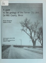

Search results from Open Library.
Recent natural events nearby
Ground air-quality sensors
Recently spotted species
Nearest stream gauge
Events
Gallery
Sources
- • Wikipedia
- • US Census Bureau (ACS 5-year estimates)
- • NOAA National Weather Service
- • Wikidata
- • Open-Meteo Air Quality (CAMS)
- • USGS Earthquake Catalog (global feed)
- • NCES via Urban Institute Education Data Portal
- • GBIF (Global Biodiversity Information Facility)
- • CDC PLACES
- • Open-Meteo / sunrise-sunset.org
- • Wikipedia Pageviews API
- • Open Library