Browse / United States / Illinois / Freeport
Freeport
Illinoiscity

Freeport
Total population
23,505
Median home value
$92,100
Bachelor's+
Median income
$51,723
Founded
1827
Demographic figures from US Census Bureau · ACS 5-year estimates. Overview below cites Wikipedia and may reference a different year.
City facts
Facts from Wikidata (CC0).
Overview
Freeport is the largest city in Stephenson County, Illinois, United States, and its county seat. The population was 23,973 at the 2020 census. Located along the Pecatonica River, Freeport is known for hosting the second Lincoln–Douglas debate of 1858, and as "Pretzel City, USA", due to a popular German bakery that became known for its prolific pretzel production in the 19th century. Freeport High School's mascot is the Pretzel to honor its heritage.
Read more on WikipediaHistory & geography
History
The community was originally called Winneshiek. When it was incorporated, the new municipality took its name from the generosity of Tutty Baker, who was credited with running a "free port" on the Pecatonica River. The name "Winneshiek" was later adopted, and is preserved to this day, by the Freeport Community Theatre Group. In 1837, Stephenson County was formed, and Freeport became its seat of government in 1838. Linked by a stagecoach with Chicago, the community grew rapidly. In 1840, a frame courthouse was erected and the first school was founded. Within two years, Freeport had two newspapers, and in 1853, the two were joined by a third, which was published in German. By then, the community had a population of 2,000. On August 27, 1858, the second debate between Abraham Lincoln and Stephen A. Douglas took place in Freeport and gave the nation direction in the following years. Although Stephen Douglas won the election and retained his U.S. Senate seat, his reply to a question on slavery alienated the South, which called it the "Freeport Heresy", and split the Democratic Party. This enabled Abraham Lincoln to win the 1860 United States presidential election. A monument to the debate was dedicated in 1903 by President Theodore Roosevelt and stands at this site. A life-size statue recreating the event was dedicated in 1992. Another renowned statue, Lincoln the Debator by Leonard Crunelle, is a focal point in the city's Taylor Park. In many years, there is also a reenactment of the debate, which has been shown on C-SPAN. Freeport is known as the "Pretzel City", and its public high school's team is named the Pretzels. The nickname is a reminder of Freeport's ethnic heritage: in the late 1850s, many German migrants, both from Pennsylvania and from Europe, resettled in…
Geography
Freeport is at the center of a large agricultural area, located approximately south of the Wisconsin state line, west of Rockford, and northwest of Chicago. The Pecatonica River and Yellow Creek flow through the city. According to the U.S. Census Bureau, the city has a total area of , of which is land and is water. The area code for Freeport is 815 with an overlay area code of 815/779. The Pecatonica River has flooded Freeport seven times since May 2017. The necessary flood cleanup has cost the city more than $1.5 million. The frequency of severe weather events appears to be increasing. According to the State Climatologist, "the number of days Freeport has experienced heavy rainfall has steadily increased every decade since 1949." }}
Excerpted from the corresponding Wikipedia article (CC BY-SA).
Demographics & economy
Race & ethnicity
Source: US Census Bureau — American Community Survey, 5-year estimates.
Geography
Coordinates & boundaries from the US Census TIGER/Line shapefiles.
Climate
Current forecast
Forecast for Freeport, IL from NOAA NWS API.
Air quality
Industrial & pollution facilities
Natural hazard risk
Health (adults)
Age-adjusted prevalence estimates from CDC PLACES (latest release).
Walkability
Amenities nearby
Wildlife & biodiversity
Schools
Largest nearby schools
- Freeport High SchoolHigh · Freeport · 1,080 students · 12.9:1 ratio
- Freeport Middle SchoolMiddle · Freeport · 485 students · 13.9:1 ratio
- Carl Sandburg Middle SchMiddle · Freeport · 397 students · 12.4:1 ratio
- Dakota Elementary SchoolElementary · Dakota · 391 students · 13:1 ratio
- Dakota Jr Sr High SchoolHigh · Dakota · 365 students · 15.9:1 ratio
- Jones-Farrar Intl BaccalaureateElementary · Freeport · 326 students · 14.2:1 ratio
- Empire Elem SchoolElementary · Freeport · 325 students · 19.1:1 ratio
- Blackhawk Elem SchoolElementary · Freeport · 307 students · 12.3:1 ratio
Public K–12 schools within ~10 mi from Urban Institute Education Data Portal (NCES Common Core of Data, 2022).
Earthquake history
Photos
Sights & places nearby
Notable people from here


People born within ~10 km, from Wikidata (CC0). Click any name for their Wikipedia article.
Nearby places in Illinois
Geography & sun
Elevation, sunrise/sunset and daylight from Open-Meteo. Solar climatology from NASA POWER.
Nearby airports
Public attention
Pageview totals from the Wikimedia Pageviews API.
Books about Freeport


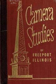

Search results from Open Library.
Recent natural events nearby
Ground air-quality sensors
Recently spotted species
Nearest stream gauge
Events
Gallery
Sources
- • Wikipedia
- • US Census Bureau (ACS 5-year estimates)
- • NOAA National Weather Service
- • Wikidata
- • NCES via Urban Institute Education Data Portal
- • CDC PLACES
- • Open-Meteo / sunrise-sunset.org
- • Wikipedia Pageviews API
- • Open Library