Browse / United States / Illinois / Markham
Markham
Illinoiscity

Markham
Total population
11,355
Median home value
$135,300
Bachelor's+
Median income
$57,302
Founded
1925
Demographic figures from US Census Bureau · ACS 5-year estimates. Overview below cites Wikipedia and may reference a different year.
- Flood Advisory · MinorFlood Advisory issued September 17 at 8:25AM CDT until September 17 at 10:30AM CDT by NWS Chicago IL
Source: NOAA National Weather Service.
City facts
Facts from Wikidata (CC0).
Overview
Markham is a city and a south suburb of Chicago in Cook County, Illinois, United States. The population was 11,661 at the 2020 census.
Read more on WikipediaHistory & geography
History
It is claimed this area was beach 10,000 years ago. After countless ages of geologic swamps, marshes and sloughs, the prairies dominated the landscape with groves of trees, flowers, and wildlife in abundance. Markham, southwest of the southern tip of Lake Michigan, had been a crossroad for early pioneers. In 1816 a treaty was made with the Ottawa, Chippewa and Potawatomi tribes which ceded a corridor of land located between a point north of the Chicago River and the mouth of the Calumet River to the settlers. The southern boundary, one of two Indian Treaty Boundary Lines, was surveyed along a line from the Kankakee River to Lake Michigan. The line still appears on government maps and now includes a short portion of Interstate 57 near the US 6 interchange northwest of Markham. The village of Markham was incorporated in 1925 with a population under 300. The village was named for Charles H. Markham, president of the Illinois Central Railroad 1911–1918, 1919–1926. In the mid-1930s, the Croissant Park subdivision was built and increased the population from 349 to 1,388. After World War II, Markham's population doubled to 2,753 residents by 1950. The village developed into a bedroom community as residents sought homes, not industry. An airport developed at 165th Street and Kedzie Avenue was the nearest field outside of Chicago. The airport site was located near what is now the Cook County Sixth Circuit Courthouse. On August 24, 1967, Markham was incorporated as a city. In 1860, a German immigrant named Lawrence Roesner made his way to the southern boundary and settled on land located in the northwest corner of Markham. He brought with him six seedlings from the Black Forest of Germany and planted them along the Indian Boundary Line. This "Lone Pine Tree" was adopted as…
Geography
Markham is located at (41.597467, -87.691570). According to the 2021 census gazetteer files, Markham has a total area of , all land. There are approximately of virgin and restored prairie land located within the boundary of Markham. There are four prairies known as "Dropseed", "Sundrop", "Paintbrush", and "Gensburg". The prairie is under the supervision of Northeastern Illinois University and The Nature Conservancy. The Gensburg-Markham Prairie portion has been designated a National Natural Landmark. The prairies continue to grow and flourish with the help of the Friends of the Indian Boundary Prairies. : Midlothian / Posen : Midlothian Harvey : Unincorporated Bremen Township Harvey : Oak Forest / Country Club Hills Harvey : Hazel Crest
Excerpted from the corresponding Wikipedia article (CC BY-SA).
Demographics & economy
Race & ethnicity
Source: US Census Bureau — American Community Survey, 5-year estimates.
Geography
Coordinates & boundaries from the US Census TIGER/Line shapefiles.
Climate
Current forecast
Forecast for Markham, IL from NOAA NWS API.
Air quality
Industrial & pollution facilities
Natural hazard risk
Health (adults)
Age-adjusted prevalence estimates from CDC PLACES (latest release).
Walkability
Amenities nearby
Wildlife & biodiversity
Most-observed species
- American RobinTurdus migratorius Linnaeus, 1766 · Aves34,390
- Red-winged BlackbirdAgelaius phoeniceus (Linnaeus, 1766) · Aves29,393
- Canada Goose (canadensis Group)Branta canadensis (Linnaeus, 1758) · Aves28,368
- Northern CardinalCardinalis cardinalis (Linnaeus, 1758) · Aves26,311
- American GoldfinchSpinus tristis (Linnaeus, 1758) · Aves24,514
- MallardAnas platyrhynchos Linnaeus, 1758 · Aves24,119
- Downy WoodpeckerDryobates pubescens (Linnaeus, 1766) · Aves22,622
- European StarlingSturnus vulgaris Linnaeus, 1758 · Aves22,337
Citizen-science & research observations from the Global Biodiversity Information Facility (GBIF).
Schools
Largest nearby schools
- Carl Sandburg High SchoolHigh · Orland Park · 2,894 students · 16.1:1 ratio
- Homewood-Flossmoor High SchoolHigh · Flossmoor · 2,798 students · 13.9:1 ratio
- Amos Alonzo Stagg High SchoolHigh · Palos Hills · 2,538 students · 14.4:1 ratio
- Rich Township High SchoolHigh · Olympia Fields · 2,487 students · 12.4:1 ratio
- Victor J Andrew High SchoolHigh · Orland Hills · 2,259 students · 14.7:1 ratio
- Thornwood High SchoolHigh · South Holland · 1,996 students · 13.8:1 ratio
- A B Shepard High Sch (Campus)High · Palos Heights · 1,973 students · 15.9:1 ratio
- Thornton Fractnl So High SchoolHigh · Lansing · 1,927 students · 18:1 ratio
Public K–12 schools within ~10 mi from Urban Institute Education Data Portal (NCES Common Core of Data, 2022).
Earthquake history
Most recent
- M 2.9 — 2026-07-0821 km ENE of Kenilworth, Illinois
- M 2.6 — 2025-03-156 km W of Dwight, Illinois
- M 3.1 — 2024-07-152 km WNW of Somonauk, Illinois
- M 2.9 — 2015-03-253 km WNW of Lake in the Hills, Illinois
- M 3.2 — 2013-11-041 km SSW of Lyons, Illinois
- M 2.6 — 2013-06-104 km NNE of Virgil, Illinois
Events from the USGS Earthquake Catalog (global) (FDSN Event Web Service).
Photos
Sights & places nearby
Notable people from here


People born within ~10 km, from Wikidata (CC0). Click any name for their Wikipedia article.
Geography & sun
Elevation, sunrise/sunset and daylight from Open-Meteo. Solar climatology from NASA POWER.
Nearby airports
Public attention
Pageview totals from the Wikimedia Pageviews API.
Books about Markham


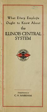
Search results from Open Library.
Recent natural events nearby
Ground air-quality sensors
Recently spotted species
Nearest stream gauge
Events
Gallery
Sources
- • Wikipedia
- • US Census Bureau (ACS 5-year estimates)
- • NOAA National Weather Service
- • Wikidata
- • USGS Earthquake Catalog (global feed)
- • NCES via Urban Institute Education Data Portal
- • GBIF (Global Biodiversity Information Facility)
- • CDC PLACES
- • Open-Meteo / sunrise-sunset.org
- • Wikipedia Pageviews API
- • Open Library