Browse / United States / Illinois / Meredosia
Meredosia
Illinoisvillage

Meredosia
Total population
871
Median home value
$65,300
Bachelor's+
Median income
$54,485
Demographic figures from US Census Bureau · ACS 5-year estimates. Overview below cites Wikipedia and may reference a different year.
City facts
Facts from Wikidata (CC0).
Overview
Meredosia is a village in Morgan County, Illinois, United States. The population was 826 at the 2020 census, down from 1,044 in 2010. It is part of the Jacksonville Micropolitan Statistical Area.
Read more on WikipediaHistory & geography
History
In 2011, Ameren Energy Resources Company announced the closure of its power station in Meredosia. The closure resulted in a loss of over 50 jobs, a major economic hit for the small community. The plant closure was related to the cost of meeting environmental regulations. The plant may reopen at some point as a facility to test clean coal technology, according to Ameren. In June 2018 the community celebrated the opening of a new bridge over the Illinois River. The former bridge, constructed in 1936, had become too narrow for modern traffic, and was dismantled during the summer of 2018. The bridge not only links Meredosia to Quincy, Illinois, but serves as an important transportation link between western Illinois and the center of the state.
Geography
Meredosia is in far northwestern Morgan County, on the east bank of the Illinois River, the border with Pike County. Illinois Route 104 passes through the village as its Main Street, leading east and then southeast to Jacksonville, the county seat, and west across the river and to Quincy. According to the U.S. Census Bureau, Meredosia has a total area of , of which , or 4.11%, are water. The Meredosia National Wildlife Refuge is directly north of the village, within the Illinois River floodplain. Marais d'Osier, meaning willow swamp, was the original French name given to the area in the early 1800s.
Excerpted from the corresponding Wikipedia article (CC BY-SA).
Demographics & economy
Race & ethnicity
Source: US Census Bureau — American Community Survey, 5-year estimates.
Geography
Coordinates & boundaries from the US Census TIGER/Line shapefiles.
Climate
Air quality
Industrial & pollution facilities
Natural hazard risk
Health (adults)
Age-adjusted prevalence estimates from CDC PLACES (latest release).
Walkability
Amenities nearby
Wildlife & biodiversity
Most-observed species
- Northern CardinalCardinalis cardinalis (Linnaeus, 1758) · Aves452
- Mourning DoveZenaida macroura (Linnaeus, 1758) · Aves400
- American RobinTurdus migratorius Linnaeus, 1766 · Aves389
- Red-winged BlackbirdAgelaius phoeniceus (Linnaeus, 1766) · Aves381
- Blue JayCyanocitta cristata (Linnaeus, 1758) · Aves345
- Red-bellied WoodpeckerMelanerpes carolinus (Linnaeus, 1758) · Aves343
- Turkey VultureCathartes aura (Linnaeus, 1758) · Aves293
- Black-capped ChickadeePoecile atricapillus (Linnaeus, 1766) · Aves281
Citizen-science & research observations from the Global Biodiversity Information Facility (GBIF).
Schools
Earthquake history
Events from the USGS Earthquake Catalog (global) (FDSN Event Web Service).
Photos
Sights & places nearby
Notable people from here

People born within ~10 km, from Wikidata (CC0). Click any name for their Wikipedia article.
Geography & sun
Elevation, sunrise/sunset and daylight from Open-Meteo. Solar climatology from NASA POWER.
Nearby airports
Public attention
Pageview totals from the Wikimedia Pageviews API.
Books about Meredosia

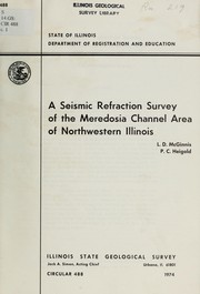
Search results from Open Library.
Recent natural events nearby
Ground air-quality sensors
Recently spotted species
Nearest stream gauge
Events
Gallery
Sources
- • Wikipedia
- • US Census Bureau (ACS 5-year estimates)
- • Wikidata
- • USGS Earthquake Catalog (global feed)
- • GBIF (Global Biodiversity Information Facility)
- • CDC PLACES
- • Open-Meteo / sunrise-sunset.org
- • Wikipedia Pageviews API
- • Open Library