Browse / United States / Illinois / Oregon
Oregon
Illinoiscity

Oregon
Total population
3,851
Median home value
$142,600
Bachelor's+
Median income
$71,841
Demographic figures from US Census Bureau · ACS 5-year estimates. Overview below cites Wikipedia and may reference a different year.
City facts
Overview
Oregon is a city in and the county seat of Ogle County, Illinois, United States. As of the 2020 census, Oregon had a population of 3,604.
Read more on WikipediaHistory & geography
History
The land Oregon, Illinois was founded on was previously held by the Potawatomi and Winnebago Indian tribes. In fact, later, settlers discovered that the area contained a large number of Indian mounds, most in diameter. The first European to visit the land was pioneer John Phelps. Phelps first visited the area in 1829 and returned in 1833 hoping to find a suitable site to settle. By December 4, 1838, due in large part to the efforts of Phelps and his brothers B.T. Phelps and G.W. Phelps, the land was claimed, subdivided and certified by the Ogle County clerk as Oregon City. The name Oregon means "River of the West". In 1839, Oregon City was renamed Florence after a visitor compared the scenic beauty of the Rock River to the Italian city of the same name. Florence was used for only about three years when the city opted to revert to its original name, without the word "city," in 1843. By 1847 the town had a general store, sawmill, ferry, 44 households and a population of 225. The Ogle County Courthouse was built in 1891 on the corner of Washington Street and Fourth Street (Illinois Route 64 and Illinois Route 2). Between 1908 and 1911, on a site just north of the city, sculptor Lorado Taft erected a 50-foot tall statue he had designed and originally named The Eternal Indian. Located on a bluff overlooking the Rock River valley, the sculpture is now known as the Black Hawk Statue, named after Black Hawk, a chief of the Sauk Indian tribe that once inhabited the area. The city of Oregon annexed nearby Daysville, Illinois, in 1993.
Geography
According to the 2010 census, Oregon has a total area of , of which (or 96.65%) is land and (or 3.35%) is water.
Excerpted from the corresponding Wikipedia article (CC BY-SA).
Demographics & economy
Race & ethnicity
Source: US Census Bureau — American Community Survey, 5-year estimates.
Geography
Coordinates & boundaries from the US Census TIGER/Line shapefiles.
Climate
Current forecast
Forecast for Oregon, IL from NOAA NWS API.
Air quality
Industrial & pollution facilities
Natural hazard risk
Health (adults)
Age-adjusted prevalence estimates from CDC PLACES (latest release).
Walkability
Amenities nearby
Wildlife & biodiversity
Schools
Largest nearby schools
- Oregon Elem SchElementary · Oregon · 776 students · 14.9:1 ratio
- Oregon Jr/Sr High SchoolHigh · Oregon · 663 students · 15.4:1 ratio
- Mary Morgan Elem SchElementary · Byron · 659 students · 13.2:1 ratio
- Byron High School 9-12High · Byron · 457 students · 13.4:1 ratio
- Byron Middle SchoolMiddle · Byron · 350 students · 11.7:1 ratio
- Chana Educ Center/Rock RiverOther · Chana
- OCEC Life SkillsOther · Byron
- Rock River ChallengeHigh · Chana
Public K–12 schools within ~10 mi from Urban Institute Education Data Portal (NCES Common Core of Data, 2022).
Earthquake history
Photos
Sights & places nearby
Notable people from here
Geography & sun
Elevation, sunrise/sunset and daylight from Open-Meteo. Solar climatology from NASA POWER.
Nearby airports
Public attention
Pageview totals from the Wikimedia Pageviews API.
Books about Oregon
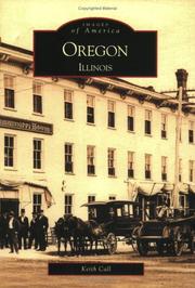

Search results from Open Library.
Recent natural events nearby
Ground air-quality sensors
Recently spotted species
Nearest stream gauge
Events
Gallery
Sources
- • Wikipedia
- • US Census Bureau (ACS 5-year estimates)
- • NOAA National Weather Service
- • NCES via Urban Institute Education Data Portal
- • CDC PLACES
- • Open-Meteo / sunrise-sunset.org
- • Wikipedia Pageviews API
- • Open Library