Browse / India / Uttar Pradesh / Ayodhya
Ayodhya
Uttar Pradeshcity

Ayodhya
Total population
55,673
Demographic figures from Ministry of Statistics (India). Overview below cites Wikipedia and may reference a different year.
City facts
Facts from Wikidata (CC0).
Overview
Ayodhya is a city situated on the banks of the Sarayu river in the Indian state of Uttar Pradesh. It is the administrative headquarters of the Ayodhya district as well as the Ayodhya division of Uttar Pradesh, India. Ayodhya became the top tourist destination of Uttar Pradesh with 110 million visitors in the first half of 2024, surpassing Varanasi.
Read more on WikipediaHistory & geography
History
Ancient Indian Sanskrit-language epics, such as the Ramayana and the Mahabharata mention a legendary city called Ayodhya, which was the capital of the legendary Ikshvaku kings of Kosala, including Rama. Neither these texts, nor the earlier Sanskrit texts such as the Vedas, mention a city called Saketa. Non-religious, non-legendary ancient Sanskrit texts, such as Panini's Ashtadhyayi and Patanjali's commentary on it, do mention Saketa. The later Buddhist text Mahavastu describes Saketa as the seat of the Ikshvaku king Sujata, whose descendants established the Shakya capital Kapilavastu. The earliest of the Buddhist Pali-language texts and the Jain Prakrit-language texts mention a city called Saketa (Sageya or Saeya in Prakrit) as an important city of the Kosala mahajanapada. Topographical indications in both Buddhist and Jain texts suggest that Saketa is the same as the present-day Ayodhya. For example, according to the Samyutta Nikaya and the Vinaya Pitaka, Saketa was located at a distance of six yojanas from Shravasti. The Vinaya Pitaka mentions that a big river was located between the two cities, and the Sutta Nipata mentions Saketa as the first halting place on the southward road from Shravasti to Pratishthana. Fourth century onwards, multiple texts, including Kalidasa's Raghuvamsha, mention Ayodhya as another name for Saketa. The later Jain canonical text Jambudvipa-Pannati describes a city called Viniya (or Vinita) as the birthplace of Rishabhanatha, and associates this city with Bharata Chakravartin; the Kalpa-Sutra describes Ikkhagabhumi as the birthplace of Rishabhanatha. The index on the Jain text Paumachariya clarifies that Aojjha (Aodhya), Kosala-puri ("Kosala city"), Viniya, and Saeya (Saketa) are synonyms. The post-Canonical Jain texts also mention…
Geography
Ayodhya has a humid subtropical climate, typical of central India. Summers are long, dry and hot, lasting from late March to mid-June, with average daily temperatures near . They are followed by the monsoon season which lasts till October, with annual precipitation of approximately and average temperatures around . Winter starts in early November and lasts till the end of January, followed by a short spring in February and early March. Average temperatures are mild, near , but nights can be colder.
Excerpted from the corresponding Wikipedia article (CC BY-SA).
Geography
Coordinates & boundaries from the US Census TIGER/Line shapefiles.
Climate
Air quality
Walkability
Amenities nearby
Wildlife & biodiversity
Most-observed species
- Red-wattled LapwingVanellus indicus (Boddaert, 1783) · Aves719
- Large-billed CrowCorvus macrorhynchos Wagler, 1827 · Aves714
- Spotted DoveSpilopelia chinensis (Scopoli, 1786) · Aves653
- White-throated KingfisherHalcyon smyrnensis (Linnaeus, 1758) · Aves633
- Black DrongoDicrurus macrocercus Vieillot, 1817 · Aves626
- Indian Pond-HeronArdeola grayii (Sykes, 1832) · Aves597
- Little CormorantMicrocarbo niger (Vieillot, 1817) · Aves570
- Black KiteMilvus migrans (Boddaert, 1783) · Aves554
Citizen-science & research observations from the Global Biodiversity Information Facility (GBIF).
Earthquake history
Events from the USGS Earthquake Catalog (global) (FDSN Event Web Service).
Photos
Sights & places nearby
Notable people from here


People born within ~10 km, from Wikidata (CC0). Click any name for their Wikipedia article.
Nearby places in Uttar Pradesh
- Faizabad3.7 mi away · pop. 165,200
- Sadar Bazar Ayodhya Cantt4.9 mi away
- Nawabganj6.1 mi away · pop. 5,000
- Kurebhar27.1 mi away · pop. 5,000
- Gonda27.5 mi away · pop. 114,000
- Rudauli28.4 mi away · pop. 5,000
- Paraspur30.7 mi away
- Basti31.9 mi away · pop. 114,700
- Tanda33 mi away
- Akbarpur33.3 mi away · pop. 111,500
- Hallaur37.6 mi away
- Sultanpur38.2 mi away · pop. 116,000
Geography & sun
Elevation, sunrise/sunset and daylight from Open-Meteo. Solar climatology from NASA POWER.
Nearby airports
Public attention
Pageview totals from the Wikimedia Pageviews API.
Books about Ayodhya


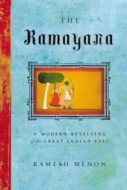
Search results from Open Library.
Recent natural events nearby
Ground air-quality sensors
Recently spotted species
Events
Gallery
Sources
- • Wikipedia
- • Wikidata
- • USGS Earthquake Catalog (global feed)
- • GBIF (Global Biodiversity Information Facility)
- • Open-Meteo / sunrise-sunset.org
- • Wikipedia Pageviews API
- • Open Library