Browse / United States / Indiana / Colfax
Colfax
Indianatown

Colfax
Total population
906
Median home value
$130,100
Bachelor's+
Median income
$63,281
Demographic figures from US Census Bureau · ACS 5-year estimates. Overview below cites Wikipedia and may reference a different year.
City facts
Overview
Colfax is a town in Perry Township, Clinton County, Indiana, United States. As of the 2020 census, Colfax had a population of 702. The town was originally known as Midway since it was a halfway point on the IC&L Railroad between Chicago and Louisville. Railways intersected north–south and east–west making Colfax a popular transfer destination. The town was renamed to honor Vice President Schuyler Colfax in 1857.
Read more on WikipediaHistory & geography
History
Colfax was laid out in 1849 by Montgomery Stroud. It was originally named Midway for its position between Chicago and Louisville along the IC&L railroad. In 1853 the town gained a post office named Colfax, and in December 1857 the name of the town itself became Colfax, by petition of the residents. By 1861 the town had two churches, two general stores, a hotel, a saw mill and approximately 200 residents. An incorporation election held December 25, 1869, resulted in 24 yeas and 1 no. The town had 187 residents in 1870, but with the construction of the Vandalia railroad through town in 1870-71 it grew quickly and by 1880 had a population of 638. The Colfax Carnegie Library and Rosenberger Building are listed on the National Register of Historic Places.
Geography
According to the 2010 census, Colfax has a total area of , all land.
Excerpted from the corresponding Wikipedia article (CC BY-SA).
Demographics & economy
Race & ethnicity
Source: US Census Bureau — American Community Survey, 5-year estimates.
Geography
Coordinates & boundaries from the US Census TIGER/Line shapefiles.
Climate
Current forecast
Forecast for Colfax, IN from NOAA NWS API.
Air quality
Industrial & pollution facilities
Natural hazard risk
Health (adults)
Age-adjusted prevalence estimates from CDC PLACES (latest release).
Walkability
Amenities nearby
Wildlife & biodiversity
Schools
Largest nearby schools
- Clinton Prairie Elementary SchoolElementary · Frankfort · 663 students · 16.2:1 ratio
- Suncrest Elementary SchoolElementary · Frankfort · 560 students · 15.1:1 ratio
- Clinton Prairie Jr-Sr High SchoolHigh · Frankfort · 530 students · 13.9:1 ratio
- Blue Ridge Primary Elementary SchElementary · Frankfort · 440 students · 17.6:1 ratio
- Green Meadows Intermediate ElemElementary · Frankfort · 410 students · 17.8:1 ratio
Public K–12 schools within ~10 mi from Urban Institute Education Data Portal (NCES Common Core of Data, 2022).
Earthquake history
Photos
Sights & places nearby
Notable people from here


People born within ~10 km, from Wikidata (CC0). Click any name for their Wikipedia article.
Geography & sun
Elevation, sunrise/sunset and daylight from Open-Meteo. Solar climatology from NASA POWER.
Nearby airports
Public attention
Pageview totals from the Wikimedia Pageviews API.
Books about Colfax
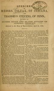
Search results from Open Library.
Recent natural events nearby
Ground air-quality sensors
Recently spotted species
Nearest stream gauge
Events
Gallery
Sources
- • Wikipedia
- • US Census Bureau (ACS 5-year estimates)
- • NOAA National Weather Service
- • Wikidata
- • NCES via Urban Institute Education Data Portal
- • CDC PLACES
- • Open-Meteo / sunrise-sunset.org
- • Wikipedia Pageviews API
- • Open Library