Browse / United States / Indiana / Elwood
Elwood
Indianacity

Elwood
Total population
8,356
Median home value
$97,800
Bachelor's+
Median income
$53,280
Demographic figures from US Census Bureau · ACS 5-year estimates. Overview below cites Wikipedia and may reference a different year.
- Flood Watch · SevereFlood Watch issued September 17 at 11:06AM EDT until September 17 at 2:00PM EDT by NWS Indianapolis IN
Source: NOAA National Weather Service.
City facts
Facts from Wikidata (CC0).
Overview
Elwood is a city in Madison and Tipton counties in the U.S. state of Indiana. The Madison County portion, which is nearly all of the city, is part of the Indianapolis–Carmel–Anderson metropolitan statistical area. The population of Elwood was 8,410 at the 2020 census.
Read more on WikipediaHistory & geography
History
Elwood was laid out in 1853 under the name "Duck Creek". It was incorporated as a city in 1891. A post office was established under the name "Duck Creek" in 1855, was renamed to Elwood in 1869, and has been operating since. The first railroad was constructed in Elwood in 1857. On August 17, 1940, the Republican National Committee held a formal notification ceremony to recognize Elwood-born Wendell Willkie as its nominee for President of the United States to run against Franklin Roosevelt. Held at Callaway Park on the outskirts of town, the ceremony drew 150,000 people for what would become the largest political rally in American history at the time. People came in 60,000 automobiles, 63 special trains, 300 Pullmans, and 1,200 buses. The Indiana University band led a parade in which 249 other bands also marched in the procession. When Willkie stepped onto the platform, the crowd cheered him for ten minutes before he could begin his speech. However, oppressive heat and Willkie's underwhelming, flat speech left many disappointed by the end of the day. By the 1880s, Elwood had become a sundown town, prohibiting Black people from residing within the town. In 1897, when a number of Black families attempted to settle in the town and were driven out, The Evening Times in Washington, D.C., reported that for more than two decades Black people had not been "permitted to remain any length of time." This prohibition remained in place for most of the 20th century. Other Black people were discouraged from attempting to attend the rally at all due to the sundown signs posted at the city limits. These signs and policies remained in place for decades afterwards. By the late twentieth century sundown policies were less strictly enforced, although as recently as 2002 law enforcement…
Geography
Elwood is located in northwestern Madison County. The equivalent of two half-blocks of land in Tipton County are also within the city limits. Indiana State Road 28 passes through the city as Main Street, leading east to Alexandria and west to Tipton. State Road 13 (Anderson Street) crosses SR 28 in the center of Elwood; it leads north to Point Isabel and south to Lapel. State Road 37 crosses the southeast corner of the city limits, leading northeast to Marion and southwest to Noblesville. Anderson, the Madison county seat, is southeast of Elwood by local roads. According to the U.S. Census Bureau, Elwood has a total area of , all land. }}
Excerpted from the corresponding Wikipedia article (CC BY-SA).
Demographics & economy
Race & ethnicity
Source: US Census Bureau — American Community Survey, 5-year estimates.
Geography
Coordinates & boundaries from the US Census TIGER/Line shapefiles.
Climate
Current forecast
Forecast for Elwood, IN from NOAA NWS API.
Air quality
Industrial & pollution facilities
Natural hazard risk
Health (adults)
Walkability
Amenities nearby
Wildlife & biodiversity
Schools
Earthquake history
Photos
Sights & places nearby
Notable people from here


People born within ~10 km, from Wikidata (CC0). Click any name for their Wikipedia article.
Geography & sun
Elevation, sunrise/sunset and daylight from Open-Meteo. Solar climatology from NASA POWER.
Nearby airports
Public attention
Pageview totals from the Wikimedia Pageviews API.
Books about Elwood

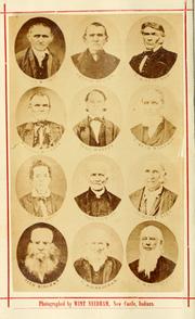
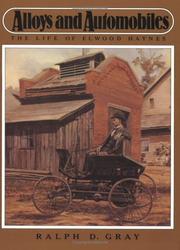

Search results from Open Library.
Recent natural events nearby
Ground air-quality sensors
Recently spotted species
Nearest stream gauge
Events
Gallery
Sources
- • Wikipedia
- • US Census Bureau (ACS 5-year estimates)
- • NOAA National Weather Service
- • Wikidata
- • Open-Meteo / sunrise-sunset.org
- • Wikipedia Pageviews API
- • Open Library